

Fire lookout towers were once used in the Angeles National Forest to provide a high vantage point to spot the early signs of forest fires. According to the National Forest Service, the lookout tower “provides housing and a secure base for a person known as a ‘fire lookout’ to visually search for wildfires.” The fire lookout would keep watch for signs of fire- i.e., smoke or visible flames- to quickly alert emergency responders with pertinent information and hopefully ensure a rapid response. Lookout towers were once common, with 19 fire lookout towers manned across the Angeles National Forest. Today, there are now only two active towers in the Angeles. For our weekend adventure on this sunny mid-October weekend, we hiked to one of them: Vetter Mountain Lookout Interpretive Site.
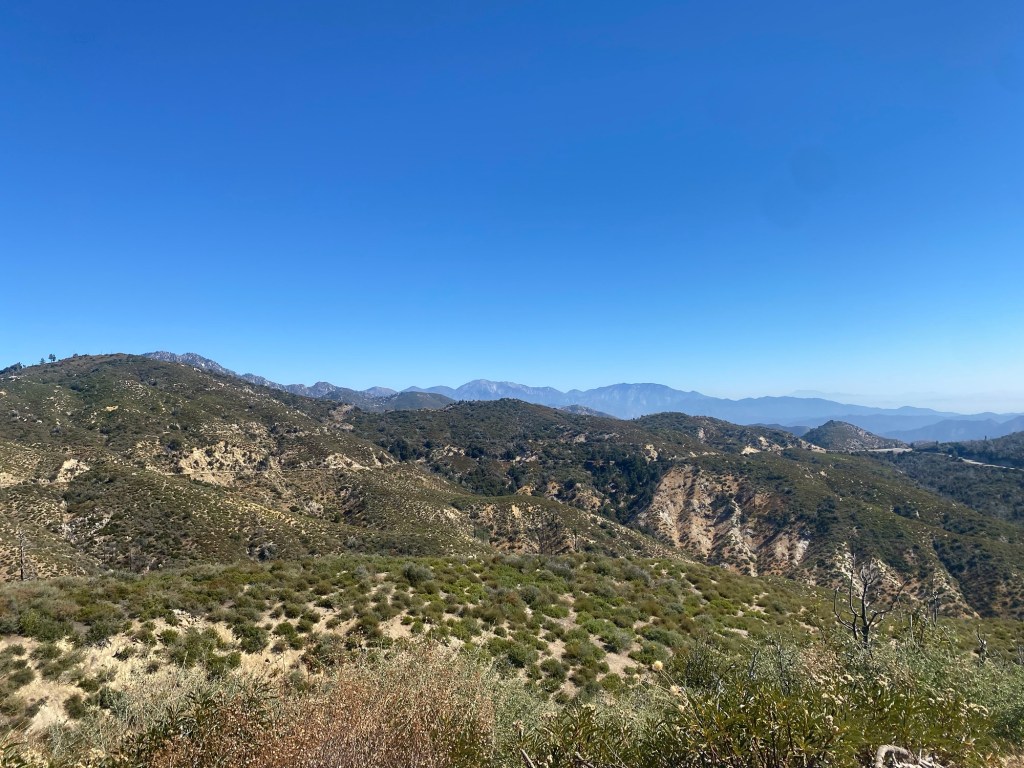
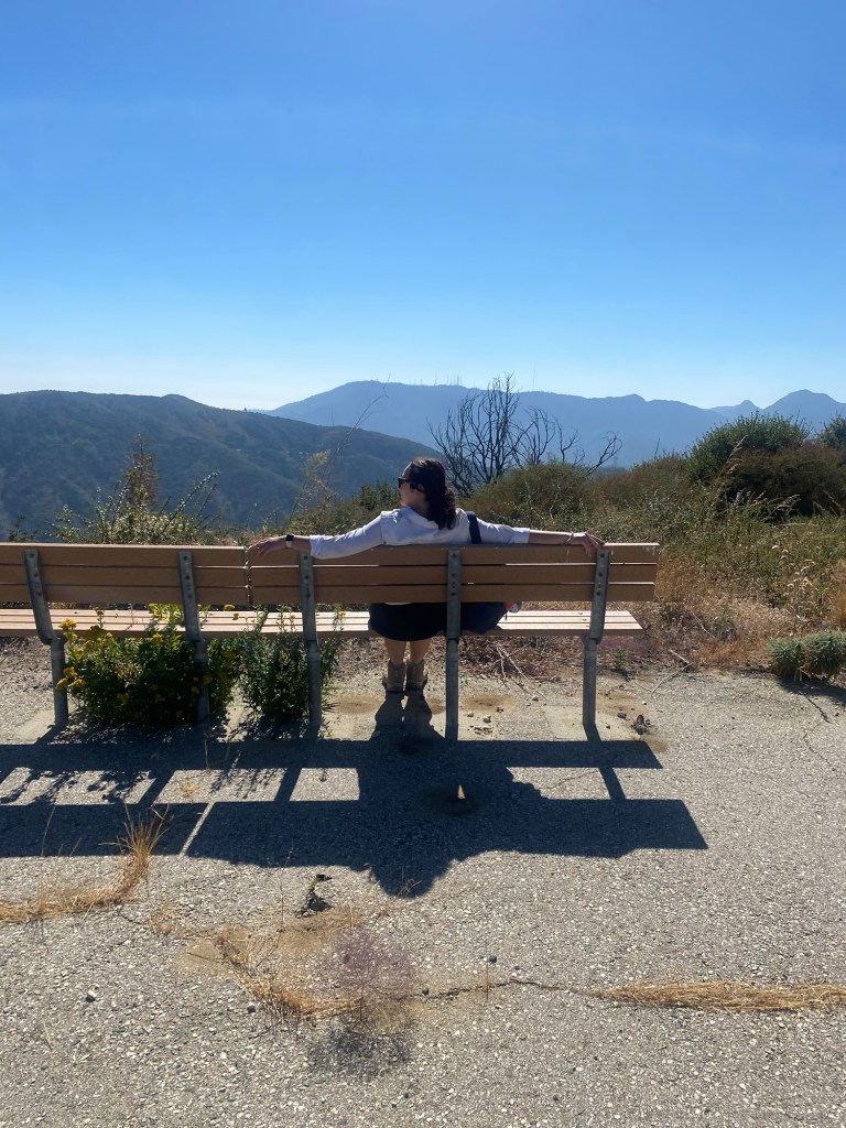
Vetter Mountain is tucked into the San Gabriel Mountains, about two miles off the Angeles Crest Scenic Byway. The Silver Moccasin Trail, which connects Chantry Flats above Arcadia and Sierra Madre to the Pacific Crest Trail at Vincent Gap, crosses Vetter Mountain on its eastern flank. At 5911 feet in elevation, the summit offers sweeping 360 panoramas of the scenic San Gabriels.

As for our last two hikes in the Angeles, we set out in the late morning, heading up Angeles Crest Highway from I-210. We followed the highway into the mountains, climbing over about 4000 feet across 23 miles. We turned onto Forest Road 3N16, and after about two miles, arrived at the parking area for the Charlton Flat Picnic Area. Thanks to the damage caused by the Bobcat Fire in 2020, we had to hike in, adding an extra mile to the 1.1 mile hike to the peak. Sadly, the campground that had been there is no longer in use.
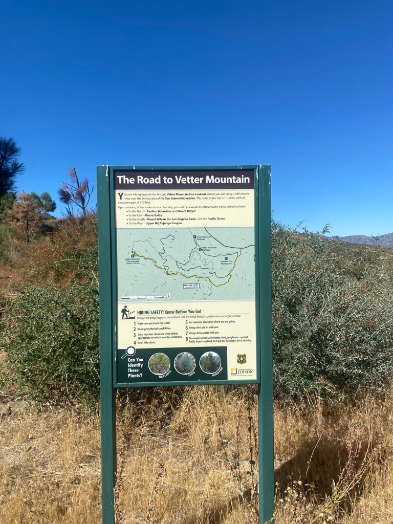
After applying plenty of sunscreen and bug spray, we set off on the fire road. The road was not a bad walk up; it was wide enough to avoid what looked to be poodle dog bush growing on the side of the road. There was hardly any shade in the late morning, so I was glad to have slathered on more Supergoop! sunscreen, however I regretted forgetting my hat. Fortunately the hike went quickly, and we promptly arrived at the sign for Vetter Mountain Road. From that point, it was another mile up the hill to the peak.
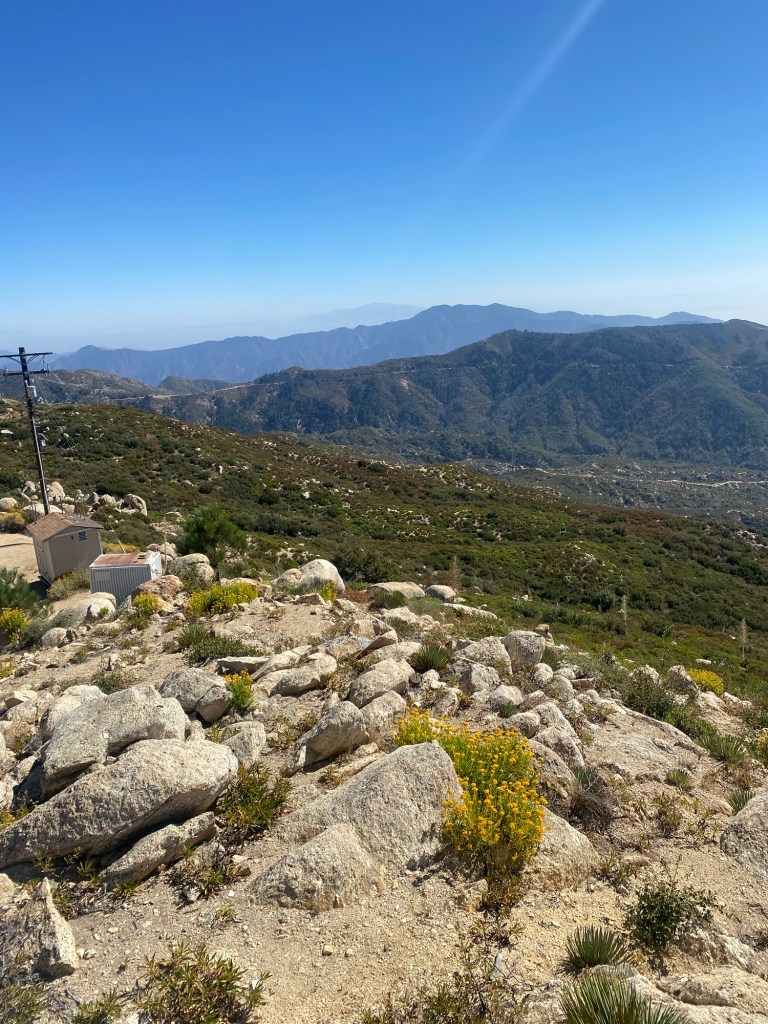
The hike was a bit of a climb, but not too difficult. The vistas heading up the mountain were impressive, especially on such a clear day, and we soon came to the info sign for the fire lookout.

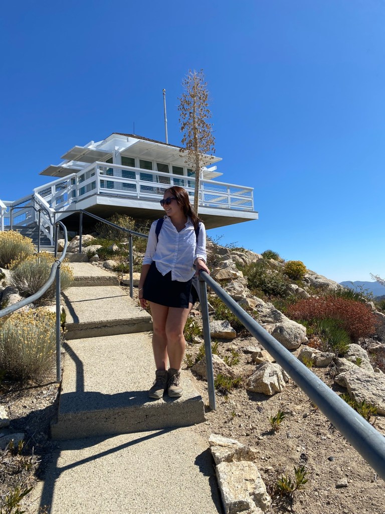
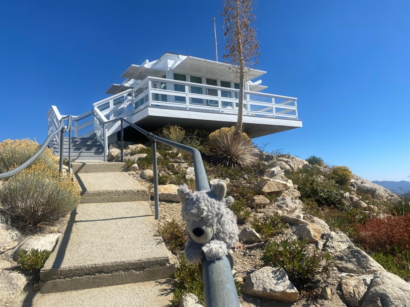
The Vetter Mountain Fire Lookout was originally built in 1937 and was in use through 1981. In 1998, the lookout tower was restored and reopened to the public. The original structure was destroyed in the Station Fire, which swept through the San Gabriel Mountains, and burned nearly 25 percent of the Angeles National Forest in 2009. Through the efforts of the U.S. Forest Service, the Angeles National Forest Fire Lookout Association (ANFFLA), and in partnership with Southern California Edison, the fire lookout tower was rebuilt in 2019. The 14′ x 14′ cab structure features large windows and high ceilings. Today, dedicated volunteers help keep watch over the forest from Vetter Mountain, and they welcome visitors on the weekends.
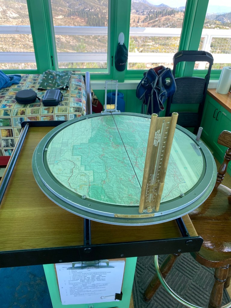
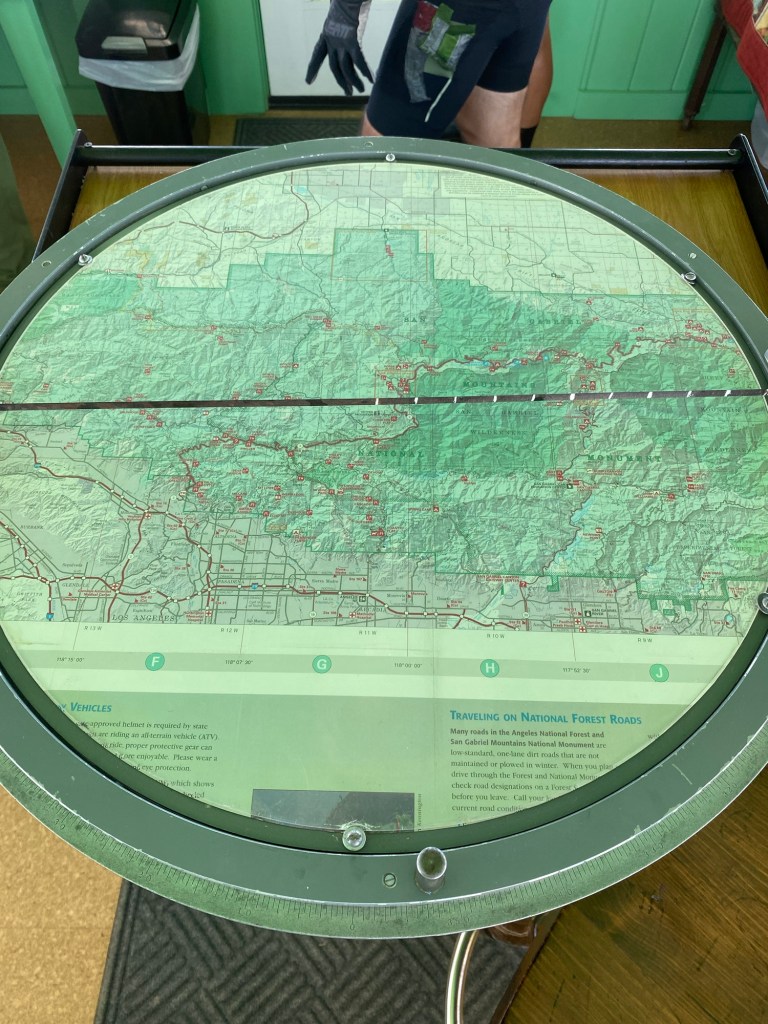
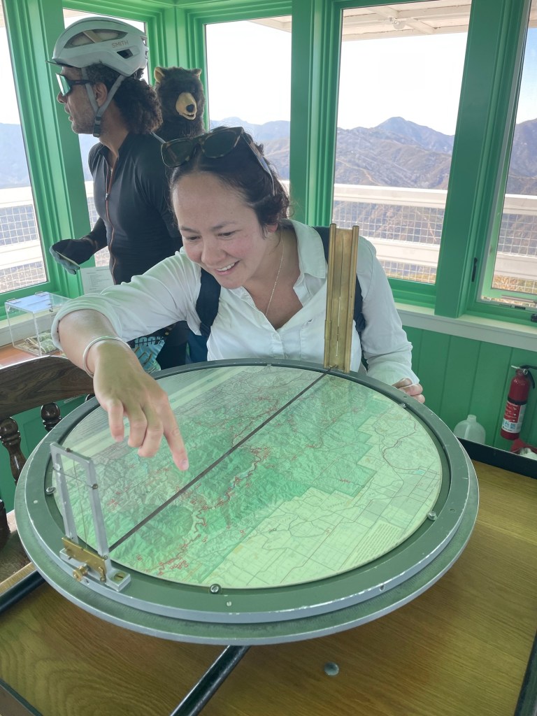
On our Sunday hike, we were able to go in and visit with the fire lookout. Though he was relatively new to his volunteer role, he showed us how to use the Osborne Firefinder, a tool used to obtain azimuth readings of potential fire activity sightings. Indeed, while we were there, we heard the report of a potential brush fire to our east, as well as the units that were dispatched out to the incident. It was quite informative, and we had the opportunity to ask some questions.
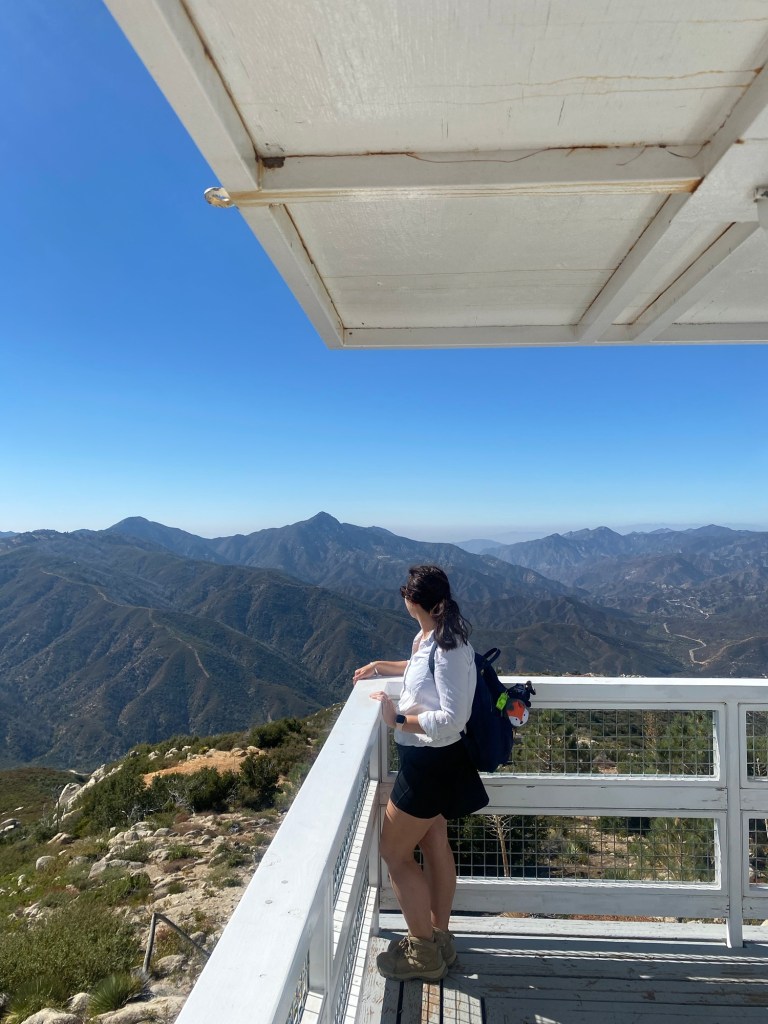
After talking with the lookout for a while, we walked onto the porch. The views were stunning. To the south we could see Mt. Wilson with its famed telecommunications towers; to the west lay Upper Big Tujunga; and to the east, we had a clear view of Mt. Baldy. Just north of us was Mount Hillyer and Chilao. After taking in the views and some video for our social medias, we enjoyed our trail snacks before heading back to the Subie. This was a reasonably short hike with rewarding views.
Some things to consider:
Adventure passes are required to park anywhere within the Angeles National Forest, including at Charlton Flats. These are $5 per day, or $30 for an annual pass. If you plan on visiting other national lands over the course of the year, I recommend purchasing an America the Beautiful National Parks pass. At just $80, it is a great value for many adventures.
Poodle dog bush is a fire follower, meaning that it thrives in the aftermath of brush fires. This pretty purple plant experienced a surge in growth after the Station Fire. Poodle dog bush has an important role in the chaparral ecosystem; its roots help to anchor soil and mitigate erosion. While lovely to look at especially in the summer when it blooms with purple flowers, it would not be so lovely to touch. The oils in the plant are toxic, and cause a reaction similar to that of poison oak. There seemed to be many poodle dog bushes lining the road; fortunately, the road is wide enough to avoid this toxic plant.
There is very little shade on the road and on the trail. Sun protection and plenty of water are recommended, even for this relatively short hike.
The hike to Vetter Mountain is generally considered an easy hike according to hiking websites, such as AllTrails. It did have a 659 foot elevation gain according to my Strava, with a tiny bit of steepness in a couple areas. That said, some of the reviews noted the trail as being moderate.

There was not much traffic on the trail. We met a group of hikers returning to the parking area as we were starting our hike, and then a couple of mountain bikers at the lookout.
According to Google, the Vetter Mountain Lookout Interpretive Site is open to visitors on weekends from 10 am until 4 pm. Be sure to check ANFFLA or the U.S. Forest Service website for any restrictions or closures.
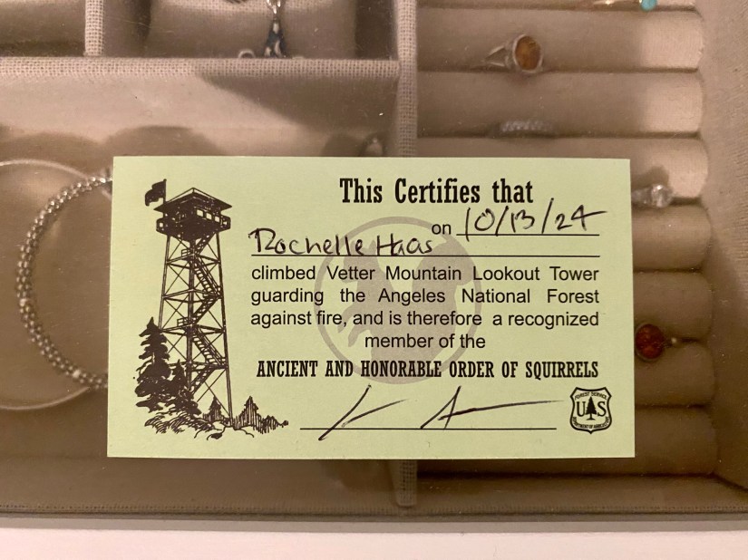
The hike to Vetter Mountain offered an fun adventure as well as an opportunity to learn more about fire suppression in our national forests. I would definitely recommend a hike up this quiet mountain for an adventure meant to be shared. And we even ‘earned’ our admission to the Ancient and Honorable Order of Squirrels. We shall carry our cards proudly. Cheers!
References:
“Vetter Mountain.” Angeles National Forest Fire Lookout Association, 2017, http://www.anffla.org/towers/vetter-mountain/.
Kresek, Ray. “Region 1 – Fire.” Forest Service National Website, http://www.fs.usda.gov/detail/r1/fire-aviation/?cid=stelprdb5108647#azimuth. Accessed 16 Oct. 2024.
*Some of the information here was also from the signage around the lookout tower.

1 thought on “Hiking the Angeles: Vetter Mountain Lookout”