

Following the Second World War, complex political factors lead to a divided Europe and a long period of history that would become known as the Cold War. As treaties were formed, i.e. NATO and the Warsaw Pact, and the world order became largely bi-polar, the fight between ideologies lead to widespread fear and hysteria- and a dangerous nuclear arms race between the United States and the Soviet Union.
As panic peaked in the 1950s, the risk of mutually assured destruction and the terrifying idea of the nuclear annihilation of Los Angeles served as a catalyst for a number of projects to defend the area as well as provide some escape from the fallout. One such project was the Shoemaker Canyon Tunnels, also known as the Tunnels to Nowhere.
In the early 1950s, it was decided that Los Angeles, which at that point had become the fourth largest city in the United States, required an escape route away from the LA metro area into the desolate safety of the Mojave Desert. In 1956, construction started on Shoemaker Canyon Road, which would connect East Fork Road in the San Gabriel Mountains above Azusa to Largo Vista in the middle of nowhere near Palmdale. The intended 25-mile stretch of road was worked on by low-security inmates from LA County Sheriff’s Department detention camps for 13 years. In 1969, budget cuts and dying Cold War fervor put an end to the construction, with only four miles of paved road and two tunnels having been completed- a path to nowhere. And while the Cold War would officially end in 1991, with the dissolution of the Soviet Union, the Shoemaker Canyon Tunnels stand as a reminder of a time in US history when fear and paranoia reigned.
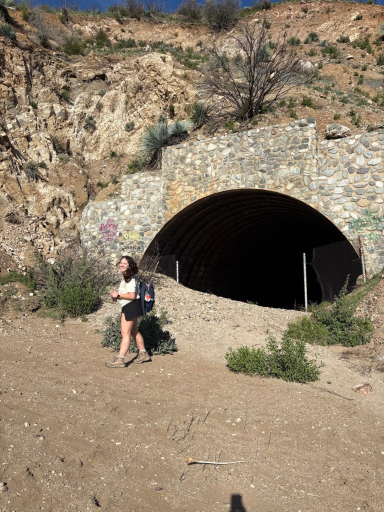
I first hiked the Shoemaker Canyon Tunnels back on Labor Day 2024. With the sun blazing on my skin in the heat of a September morning, the tunnels felt a nice respite from the shadeless trail. Unfortunately, the Bridge Fire was sparked nearby just six days later, ultimately burning over 56000 acres across Los Angeles and San Bernardino Counties. Shoemaker Canyon, along with popular hiking trails including portions of the PCT, were affected by the blaze. The trail reopened later in 2025, and this past Sunday, we decided to hike it to see what the conditions were.
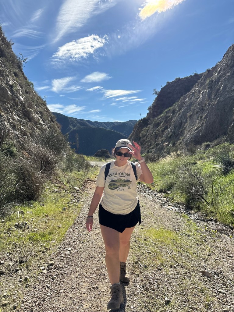
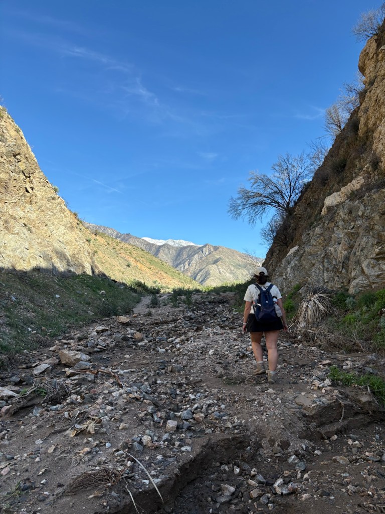
The drive up San Gabriel Canyon to East Fork Road, looked much as it always does, winding and beautiful. A notable difference is some post-fire construction and LA County Public Works clearing debris from the San Gabriel River. Usually the water in the San Gabriel Dam is a deep blue; on this trek, the water was brown thanks to the sediment and debris from recent rains and mudflows. But otherwise the drive was uneventful. We turned onto Shoemaker Canyon Road and drove the two miles or so to the parking area. A quick application of sunscreen and we hit the trail.
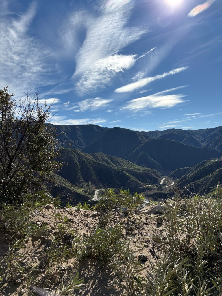
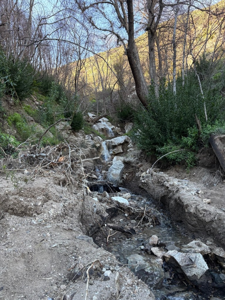
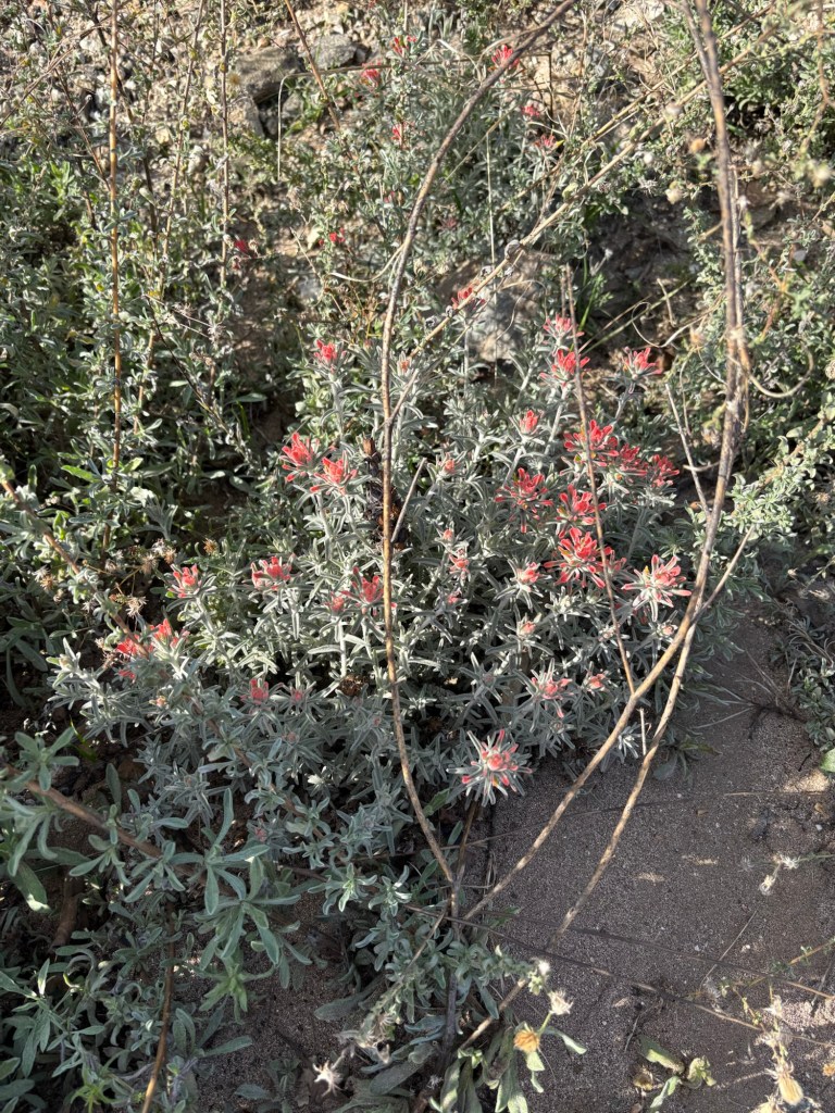
Another striking difference between our two hikes taken 16 months apart is how green the vegetation is at time of writing. The rains have given the mountainsides verdant foliage, and it is quite lovely, especially with the sound of the river and its many streams feeding into it. That said, there is still very little shade on the trail, so my hat and sunglasses were a must.
That said, the rains have also created some issues for the hiking trail. We trekked for just over a mile-and-a-half to the entrance of the first tunnel. While there was evidence of rockfall in the canyon, there were no major obstacles getting to the first tunnel, just a steady uphill climb.
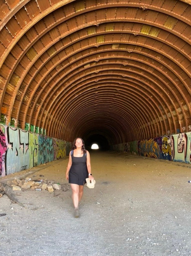
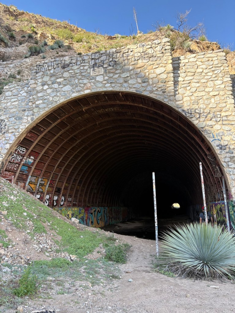
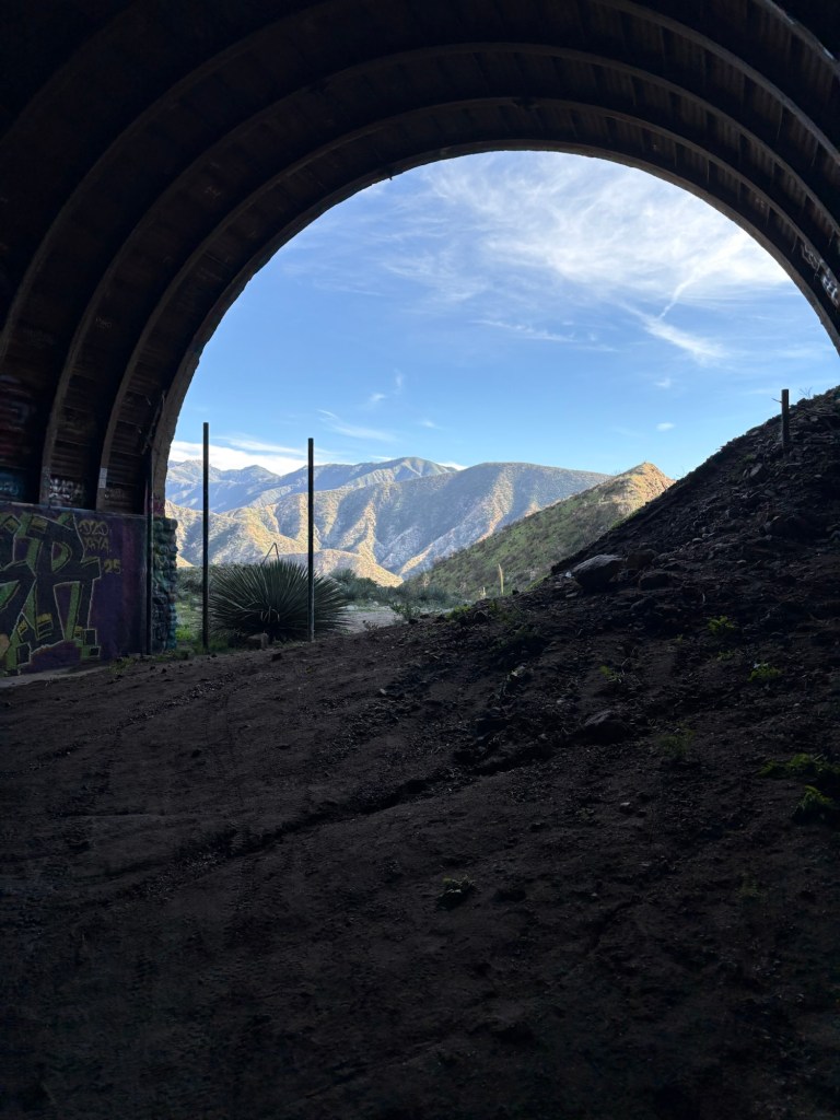
The tunnel was adequately dark and spooky, with water dripping from the ceilings and a creepy echo. I had a headlamp with me just in case, but the light from the ends of the tunnels lit the damp ground just enough to make out where I was going. The lack of light lent to the eeriness, but it was not so dark that I was sacrificing safety. We exited the 1000-foot tunnel and took a quick snack and water break before attempting the second tunnel.
We walked about a tenth of a mile past the first tunnel and came to what is a major obstacle. It appeared that the rains overwhelmed the culvert, and as a result, the trail had been washed away. We considered whether this was a hike-stopping hindrance, and decided that we could safely make it across the washout given the water level with some careful climbing.
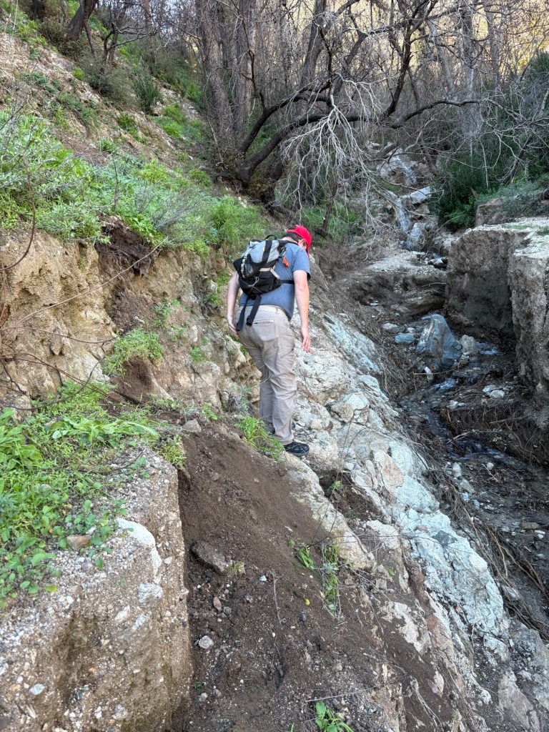
We managed to cross to the other side, taking our time to calculate the best path forward given our abilities. Once safely back on trail, we continued on, finding that there were a few other issues with the trail to the second tunnel.
There were a number of areas where water cut channels into the trail. There was also evidence of mudflows or other mass wasting events. This did not make the trail impassable at this time, however, conditions can change. I also saw what looked to be baby poodle-dog bush sprouting from the damp ground. This lovely but toxic plant is a fire follower and is important ecologically for erosion control. Unfortunately, it causes a horrible rash similar to poison oak.
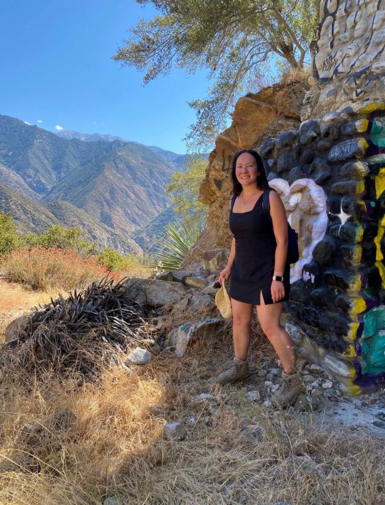
Nonetheless, we were able to make it to the second tunnel. And this is where we stopped. We saw that the tunnel, though at about 700 feet is shorter than the first, was flooded at the start of it. I gauged the depth of the water by tossing a rock into it; from the sound of it, it appeared that the water level would reach up to at least my calves, and hence soak my hiking boots. We could have hiked along the tunnel walls and used the rebar for support if needed, but it didn’t seem worth the effort. Thus, we took a few photos and turned back. We were going to have to take our time getting across the washout anyway.

Although turning around subtracted a whole 1400 feet from my Strava, we still hiked 5.81 miles according to my app with 770 feet of elevation. More importantly, we were able to have a fun, safe adventure and enjoy being outside in the sunshine for the first time since Christmas. Rainy weather and busy work schedules have kept me from my beloved mountains, and it felt good to be back.
Some things to consider:
Adventure passes are required to park anywhere within the Angeles National Forest, including in the parking areas along Shoemaker Canyon. These are $5 per day, or $30 for an annual pass. If you plan on visiting other national lands over the course of the year, I recommend purchasing an America the Beautiful National Parks pass. At just $80, it is a great value for many adventures. I feel we get more than our money’s worth every year.
The trail is rated moderately difficult. With the changing weather and trail conditions, the trail can become more challenging. Be sure to check AllTrails or other apps for recent reviews and information.
Sun protection and water are a must. The weather on our Sunday hike was very pleasant and a little on the cooler side, but the sun was still pretty intense. I made sure to use plenty of sunscreen.
This post is not a recommendation to attempt crossing the washout. While it is doable for experienced hikers at time of writing, another winter storm can change trail conditions. That said, if you choose to head to the second tunnel, please take your time and know your limits. And if it happens to become unsafe, please turn around. The tunnels are cool, but they are not worth sacrificing safety.

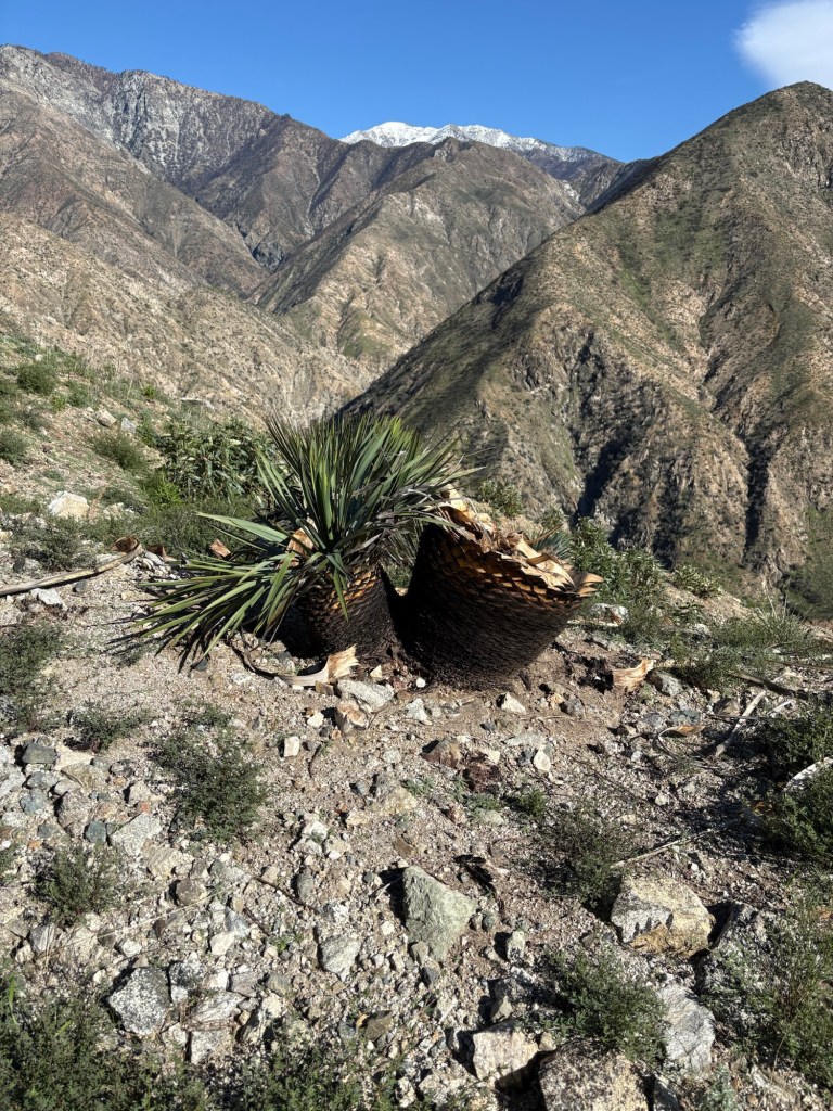
There is evidence of fire along the trail. Many yucca and other hardy succulents were burned in the Bridge Fire. There were also several trees to the side of the trail that suffered fire damage. Burned vegetation can pose hazards as damage to their root systems and trunks can weaken them and make them susceptible to falls. I did not see too many burned plants along the trail itself that appeared inherently dangerous other than a few tall yucca, but even these can become a hazard.
Hiking Shoemaker Canyon was a fun adventure and a nice way to ease back into my fitness routines. It also served as a reminder that chaos and paranoia is not unique to my time, but has impacted political decision-making along with- albeit abandoned- infrastructure projects and budgets in decades past. It was also a reminder that after destruction can also come renewal. The San Gabriel Mountains have stood for millennia and will continue to bring forth new growth even after devastating fire and rains.
May 2026 provide renewal and growth, with many adventures meant to be shared. Cheers.
References:
Harrison, Scott. “From the Archives: L.A.’s Cold War Highway to Nowhere.” Los Angeles Times, Los Angeles Times, 27 Apr. 2017, http://www.latimes.com/visuals/photography/la-me-fw-archives-highway-nowhere-20170316-story.html.
“The Cold War Era: Characteristics of the Old World Order • Polsci Institute.” Political Science Institute, 14 Dec. 2025, polsci.institute/international-relations/cold-war-era-characteristics-old-world-order/.
Author. “Bridge Fire.” CAL FIRE, http://www.fire.ca.gov/incidents/2024/9/8/bridge-fire.
“Bridge Fire (September 2024).” San Bernardino County Fire Protection District, 28 July 2025, sbcfire.org/bridge-fire/.
