

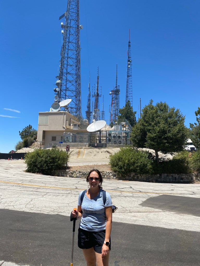
Since I was a kid, Mt. Wilson has been fascinating to me. It is a prominent peak in the front range of the San Gabriel Mountains, distinguished by the radio towers. Perhaps some of the fascination was because my dad loved talking about those communications antennas. Having worked in radio broadcasting, he enjoyed sharing with us what he knew about the science behind FM and television signals as it brought to us the music we listened to in the car. He especially loved exploring the area, and took joy in sharing the adventure with his family. When he had the time, he’d pack the family into the car and drive up into the mountains. I remember, as a six-year-old kid, playing with the rocks in the parking lot while being awed by the spectacular views of the valley that we now called home. I suppose in some ways, not much has changed.

It has been years since I’ve been up to Mt. Wilson. I’ve hiked the Mt. Wilson Trail, making it up past Orchard Camp, however I had never gone up to the peak on foot. That is until this past Saturday. And just as I was as a young kid new to California, I was struck again by the spectacular views of the valley that I have called home now for many years.
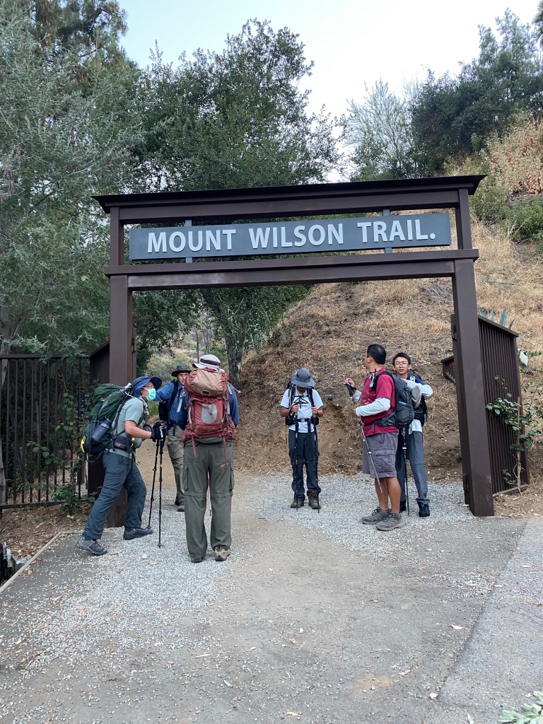
We began the trek to Mt. Wilson in much the same way we’ve started many other hikes on this trail: we met at the trailhead on Mira Monte Avenue in Sierra Madre, just past Mt. Wilson Trail Park early in the morning. Especially knowing that the day would be warm and that the hike would be 14.5 miles out-and-back, it was good to begin while the day was still cool. We could see the bright blue skies above the fog, and I was thankful that the morning was cool enough for a light sweater. Though I knew that I would be shedding it well before we arrived at Orchard Camp.
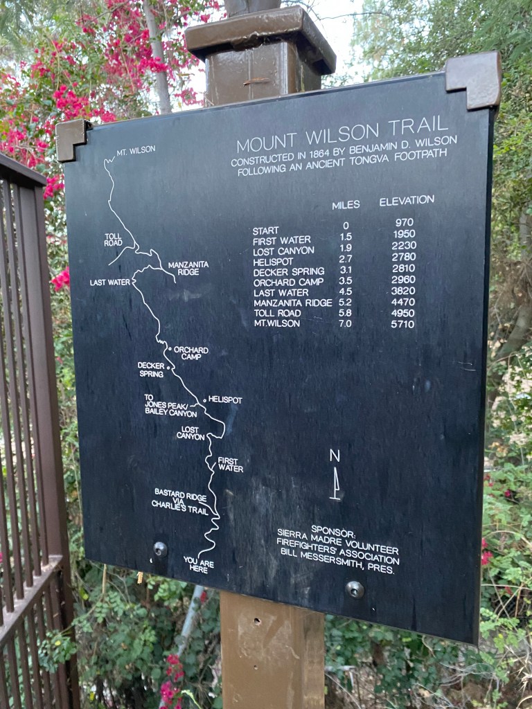
The familiar hike to Orchard Camp was just that- familiar. Even with a 2260 foot elevation gain over 3.5 miles, the quick but steady incline felt pretty good in the coolness of the morning. Still we took about a 20 minute break for some snacks and water before hitting the trail again and heading left on the trail up to Manzanita Ridge.
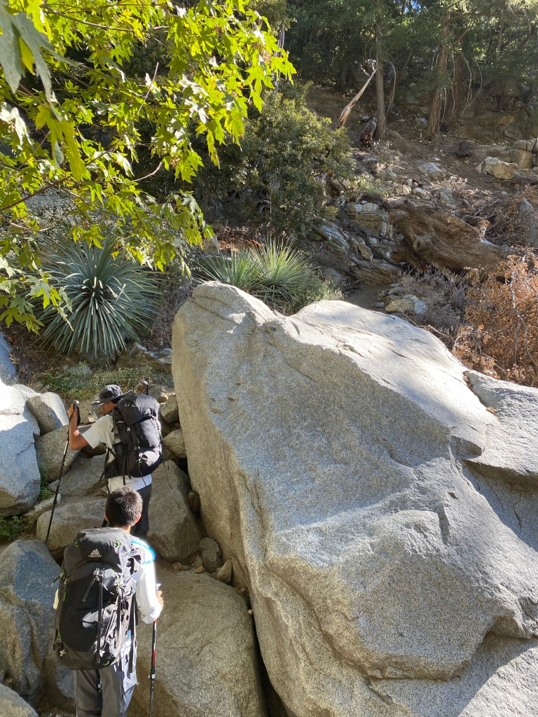
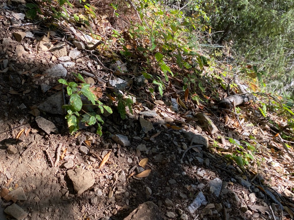
It was admittedly a bit harder to start the hike to Manzanita Ridge. The incline from the ruins of the hikers camp was quick and steep. Thankfully this leveled out a bit, but it was still a steady climb to the ridge. Here we encountered a few very narrow sections and some rocky parts that required a bit more concentration. I would not quite call these bits technical, but they did require some attention. There were also many patches of poison oak along the sides of the trail, so we had to be aware of that as well.
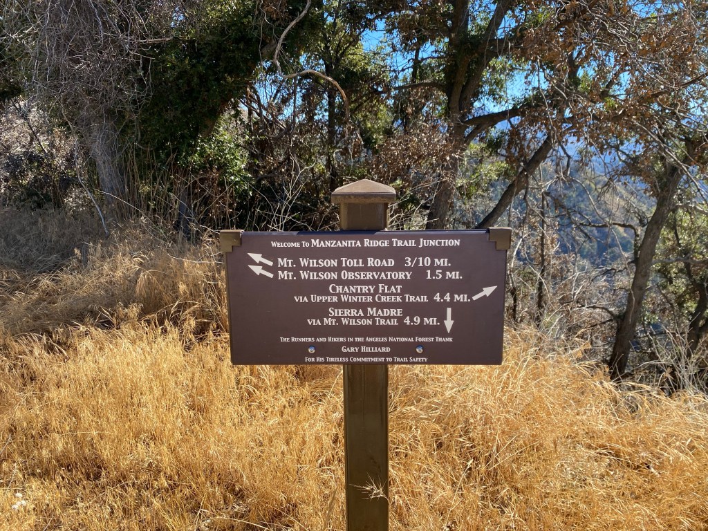

We took about a five minute break at the ridge. Here the Mt. Wilson Trail meets up with the Upper Winter Creek Trail to Chantry Flat. The views from Manzanita Ridge were really pretty looking toward Big Santa Anita Canyon, but even better was that we could see how close we were getting to Mt. Wilson. With some fresh encouragement and plenty of water, we headed up.
It was smooth trekking for about a half mile, until we reached the Mt. Wilson Toll Road. There the trail met up with the unpaved dirt road for another quarter-mile before we came to another junction. At that point we had a choice: continue on the toll road or hike up the trail that roughly parallels it to the peak. We opted for the trail, with the thought that it would be a bit shorter and would have more shade. We were correct on the shade aspect; I wasn’t sure about the distance. What I can say though is that the trail up was definitely tough. Up until that point, I felt pretty good on the trail. The hike was definitely long, but it was feeling relatively easy. However, the last three-quarters of a mile up really started kicking my butt, and reminded me that this hike was indeed challenging.
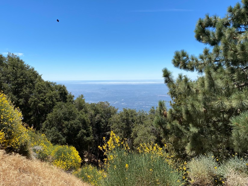

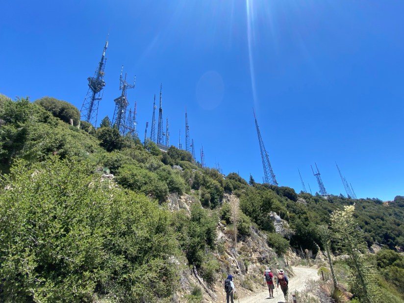
Thankfully though, the views of the radio towers remained in view, serving as encouragement to keep going as we were already so close, and the panoramic views of the San Gabriel Valley and beyond were a testament to how far we had already come. The wildflowers were also in bloom in the heat, and the sweet scents hung in the summer air. We reached the summit and the trail ended at the parking lot in front of the Cosmic Cafe.
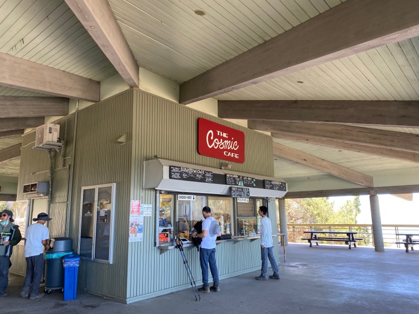
This was probably my favorite part of the hike. I love being outdoors, and there’s no better way to celebrate a good hike than with a cold drink and some food. The guys dropped their packs, and we walked up the short hill to the cafe. I was super happy excited about their dessert offerings, even with what we called ‘Disneyland prices.’ While limited, as would be expected for a mountain top cafe, they had both apple pie and ice cream. Of course, I purchased a slice of pie to accompany my iced tea. It was served warm, and was absolutely delicious after a calf-burning, butt-kicking 7.5 miles up 5004 feet of elevation.
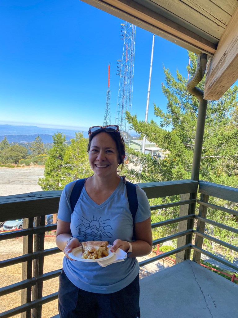
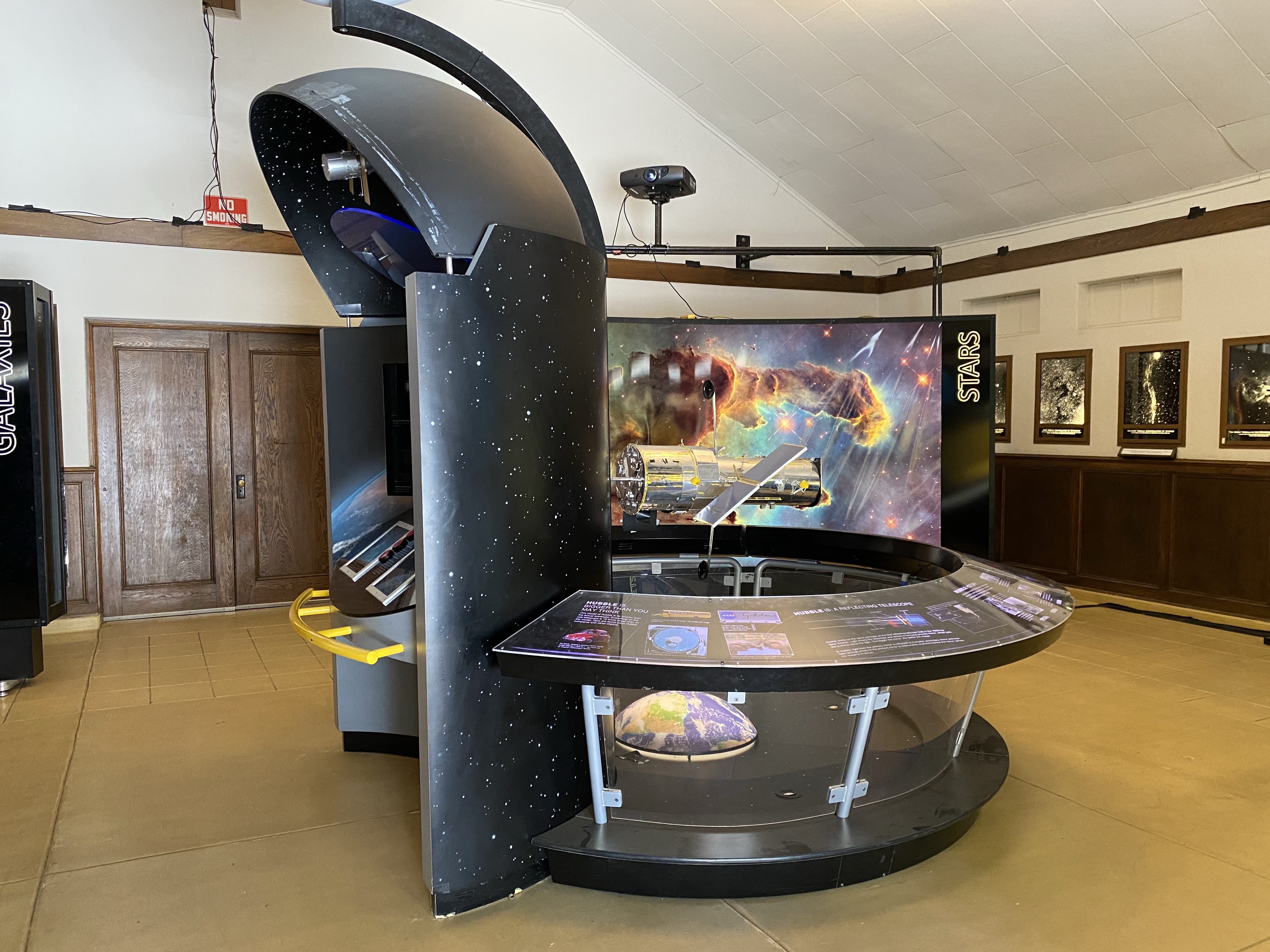
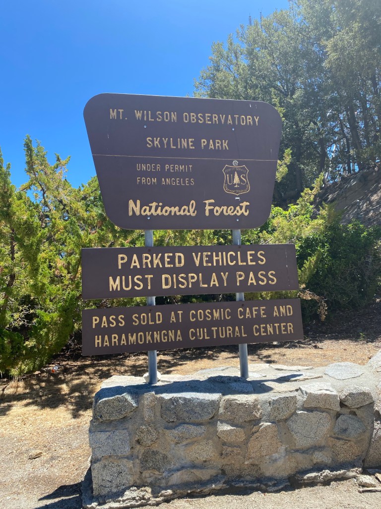
We rested for a bit at the picnic tables at the cafe, and waited for the last two members of our group, who were only about 15 minutes behind us. While there, we talked to some Forest Service volunteers about the hike and the surrounding trails. With Mt. Wilson’s long history of astronomical research and scientific discovery, it is a fun place for a weekend field trip. There are tours that can be purchased to view the multiple telescopes on the mountain top, and there is a small museum paying homage to the Hubble Telescope and other projects in which the Mt. Wilson Observatory has had a role. We hiked around a bit to check it out, giving ourselves our own kind of ‘self-guided tour’ for free.
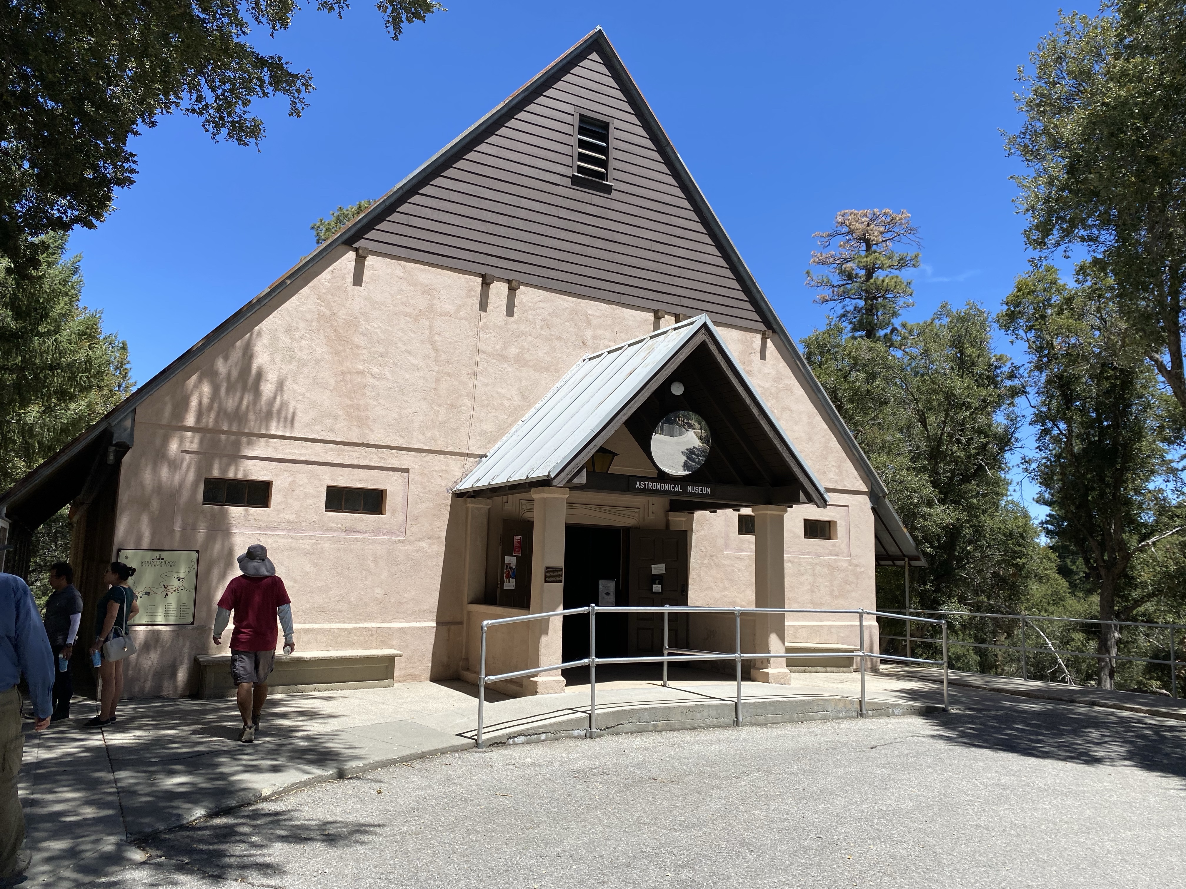
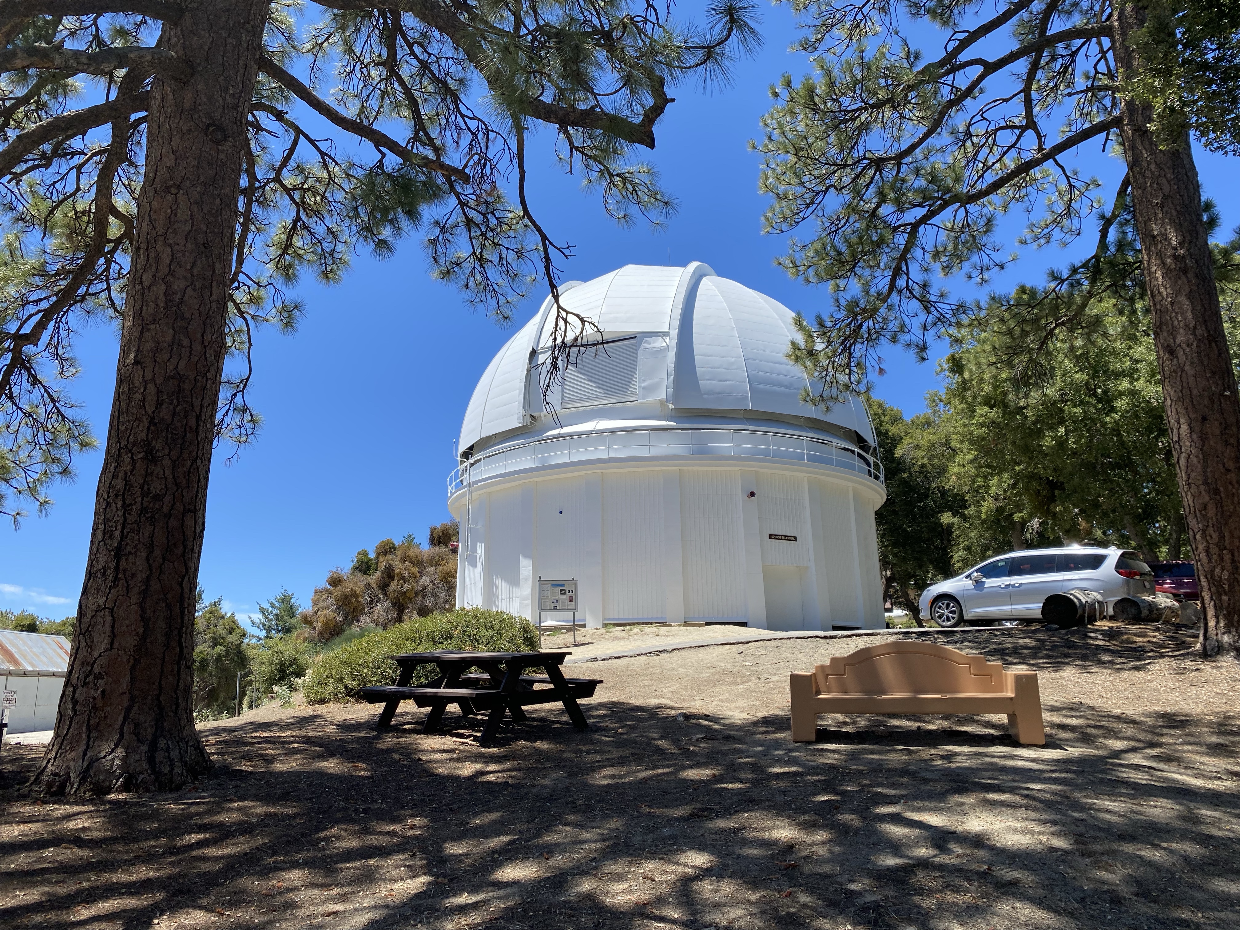

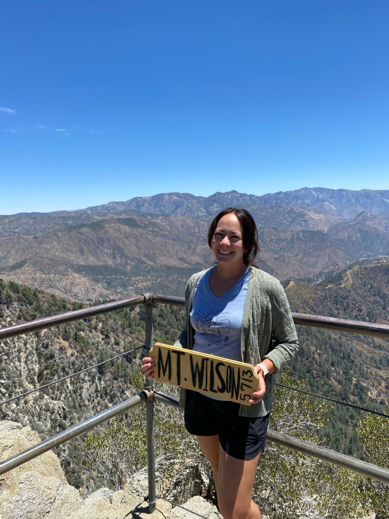
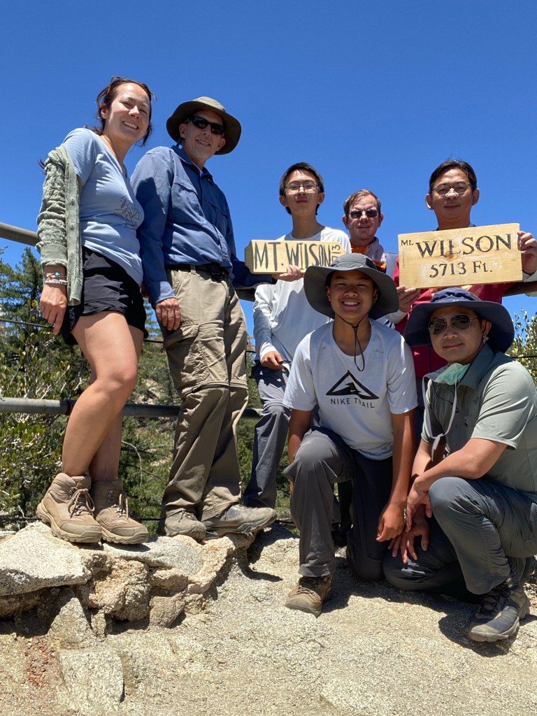
After visiting the museum, we went past the solar telescope, and found what we were looking for. We had asked the Forest Service guys where we could find the wood signs that many a hiker has posed with for social media. Following their direction to the vista point at Echo Rock, we came to the railed point that had views of the San Gabriels clear to Mt. Baldy and beyond to the east, and just behind us in the opposite direction, the observatory. We took many photos with the signs for our social medias then headed back to the cafe.
After another few minutes of rest and a final bathroom stop, we started the hike down. This time, we took the toll road, which gave us some nice views of the line of television and FM towers. This part of the trail was not shaded at all, but it was rather easier on the knees than going down the rocky trail would have been.
While the decent was relatively smooth, it was by no means easy. The day was warm, and though there was a merciful breeze at times, the sun reflecting off the granite felt hot on my face. The trail itself was also long. It is 3.5 miles to Orchard Camp, and another 3.5 miles back to the trailhead. This was no joke, and after the long trek up along with the steps we put in exploring the peak, the strain on my feet was evident especially in the last 1.5 miles of the hike back. It felt grueling toward the end, but we did make it back to trail head at about 4 pm.
We were exhausted by the end of the hike, and we pretty much dropped ourselves on the side of the road by the trailhead. I logged 17.28 miles and 5004 feet of elevation on Strava, Hiking Project tracked 15.5 miles. This hike was no joke, but it made for a few laughs and an amazing day.
Some things to consider:
The hike to Mt. Wilson is considered a strenuous hike. The length of the hike alone can be a challenge, add to that the over 4600 feet in elevation gain and you’ve got what can be a difficult hike. I was definitely feeling it, especially on the return trip which was hard on the knees and feet. Training hikes are recommended.
Parking in Sierra Madre does not require a Forest Service adventure pass, however street parking can get a little tight especially on weekends and holidays. I often park a couple blocks away from the trailhead, even when arriving early on a Saturday morning.
While the trail is shaded in many parts, there are some stretches, especially along the side of Little Santa Anita Canyon that are exposed. If you opt to take the fire road, also note that there is no shade on the trail. Be sure to bring more water than you think you’ll need, trail snacks, and sunscreen.
This is one of the hikes in the Six Pack of Peaks Challenge SoCal. For me, this was peak 4 in the 2022 challenge. It is also the easiest to access from the Pasadena area.
This peak will hold a curiosity for me, especially as a science teacher, when considering the advances in technology and scientific research that took place on this very mountain. I think too that I’ll always associate Mt. Wilson with those trips with Pop many years ago, as he shared his love of adventure and learning. I think that that’s okay, that even in the seasons of loss, that there are happy memories of happy trails that we once traveled on. The peak with its iconic radio towers is a beacon, pointing north from the San Gabriel Valley, giving direction on the literal and figurative roads of life. I hope that you enjoy the trail, because it is about the journey as much as it is about the destination.

5 thoughts on “Hiking the Angeles: Mt. Wilson”