

The County of Calaveras is on the smaller end of the California counties, ranking 40 out of 58 in terms of acreage, but it does boast a number of hiking trails and outdoor areas in a relatively concentrated area. The eastern portion of Calaveras is protected by the Stanislaus National Forest. In addition, there are many Sierra-fed lakes and streams, perfect for water play and fishing. The county also has several reservoirs, including the scenic New Melones along CA-49, one of the largest reservoirs in the state at 12500 acres and 2.4 million acre-feet of capacity. But rather than head out to the larger recreation areas during the limited time we spent at Angels Camp and the surrounding communities, I enjoyed a visit to a local swimming hole: Natural Bridges in the Vallecito area.
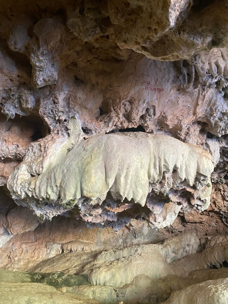
Despite its name, the Natural Bridges are more like a series of limestone caves that were carved out by the waters of Coyote Creek. There are several pools within the caves that are perfect for floating through. The Natural Bridges trail is a well-known secret, a popular spot especially among residents; however, it isn’t on too many Calaveras top ten lists. That said, the small parking area fills up quickly especially on weekends, and after hiking the Natural Bridges trail, I can understand why. This was a fun trek for a dip in a cold creek on a hot summer day.
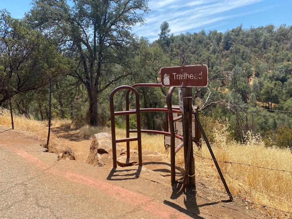
I headed to Natural Bridges right after visiting the Angels Camp museum. It was a close drive, and it was still early in the afternoon on a Tuesday. From the museum, I headed south through the downtown area on Main Street and to CA-4 toward Vallecito. The trailhead was about a 10 minute drive from Angels Camp, and is located off Parrotts Ferry Road. I found that it would be easy to miss without navigation, but Google maps worked just fine here. I was happy to find that being a weekday, there was ample parking in the small parking area off Parrotts Ferry Road along Airola Road. I carefully parallel-parked the car, applied some extra sunscreen and headed over to the trailhead.

I figured that 1.5 liters of water and a few sweet and salty snacks would be enough for the two-mile round trip hike. While the trail was described by the Wyndham concierge as being hard and by Hiking Project as being intermediate-difficult, the hike had only about a 270 foot elevation gain. I suppose though the issue with the hike is that one heads down to the creek, which means that the trek back has a tiring uphill, especially after cooling off in the water. There are also some rocks to climb over, but these are not too common on most parts of the trail. Something to note is that there was quite a bit of poison oak along the trail, however the path is pretty wide so this should not be an issue. Update, August 2023: There are more rocks along the trail since the rains earlier this year. While I would still rate the trail as easy-moderate, the trail is more rocky than when the post was first published.

I hiked down from the trailhead and crossed the first bridge. From there, I continued right, checking with some hikers who were returning from the creek to double-check that I was going in the right direction. From there the trail was pretty straightforward, at least up until I hit the 0.9 mile mark. At that point I and a group of hikers who were prepped for a picnic hit a wooded area with a fence. We continued straight on the trail, which ended up taking us above the creek. After about another tenth of a mile, the trail descended back toward the creek. The only problem was that we were now upstream from the caves, and there was not a clear way back down other than through the caves and the water.


Even so, this turned out to be a fun surprise. There were small crawfish in the water as well as small fish. I observed the animals and took some video to use in future science lessons about arthropods and riparian ecosystems. After several minutes, I bid farewell and good luck to the group who were still exploring how to continue on in their hike. I headed back up the trail from which I came and back to the fence, figuring that I had missed a turn.
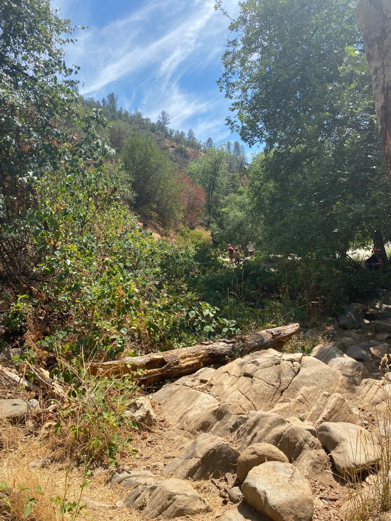
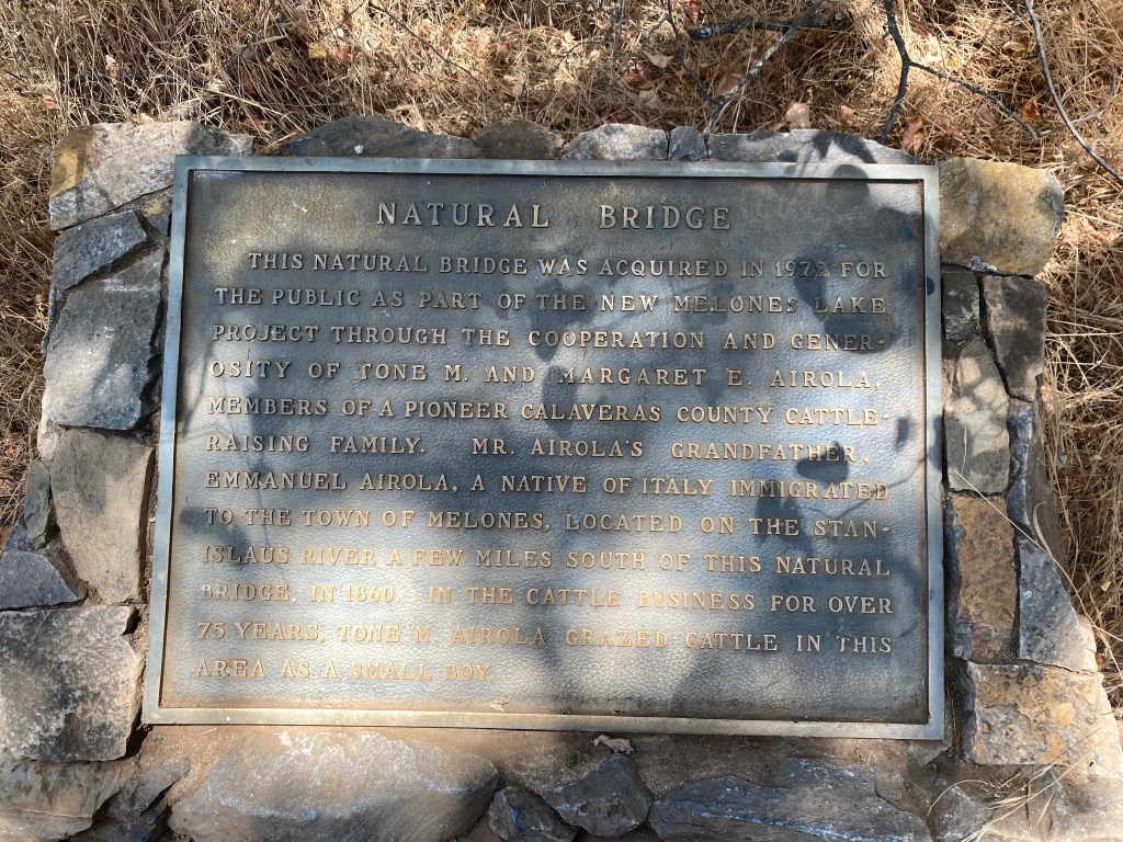
Sure enough, I had. There were some steps that would have been to the left prior to hitting the fenced area and across the trail from a plaque commemorating the acquisition of the natural bridge for public use back in 1973, thanks to the generosity of the Ariola family. Currently, the area is managed by the Bureau of Reclamation. I walked down the steps, and reached my intended destination- the caves.
Just being so near the creek and in the shadow of the caves helped me to cool off from the exertion of a short, moderate hike on a hot afternoon. There were a number of people hanging out near the water, and quite a few kids enjoying their last bits of summer vacation floating on the creek. I kicked off my hiking boots and ventured into the water. I didn’t have much of a desire to change into a swimsuit on this particular trek, so I contented myself with wading. The water was indeed cold and pleasant, a contrast to the heat of the day. Even with just my legs in the water, it was really refreshing.

After hanging out at the stream for a while, I figured it was time to head back to Angels Camp. I reluctantly dried off and put my boots back on and after reapplying more sunscreen, I started the trek back to the car. After having relaxed for a bit and cooling down in the creek, it was a bit more challenging mentally to head back up the hill to the parking area. Still, the trail was not difficult, and while there were some steep spots, especially as I approached the trailhead, the return hike went relatively quickly. According to Strava, the total hike from my vehicle and back was 2.15 miles with 55 minutes of movement. I thought that this was a short hike to a charming place. My photos really don’t do the Natural Bridges justice. This is one happy trail that I would encourage a visit to if you ever find yourself in Calaveras County and want an easy water hike and even a swimming hole to cool off in.
Some things to consider:
The Natural Bridges Day Use Area is managed by the Bureau of Reclamation. There is now an $8 fee to park in the parking area.
Parking is not allowed on Parrotts Ferry Road. The parking area is small and can fill up quickly especially on weekends. It is recommended that if the parking area is full to return at a less busy time. I did not have an issue with parking midweek.
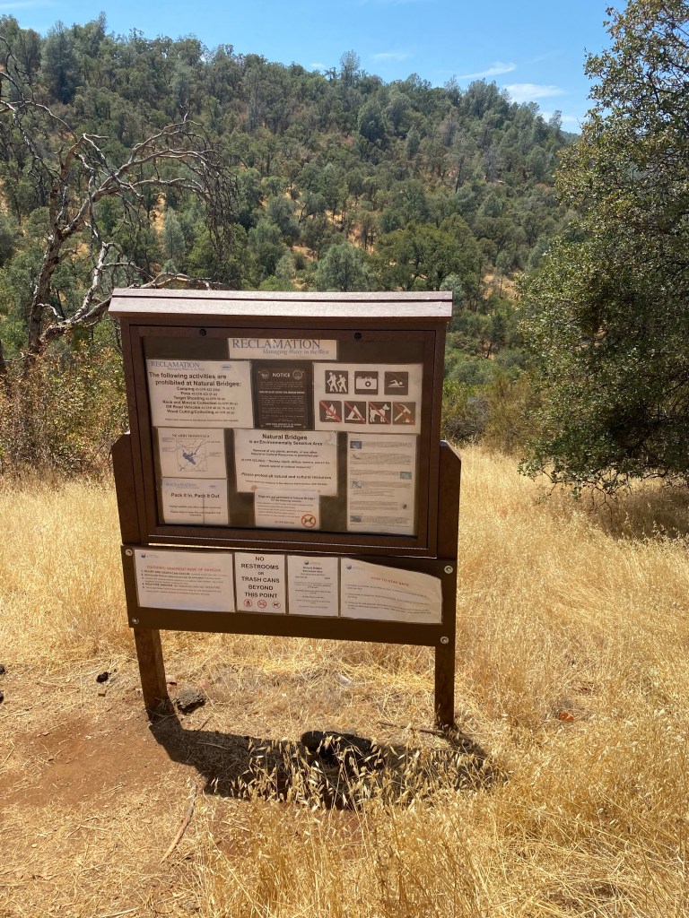
The ecosystem around the Natural Bridges is fragile, and as such, dogs and bikes are not allowed on the trail. Also, websites ask that visitors be careful not to touch the limestone formations in the caves so as not to damage or disturb the natural formations.
Please be sure to practice leave no trace principles. There are toilets not far from the trailhead in the parking area, however there are none along the trail. There is also no trash service, so be sure to pack in and pack out. The area is beautiful, but it needs our help to stay that way for future visitors.
The hike to Natural Bridges was definitely fun. I wished that I had more time on this trip to explore the many other trails in Calaveras County. There are so many natural areas with scenic as well as historic value. I hope to make Angels Camp- and Calaveras County- the destination for a future vacation. Happy trails!
To plan your trip, check out:
Calaveras Visitors Bureau
Natural Bridges Trail
References:
“California Land Area County Rank.” USA.com, http://www.usa.com/rank/california-state–land-area–county-rank.htm.
*This post was updated in August 2023 to include new photos. The original trail information remains the same at time of writing; however there is a bit more water in the creek and there are more rocky spots due to the winter 2023 rains.

1 thought on “The Natural Bridges of Calaveras County”