

The San Gabriel Mountains have long held a wealth of history and natural resources. Long before California was a state, the Gabrielino Indians utilized the flora and fauna in the mountains for food, medicine, and tools. In the decades following California gaining statehood, these mountains became especially popular in the late 19th and early 20th centuries as visitors flocked to the forest during the “golden age of hiking.” As a result, there are many historic sites in the San Gabriels’ front range- from the ruins of the Echo Mountain House to the historic Mt. Lowe Railroad– that bear witness to these times gone by. Indeed, one may opine that we are still in a ‘golden age of hiking,’ however the amenities that our local mountains offer are of a different sort.
In addition to the natural beauty of the mountains and their resources in terms of plants, wildlife, and water, the mountains did once have gold. While not nearly on the scale of gold mining operations in Northern California, Dawn Mine, located in Millard Canyon, was the site of gold mining in the San Gabriel Mountains intermittently from about 1895 until the mine shut down permanently in 1954. Today, the mine is an attraction for hikers who want a moderate adventure along a popular trail that isn’t quite as busy as Echo Mountain or Henninger Flats.
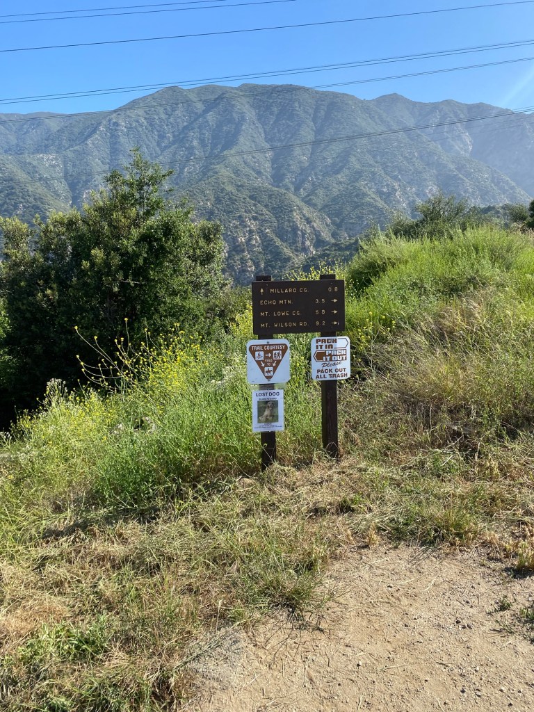
On Memorial Day, we set out to hike from Millard Campground to Dawn Mine. It appeared that much of the Pasadena area had the same thought. So after seeing that the campground parking lot was full, we drove back up and parked along Chaney Trail. After applying sunscreen and bug spray, we set off for the Sunset Ridge Trail. We followed the road back up to the gate by the small parking area at the junction of Chaney Trail and Mt. Lowe Road. We walked past the gate and continued on the road. After about a tenth of a mile, we saw the sign for the trail coming up from Millard Campground. We continued on the road in the direction of Echo Mountain. After about 0.4 mile, we came upon the sign for the Sunset Ridge Trail. There was also some nice signage talking about the history of the Mt. Lowe Scenic Railway and the significance of both Mt. Lowe Road and the trail we were hiking.
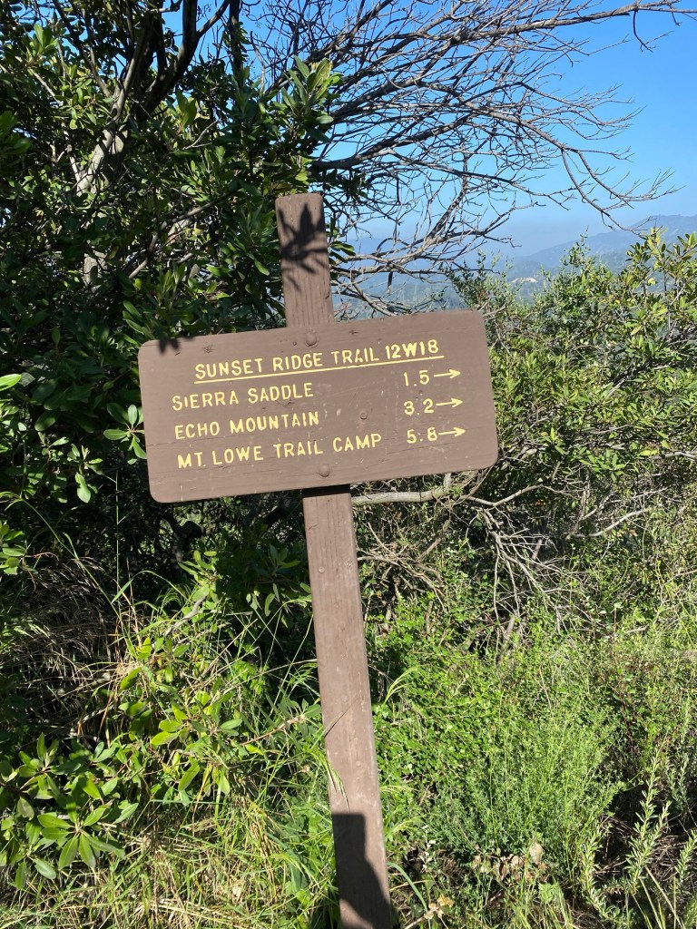

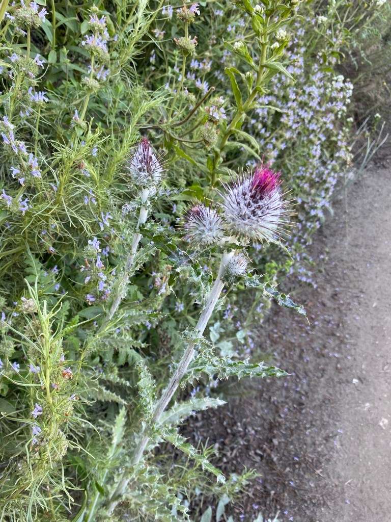
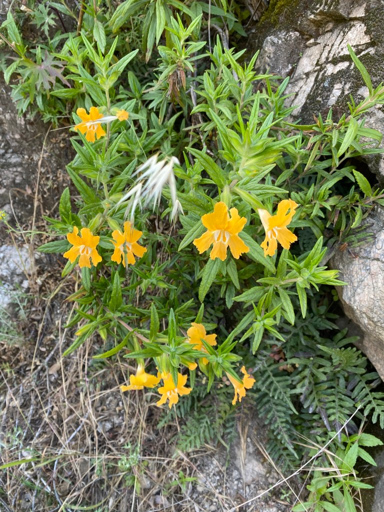
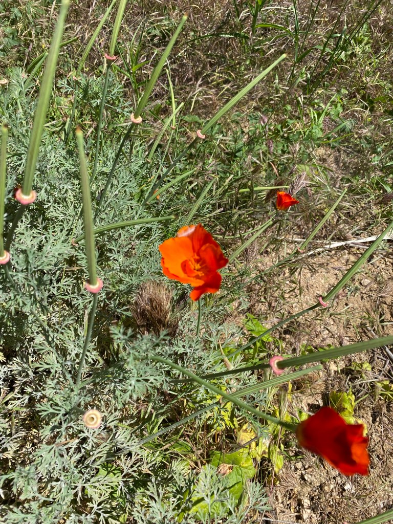
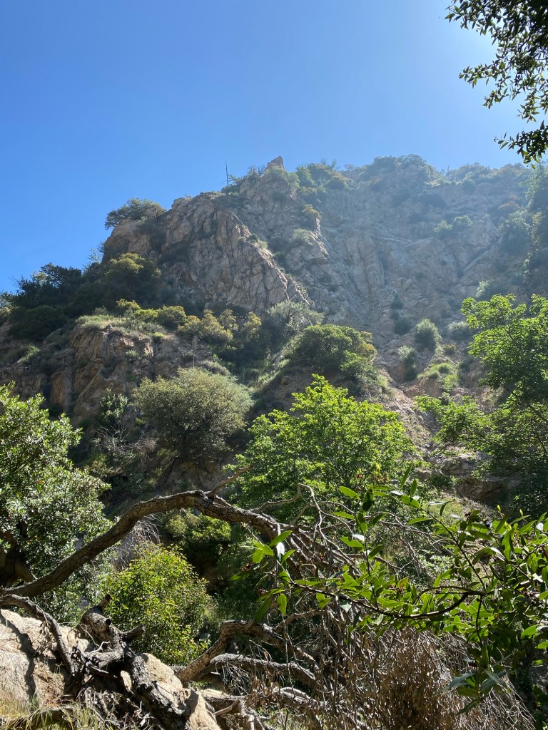
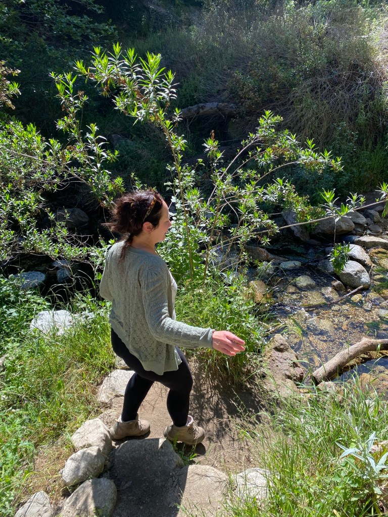
After looking at the signs for a bit, we headed onto the Sunset Ridge Trail. The trail was not super shaded, even as it started dipping into the canyon. That said, the morning was still relatively cool, and there were a variety of wildflowers in bloom.
After walking a bit, we came to the split in the trail, and followed the sign for Dawn Mine. This would take us deeper into the canyon.

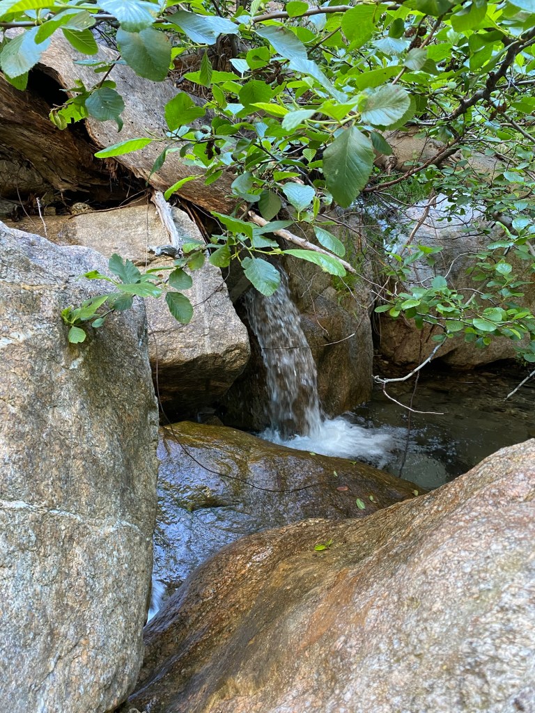
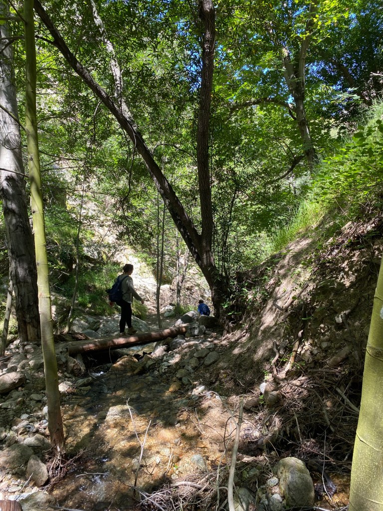
I’ve hiked this trail before, and while there is always some water in the stream, it is typically not as much as there was on this hike. The rainy winter made this much more pleasant with all the mini-waterfalls and pools along the trail.

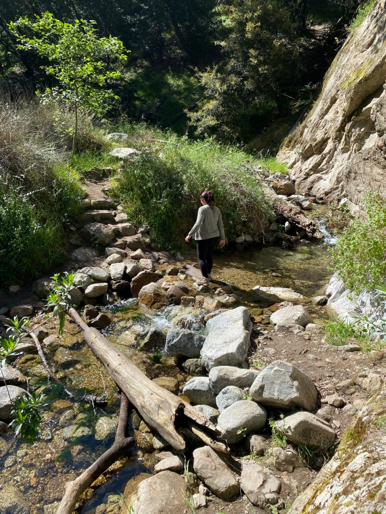
There were also a number of stream crossings. These were not too difficult to cross, however, for me it does require some caution.
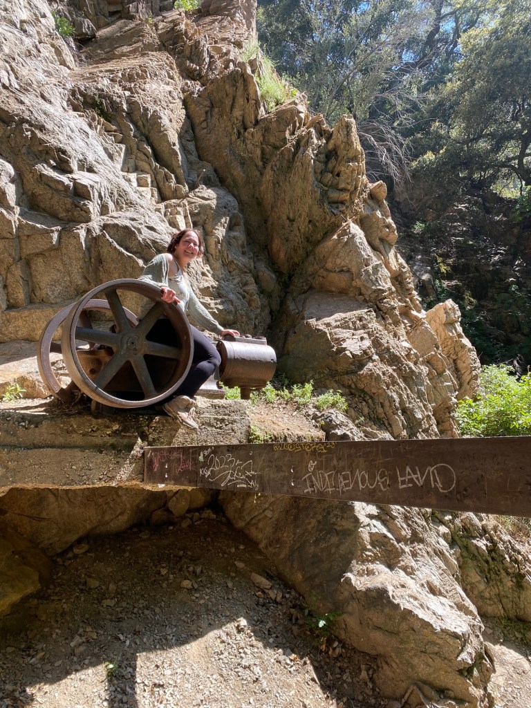
We continued the trail, and soon came to the remnants of the old water pump, our signal that we had arrived at Dawn Mine. According to friends of mine who grew up hiking the hills above Altadena, the mine used to be accessible, albeit dangerous, to explore. However, since about 2017, the entrance to the mine has been secured by a sturdy metal gate. This was due to vandalism, as well as the obvious safety issues an abandoned mine presents. Indeed, there was some water trickling from a rock close to the mine entrance, which could indicate that the lower part of the mine was flooded, as it is prone to do.
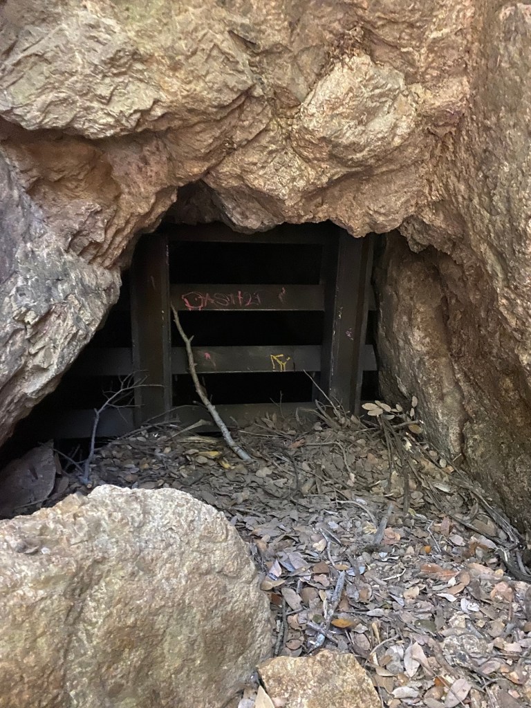
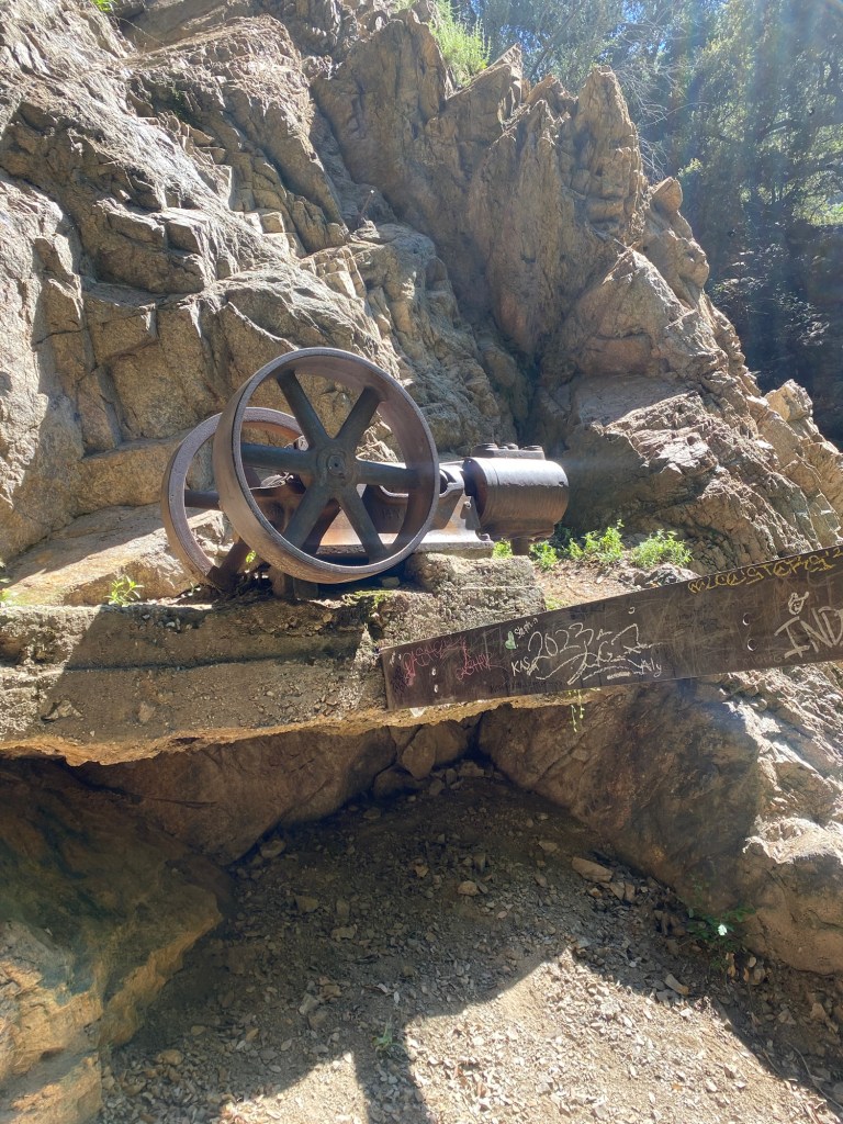
We hung out for a bit, and ate snacks by the entrance to the mine. The day had warmed up substantially, and I could feel the temperature difference in and out of the cave thanks to the draft. It felt pleasant, kind of like an air conditioner. After cooling off, I climbed up onto the old water pump, as is my usual habit. I am noticing though I am becoming a bit more cautious and less agile with age- more like I’m afraid of falling than anything else. Still, it was fun climbing up onto the old structure and playing for a bit.
However, soon it was time to turn around. Our plan was to drive down to Riverside to pay tribute to Dad for Memorial Day, so we would have to hightail it back home to get changed. Rather than taking the loop trail, we headed back the way we came. In terms of distance and elevation, it was pretty similar to what we would have experienced had we done the lollipop, which is a route we’ve taken in the past. It felt faster heading out of the canyon, even with the rescue of a dropped water bottle in the stream and the heat of the day. All in all, it was a nice moderate hike through some pretty scenery.
Some things to consider:
I do like this trail, as it is rather well marked. There are some areas around the water crossings where it can be difficult to tell where the trail picks up. I have found that as long as I’m paying attention and not getting too distracted, this is not a major issue, especially since this trail is relatively popular.

The Dawn Mine hike is considered moderate. My memory likes to remember it as being rather flat, however there is an elevation change. Strava registered the hike as 5.03 miles from where we parked with 1307 feet of elevation. This is not exactly flat. Additionally, there are a number of water crossings, rocky spots, and areas where the trail gets really narrow. That said, the gain felt for the most part more gradual once on the Sunset Ridge Trail, so it wasn’t too bad.
The canyon is nicely shaded, however there are areas where we caught some sun. Also, the road is not shaded, so sun protection are a must, as is plenty of water.
I would say that the worst thing about this trail is the parking situation. There is a tiny parking area right near the gate, which fills up very quickly. There is usually parking near Millard Campground, however, the morning we went, the lot was full and then some. The overflow lot along Chaney Trail was still closed when we started our hike (it was opened when we returned), so we parked on the side of the road on Chaney Trail. All that to say, parking can be a bear. Please be courteous to other motorists as the road is narrow.
Adventure passes are required to park in the lots as this is part of the Angeles National Forest. As usual, I recommend the America the Beautiful national parks pass. For only $80, this pass grants one year of entry to America’s national parks and federal lands. For many adventurers, this is a steal; it is one of my annual purchases where I feel I get my money’s worth and then some. This can be purchased at national parks, online, or at REI and other adventure retailers. If more national forest adventures are your jam, the adventure pass may also be picked up at REI.
For those in the Pasadena area, the Dawn Mine hike is a nice work out and a fun adventure that pays homage to eras gone by. I like this hike for all of the reasons above, and for me, it holds memories of hiking with the pup in his younger days. After all, life is an adventure meant to be shared.
References:
Masters, Nathan. “Rise of the Sierra Madre: A Brief History of the San Gabriel Mountains.” PBS SoCal, 21 June 2022, http://www.pbssocal.org/shows/lost-la/rise-of-the-sierra-madre-a-brief-history-of-the-san-gabriel-mountains.
Fassbender, Posted byTom. “The Dawn Mine.” Los Angeles Explorers Guild, 4 June 2022, losangelesexplorersguild.com/2021/06/29/the-dawn-mine/.

2 thoughts on “Hiking the Angeles: Dawn Mine”