

I’ve spent the last several weekends hiking in the Angeles National Forest, with each adventure bringing something a bit different- from different landmarks, to interesting plants, to the different perspectives each trail has to offer. And with literally hundreds of miles of trails across over 700000 acres, there are many opportunities for unique adventures.
One of my favorite trailheads begins at Eaton Saddle, off Mt. Wilson Red Box Road and about two miles south of the Red Box Picnic Area and Haramokngna American Indian Cultural center. Eaton Saddle is a spot between two mountains- San Gabriel Peak and Occidental Peak- and overlooks Eaton Canyon to the south. From the saddle, hikers can take the Mt. Lowe Fire Road or cross Red Box to head to Valley Forge. Either way, it is a great starting point for many treks.
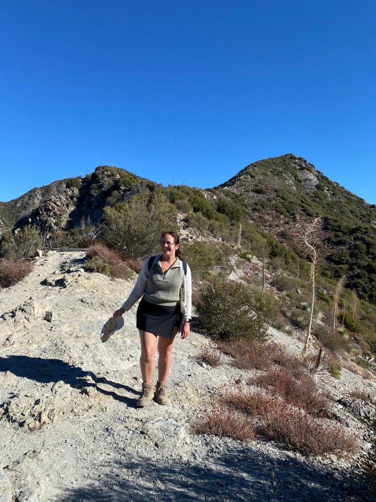
I have not yet headed down the trail to Valley Forge, but we have done many hikes taking the Lowe Road. For us, the Mt. Lowe fire road is the gateway to many of our adventures. In the last month or so, we headed up to the peak of Mt. Lowe, as well as San Gabriel Peak and Mt. Disappointment. Our last two hikes did not involve us heading directly to a peak, but we were able to explore more of the trails in this part of the Angeles.
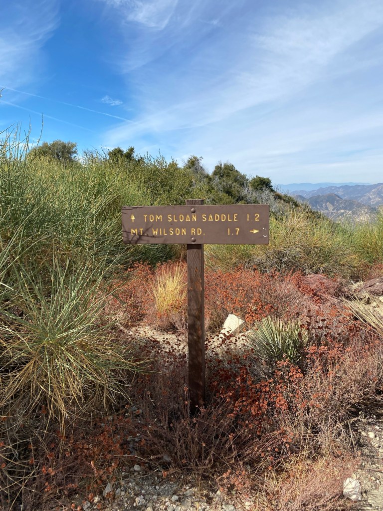
Tom Sloan Trail
To get to Tom Sloan Saddle, we started at Eaton Saddle and headed down the Mt. Lowe Fire Road through Mueller Tunnel. When we reached Markham Saddle, we continued down the middle path, rather than left to Mt. Lowe or right to San Gabriel Peak.
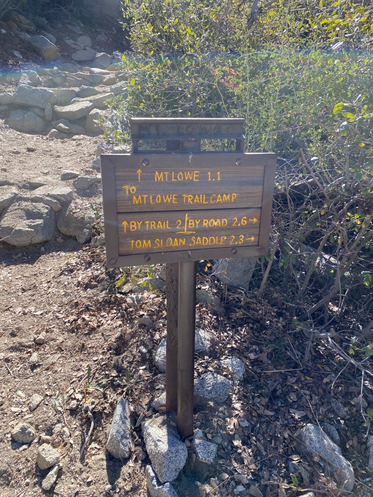
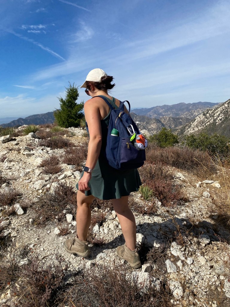
The Tom Sloan Trail heads west and has a slight decline to the saddle, which connects with the Bear Canyon Trail, Dawn Mine Trail, and a trail to the summit of Brown Mountain. We did not continue onto other trails on this trek; our late morning start prohibited us from making this into a longer journey.
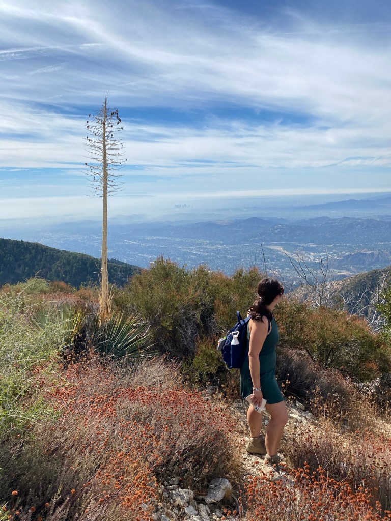
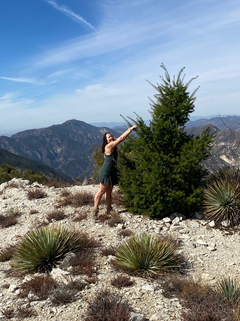
That said, we did enjoy gorgeous views of the San Gabriels, and I was enchanted by what looked like a random Christmas tree along the trail.
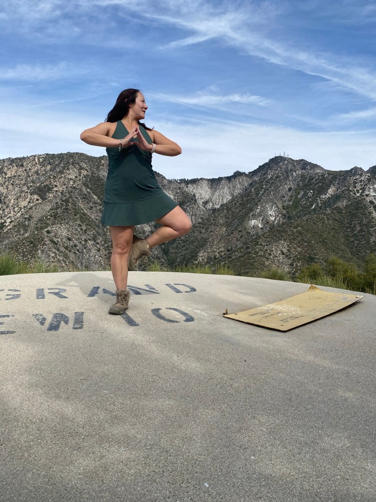
After taking a few photos, we continued on a bit further. We were about a quarter-mile away from the saddle when we decided to turn around. It was getting to the afternoon, and we were starting to get hungry. On the way back, we stopped at the water tank for a short sit and some trail snacks. I also pretended to do some yoga. This trail would have been great for some real yoga; the day was was very quiet. After Markham Saddle, we didn’t see other hikers along Tom Sloan Trail.
The trek back was not difficult. The elevation gain according to Strava was about 750 feet, and the trail was in good shape for the most part. There were a couple spots that were a bit overgrown, but overall, it was pleasant. This was an easy adventure on a slow morning after a busy week.
Eaton Saddle to Inspiration Point
I’ve done the hike up to Inspiration Point a number of times, usually starting from Cobb Estate, heading up to Echo Mountain and through Castle Canyon. This route is a hike that is about five miles up and five or six miles down depending on if I take the Castle Canyon Trail for an out and back hike or I do a sort of loop and return via Sam Merrill. Regardless, it is over ten miles with about 2800 feet of elevation gain.
To cut out some mileage as well as elevation, we can get to Inspiration Point via the east Mt. Lowe Road. This hike ended up being only six miles out and back and 1316 feet of elevation according to Strava.
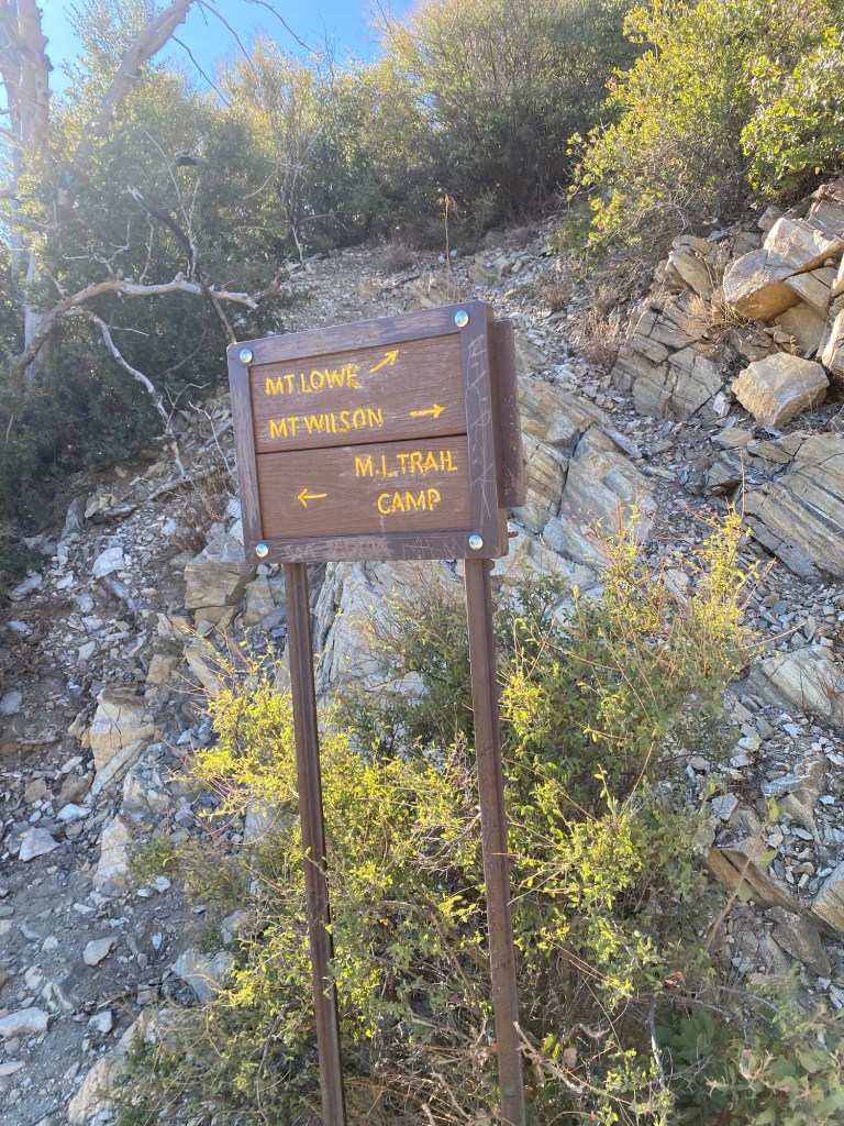
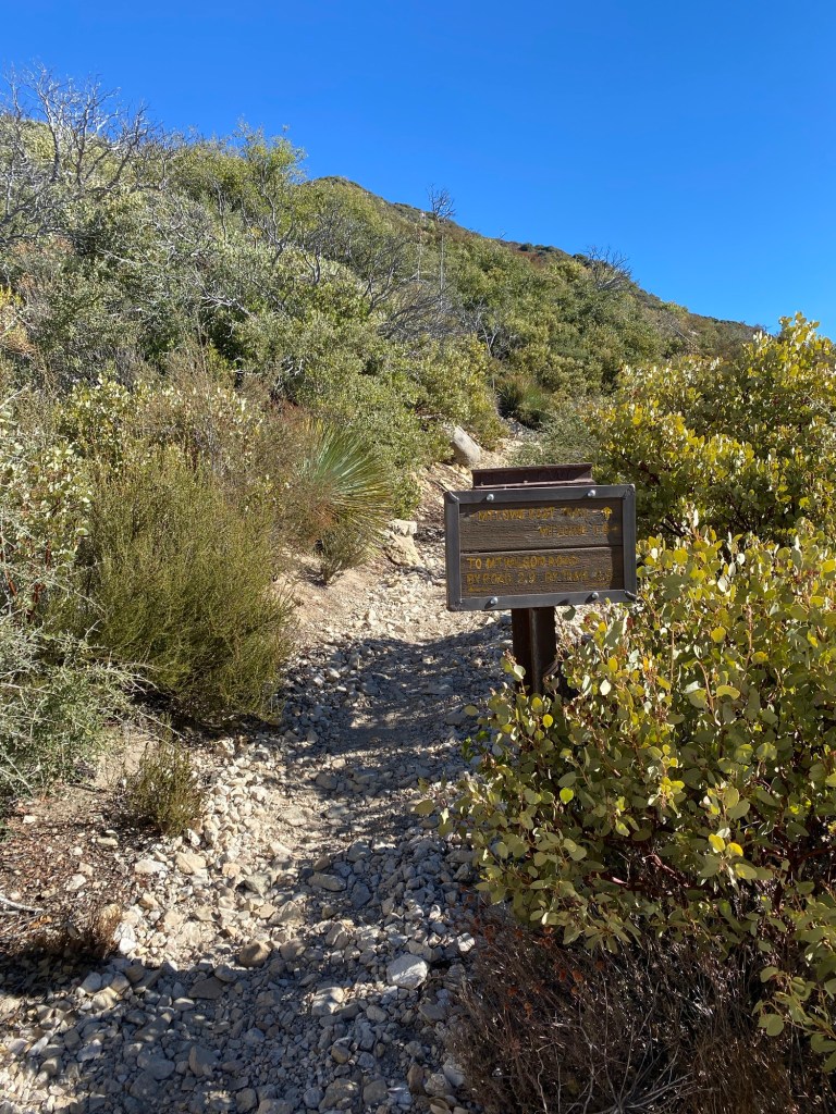
To get to Inspiration Point, we again started from Eaton Saddle and took the Mt. Lowe Road to Markham Saddle. From the saddle, we took the trail up to Mt. Lowe. After over a half-mile or so, we came to a fork in the trail: up would continue to the peak of Mt. Lowe, left goes toward Mt. Lowe Trail Camp, which is only about a quarter-mile from Inspiration Point.
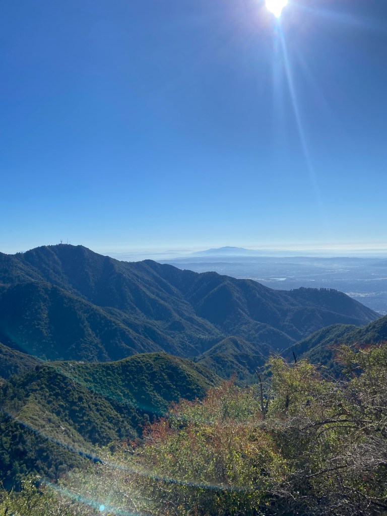
We took the trail to the left. From there we had panoramic views of Mt. Markham and Mt. Wilson. The trail at this point was rather exposed, but the weather was thankfully cool with an occasional breeze so it wasn’t unpleasant.
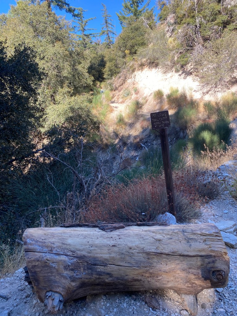
It was 1.5 miles down to the trail camp. The trail did get narrow and rocky at some points. As we approached the road, the trail split, and there was a sign indicating to to to the left to head to Inspiration Point, or head right toward Mt. Lowe Trail Camp. We headed right and after about another quarter mile we came to a spot with several large Spanish broom plants that were rather overgrown right before the trail met the road. Once on the road, we found the sign for the trail to the old Alpine Tavern.
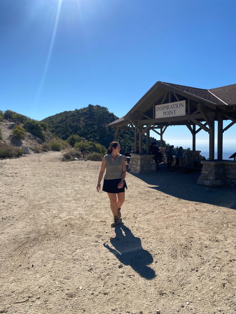
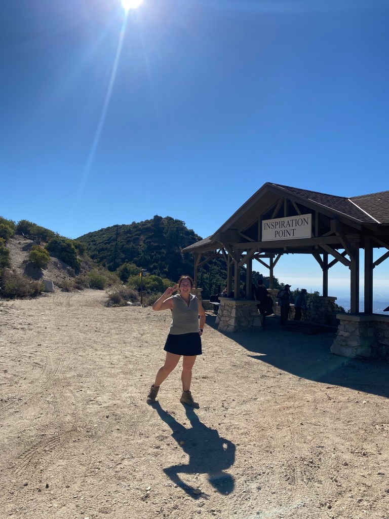
Rather than head down to the Alpine Tavern site, we continued on the road to Mt. Lowe Trail Camp. From there, it was another 0.2 miles to Inspiration Point.
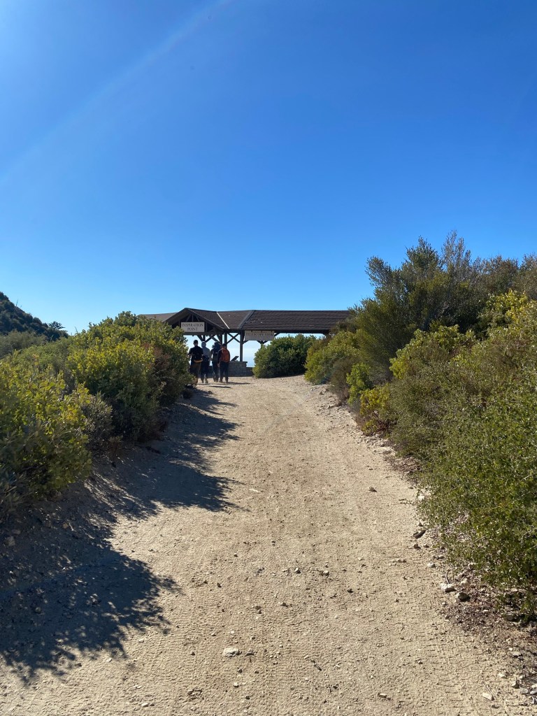
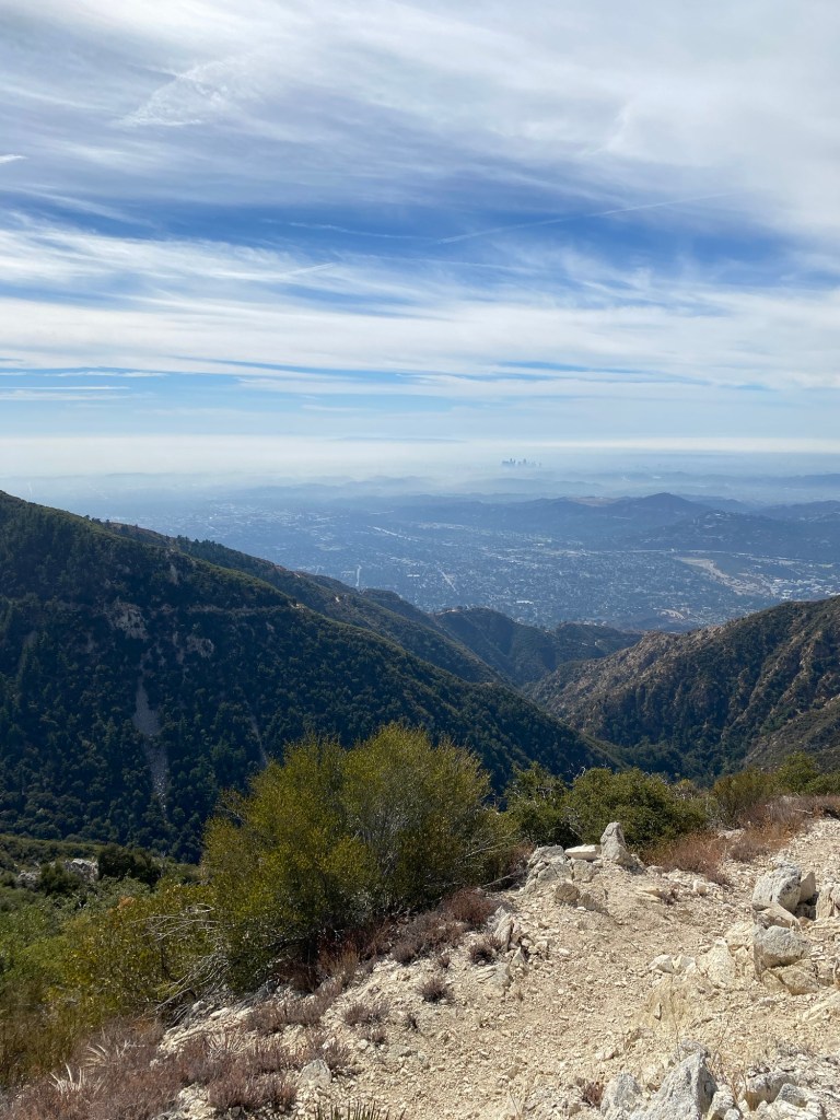
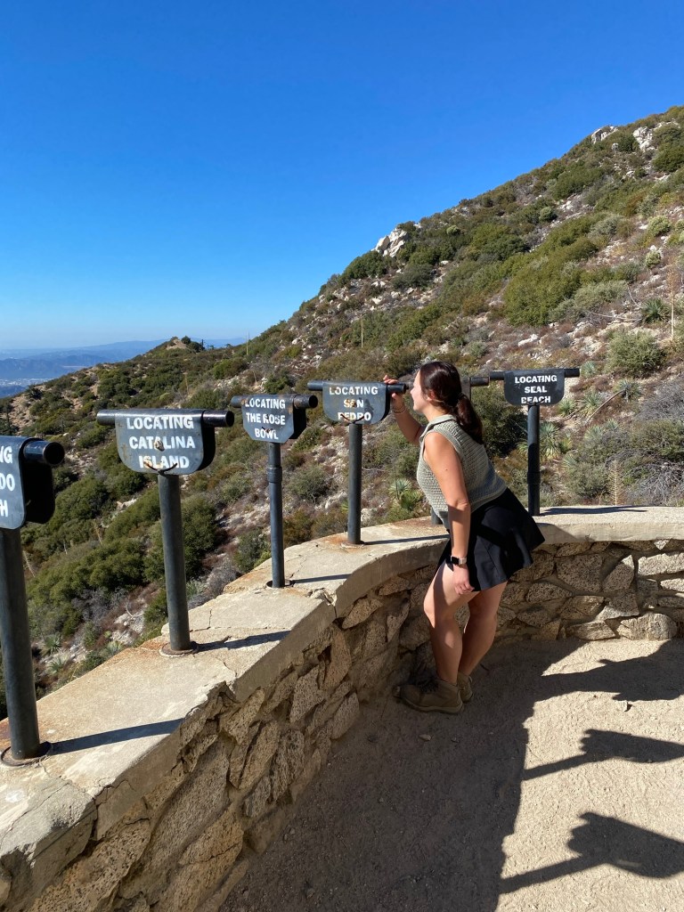
Inspiration Point is a popular spot for hikers and mountain bikers, and there were a number of them on this crisp autumn day. It is one of my favorite spots, offering expansive views of the valley below. Indeed, there are telescopic viewfinders directed at various landmarks across the LA area.
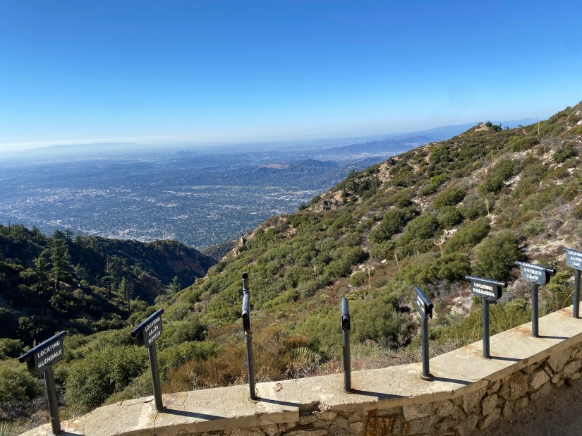
We took a spot on one of the many benches to enjoy a trail snack and the pleasant weather. After finishing my banana and some espresso crackers, I headed down to look through the telescopes. Even with the thin layer of haze, the landscape below was beautiful.
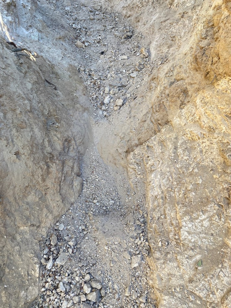
Too soon, it was time to head back. Unfortunately, heading down to Inspiration Point meant that to get back to the Subie, we would have to climb back up. Easier said than done. The Mt. Lowe East Trail was rather washed out at points. I put one foot in front of the other as I slid backwards a bit while regretting my life’s decisions.
While tiring, we got past the gravely parts and back on a smoother path. The uphill was still a moderate incline, but at least it was easier. After about 1.5 miles, we got back to the sign and went back down the side of Mt. Lowe to Markham Saddle and back to the car. It had been a fun morning of exploring, and it was time to head back down Angeles Crest to La Canada for brunch and a very large orange juice.
Some things to consider:
Adventure passes are required to park anywhere within the Angeles National Forest, including at Eaton Saddle These are $5 per day, or $30 for an annual pass. If you plan on visiting other national lands over the course of the year, I recommend purchasing an America the Beautiful National Parks pass. At just $80 per year, I’m pretty sure we’ve already gotten our money’s worth in the three months we’ve had our 2024 pass.
Both trails, along with others in this section of the Angeles are rather exposed. While there is shade in the canyons, there is also a lot of sun. Hats, sunscreen, and plenty of water are definitely advised.
The trail to Inspiration Point from Eaton Saddle is rated moderately challenging. With the elevation gain and general difficulty of the trail, I would agree with this assessment with some additional info. There are parts of the trail that are narrow and require some caution. There were also parts of the Mt. Lowe Trail east that were very rocky. For the most part, trekking poles are not necessary, however there were a few sections of the trail where poles would have been helpful.
These were certainly fun adventures in the Angeles National Forest, and there are many more to be had. Just pick a happy trail (or two) and go! Cheers!
References:
Eaton Saddle, 14 Oct. 1999, tchester.org/sgm/places/eaton_saddle.html.

3 thoughts on “Hiking the Angeles: Eaton Saddle Trails”