

Prepare for Disappointment

Way back in the day, in the late 1800s, surveyors observing the San Gabriels east from the Santa Susana Mountains spotted the peaks in the vicinity of Mt. Wilson. The story goes that based on their visual assessment, they figured that the peak shown in the photo above was the highest in that section of the range. After reaching the peak, on closer inspection- and measurement- they were disappointed to find that its neighbor, San Gabriel Peak, just a half-mile away, was actually higher by about 167 feet. And thus, Mt. Disappointment received its ironic moniker.
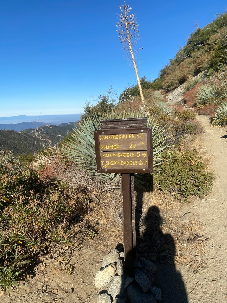
Today, Mt. Disappointment and San Gabriel Peak both can be hiked starting from Eaton Saddle. It is only about a 4.4 mile hike from the saddle to bag both peaks, and both offer up some stunning views of the mountains to the east as well as the San Gabriel Valley below.
As we did the weekend prior when we hiked Mt. Lowe, we headed up Angeles Crest Highway and onto Mt. Wilson Red Box Road. We parked just north of the small parking area at the trailhead, as there were more cars on this particular weekend than the weekend prior. We figured that others were out to enjoy the second weekend of fine early fall weather.

After applying our sunscreen and bug spray, we gathered our hiking essentials, this time bringing along a set of trekking poles, and hit the trail. We once again set out on the Mt. Lowe Motorway above the top of Eaton Canyon and passed through the Mueller Tunnel. After exiting the tunnel, we continued west and came to Markham Saddle, which has several trail options. We took the trail to our right, up to San Gabriel Peak and toward Red Box.
This was a quick climb. While it was only about a mile to the road, the trail was a good ascent. There were some parts that were rather narrow, as well as areas where there was some previous rockfall. Nevertheless, we arrived at the road and our next point of historic interest: an old Nike missile launch site.

During the Cold War, Nike missiles were kept to provide an anti-aircraft defense in the case the United States came under attack. There were a number of sites around California to protect major cities like Los Angeles and San Francisco. Fortunately, the missiles never had to be deployed, and the project was dismantled in the 1970s. Today, only the foundations of the mess hall and barracks remain at this site in the Angeles National Forest. After taking a few photos, we continued up the road to the peak of Mt. Disappointment.
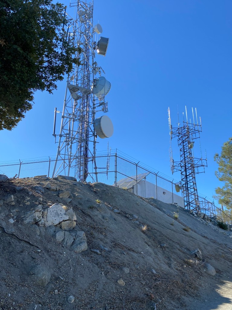
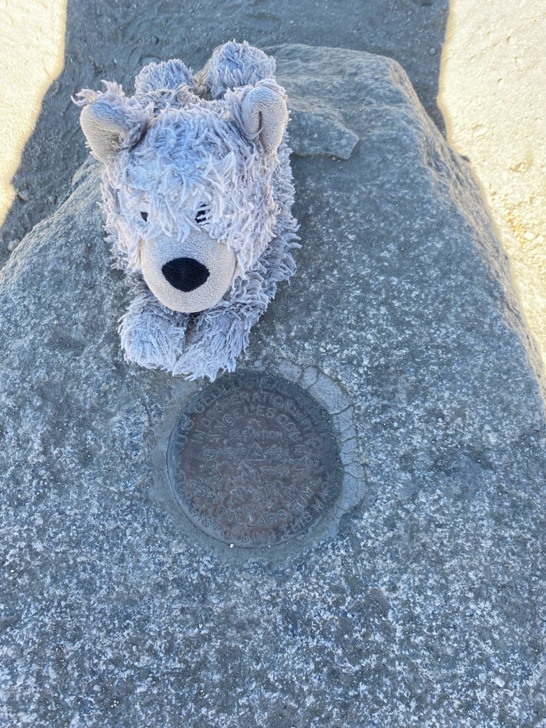
The peak would have been the actual launch site had it ever needed to be activated. Currently, the peak hosts a number of military telecommunications equipment. We saw signs that indicated that at least some of the equipment was managed by the Army Corps of Engineers. One ‘disappointment’ I had was that none of the towers belonged to Verizon. I was still quite without cell service.
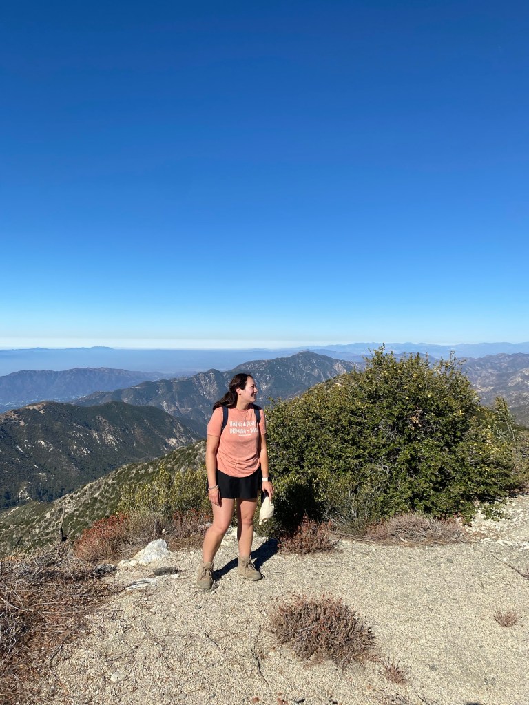
What was not a disappointment, however, was the view. The views of the mountains behind us and the valley below were truly spectacular. I climbed up on the rocks to get a better look while enjoying the bright blue sky and the mild fall day. After taking more pictures and chatting with a group of hikers who arrived shortly after us, we headed back down the road and to the trail up to San Gabriel Peak.
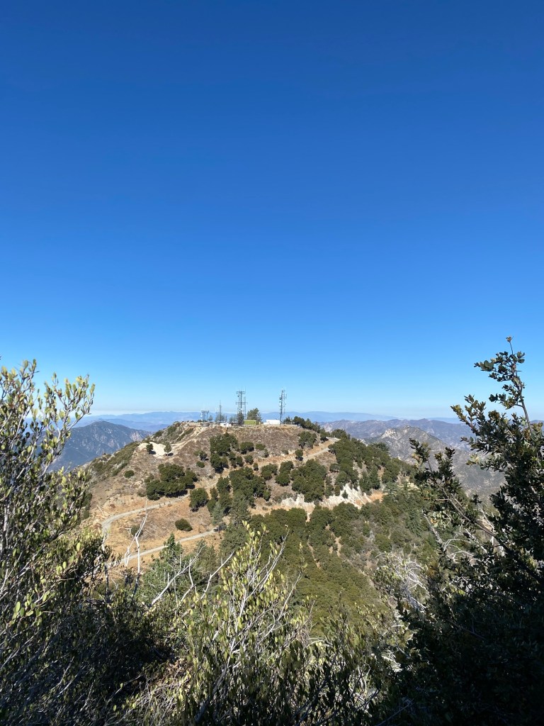
I was glad we hiked Mt. Disappointment first. While San Gabriel Peak is only 167 feet higher than Mt. Disappointment, the trail has more narrow portions as well as steep areas and rocks. I was on the struggle bus a good way up the mountain. Though it was interesting to see the view of Mt. Disappointment from trail up to San Gabriel Peak. From the trek up to San Gabriel, it becomes obvious that there is indeed a height difference.
After spending a few more minutes riding the struggle bus, we arrived at the peak. This hike wasn’t very long, but it was steep, and the day was really starting to warm up. We soon reached the peak, and were rewarded with gorgeous views of Mt. Wilson and its familiar radio towers.

We stopped for photos and our trail snacks. At the top of the mountain, there are a number of benches for weary hikers to sit and take in the views. We didn’t spend too much time at the peak, as there was no shade. As we started our descent, we met up with the hikers we had chatted with at Mt. Disappointment. It seems that we all had a similar idea for a morning adventure.
The trek back down went smoothly. It helped to have the trekking poles for the steep and sandy parts of the trail. All in all, though, it was not bad on a dry day without any obstacles along our path. We made quick work of our descent back to Markham Saddle, and from there, it was a quick walk back through the tunnel and back to the car. We had plenty of time for the drive back to La Canada to fuel and a stop in nearby Montrose to get a yummy brunch at the Black Cow Cafe, complete with a strawberry mimosa.
Some things to consider:
While the hike to both Mt. Disappointment and San Gabriel Peak is only about 4.4 miles, it is rated challenging. There is a 1256 foot elevation gain from Eaton Saddle, according to my Strava. Additionally, there are points along the trail that are both steep and narrow and require some caution.
Many hiking websites mention poodle-dog bush. It is a plant that thrives in the aftermath of brush fires. This pretty purple plant experienced a surge in growth after the Station Fire burned swaths of the San Gabriels. While lovely to look at, it would not be so lovely to touch. The oils in the plant are toxic, and cause a reaction similar to that of poison oak. Fortunately, I did not encounter any poodle-dog bush along the trail on the day I hiked, but just be aware that it can and does grow in the San Gabriel Mountains.
Much of the trail is exposed, especially in the afternoon. Sun protection and plenty of water are a must.
While we did run into a few fellow hikers on the trail, the trails from Eaton Saddle are typically not as busy as those that are more accessible from Altadena. That said, the small parking area at the saddle did fill up quickly, and we did have to park along Red Box Road.
Adventure passes are required to park anywhere within the Angeles National Forest. These are $5 per day, or $30 for an annual pass. If you plan on visiting other national lands over the course of the year, I recommend purchasing an America the Beautiful National Parks pass. At just $80, it is a great value for many adventures.
I had fun exploring Mt. Disappointment and San Gabriel Peak this past Saturday. These peaks have been on my list for a few years now, ever since I hiked up Mt. Lowe for the first time. There is so much to explore in this area of the San Gabriel Mountains. With literally hundreds of miles of hiking trails to explore, there is much opportunity for adventures meant to be shared.

References:
“Cold War Era, 1952-1974.” National Parks Service, U.S. Department of the Interior, http://www.nps.gov/goga/learn/historyculture/cold-war.htm. Accessed 1 Oct. 2024.
Mount Disappointment and San Gabriel Peak | Map, Guide – California | Alltrails, http://www.alltrails.com/trail/us/california/mount-disappointment-and-san-gabriel-peak. Accessed 1 Oct. 2024.
“Angeles National Forest – Recreation.” Forest Service National Website, http://www.fs.usda.gov/detail/angeles/recreation/?cid=stelprdb5318308. Accessed 1 Oct. 2024.

3 thoughts on “Hiking the Angeles: Mt. Disappointment and San Gabriel Peak”