

This Thanksgiving holiday, we had hopes of a low-key family vacation to get a reprieve from the stresses of everyday life. So we booked a five-day stay in Pinetop, Arizona. Unfortunately, however, the older kids did not have time off from their jobs or from Rose Parade preparation, thus this trip was indeed going to be a low-key vacation.
So in the morning of the Tuesday before Thanksgiving, we loaded up the Subie with the essentials and a backseat full of Sami’s knuffles and set off for the nine-hour drive from the Los Angeles area up to the White Mountains of eastern Arizona. The drive took longer than I had anticipated; I had not considered rush hour traffic through Phoenix when I mapped out our route. While stopped for dinner in Mesa, I debated with myself and the internet as to whether we should take the ‘shorter’ route to Pinetop via U.S. 60 through Salt River Canyon or to take the slightly longer but less challenging AZ-87, also known as the Beeline Highway.

According to various sites, AZ-87 from Mesa to Peyson can pose some challenges. The road is winding, and there is an elevation change of about 3800 feet over 74 miles. It is said to be a very scenic drive through the Tonto National Forest. Unfortunately, it was dark by the time we hit this portion of our drive, so I couldn’t enjoy the views. The dark was also why I went for what I thought would be a safer drive at night. We made it safely to the WorldMark just past 10 pm, and ended up being last check-in of the evening. By then, I was ready for a nice shower and a good sleep.
The morning brought a renewed sense of adventure and a hankering for breakfast. Thankfully, the small resort town of Pinetop-Lakeside offers both. Located in Navajo County, and nestled in the White Mountains, the town incorporated in 1984 when Pinetop and Lakeside merged. The White Mountains Trail System, centered mainly around Pinetop-Lakeside and the neighboring town of Show Low, consists of over 200 miles of trails for hikers, mountain bikers, and equestrians to enjoy.
After breakfast at Darbi’s Cafe and shopping for groceries at the local Safeway, we were ready to stretch our legs. There are a number of easy hikes within a five-mile radius of the resort. One of those was literally in our ‘backyard,’ so to speak, with a path to the Springs Trail from the building next to ours. In this post, I’ll share three easy hikes we explored in Pinetop-Lakeside.
Springs Trail
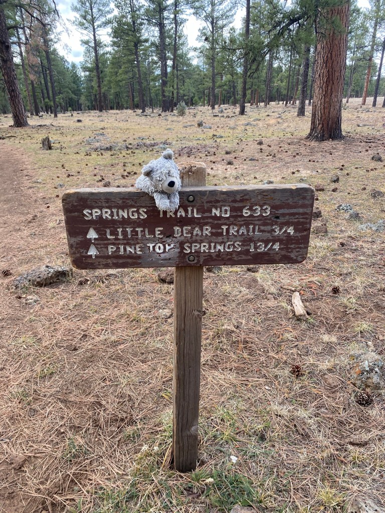
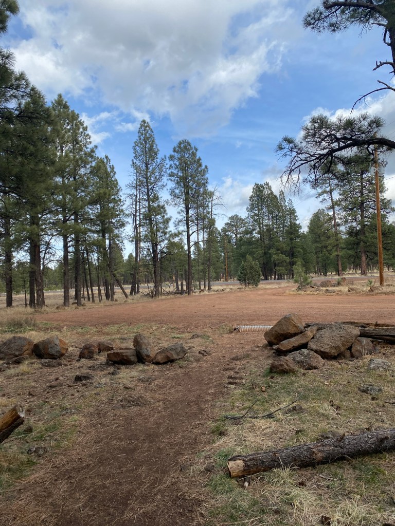
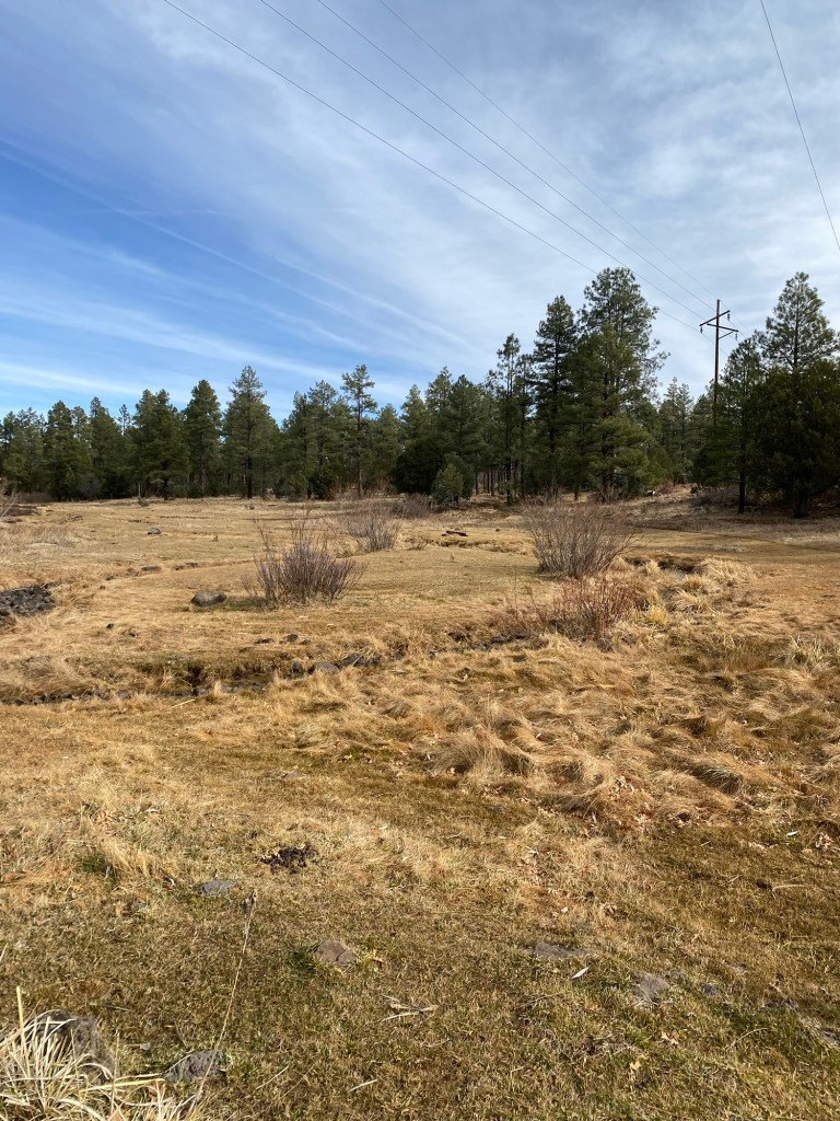
Our first trail on this trip was the easy Springs Trail. This 3.6 miles loop in the Apache-Sitgreaves National Forest is a popular spot for hiking and horseback riding. The trailhead starts at Forest Road 182, with a large sign marking the start of the trail.

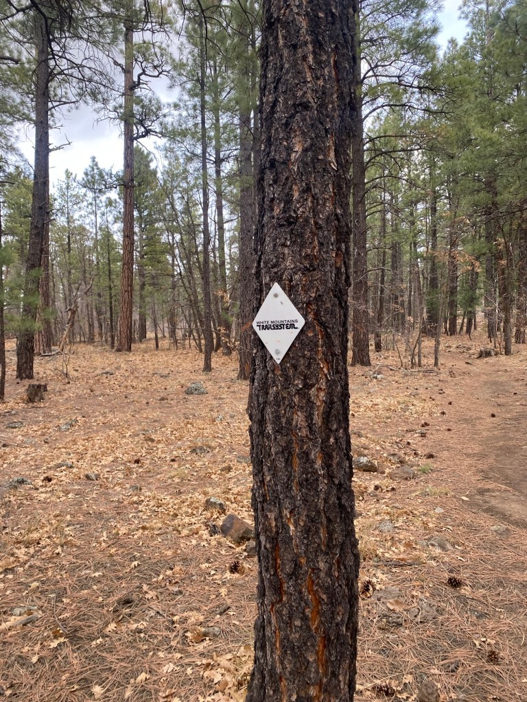
However, we did not start our hike from this point, rather we started on the path from WorldMark Pinetop. This was no problem as the Springs Trail is a loop, and like most trails in the White Mountains Trail System, is well-marked. There are silver diamonds screwed into the trees to mark the trail, as well as numbers that indicate where you are, which is especially helpful in the case of emergencies. We entered the loop between S6 and S7 and followed the trail through the tall ponderosa pines east to the trailhead. After looking at the map on the kiosk, we headed back on the trail, looping west back toward the resort. We crossed and then followed Thompson Creek, which had some spots that were frozen over, a reminder that winter skies are approaching.

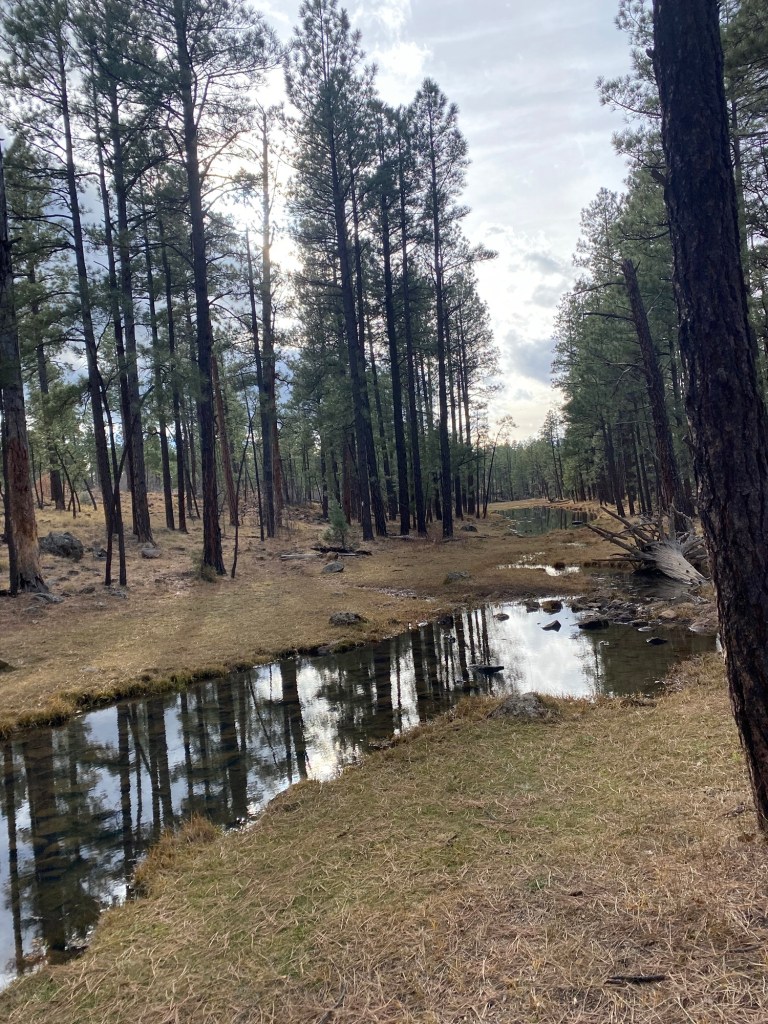
This hike took about an hour-and-a-half, and I logged a total distance of 4 miles, including the short walk from the resort. Elevation was only 188 feet of gain in short stretches of the trail that switchbacked away from the creek. The rest of the trail was pretty flat. This was an easy hike to reset after a full day of driving the day before.
Pat Mullen Mountain via Country Club Trail
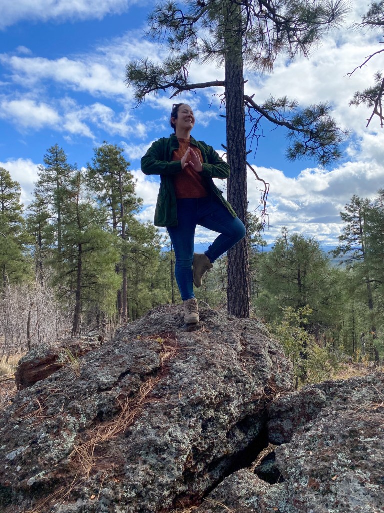
Thanksgiving Day was a perfect opportunity for a late-morning hike before prepping our semi-traditional Thanksgiving dinner. After some consideration, we decided up to Pat Mullen Mountain for scenic views of the surrounding peaks, including Mt. Baldy and Porter Mountain.
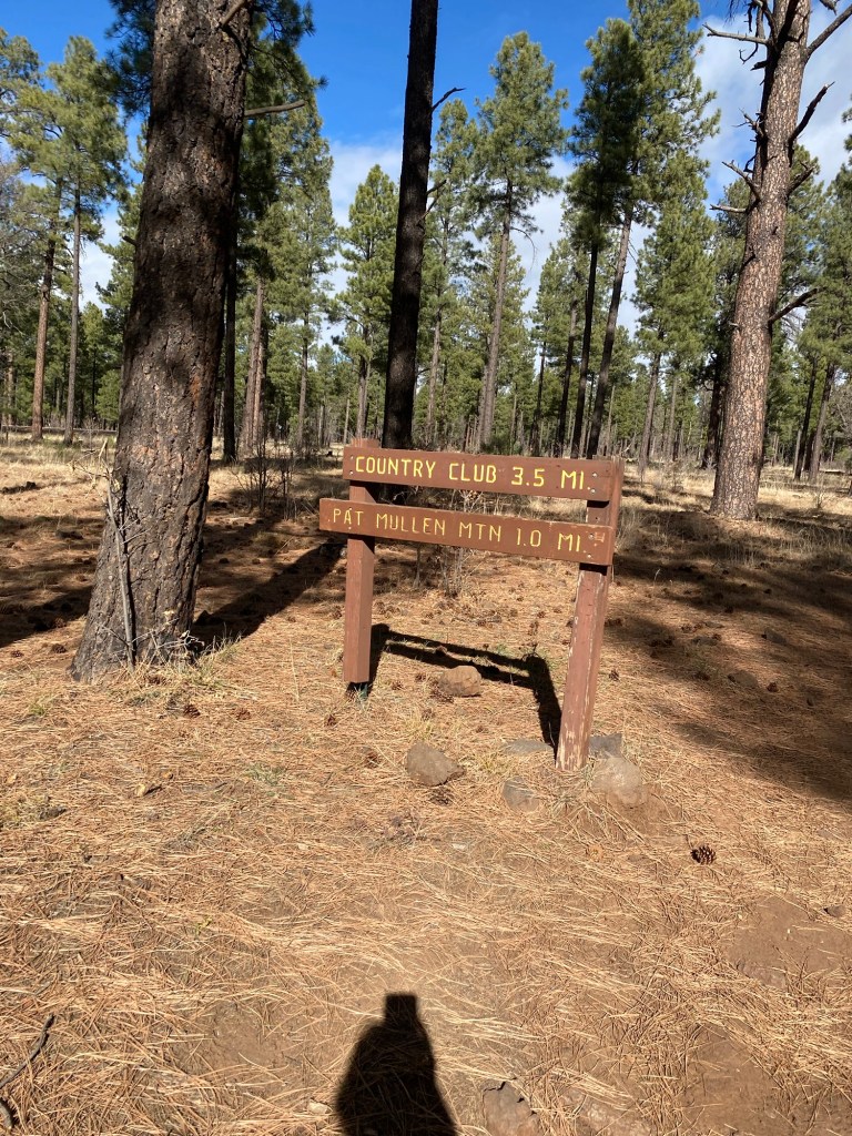
We started this hike at the Country Club Trail along Forest Road 185. We did the Country Club loop going clockwise, as this would make a shorter trek to the mountain. Most of the trail was pretty flat, though rocky in parts. The half-mile spur up to the peak, called the Huf’n Puff Trail on Strava, gave the hike about 230 feet of elevation.

Admittedly, the summit was a bit disappointing. There were not cute wooden signs to take photos with, nor was there anything marking the peak. Additionally, the views were better on the way up to the peak. There was quite a bit of timber that was obstructing the view.
Still, it was a nice trip up. After taking photos, we headed back down the mountain and back onto the Country Club Trail. We deliberated on whether we should take the short way, making an out-and-back hike. We decided to finish the loop and get a few more steps. On the loop back to the car, we found the junction for the Chipmunk Connector, a 7-mile trail connecting Country Club to the Los Burros Trail.
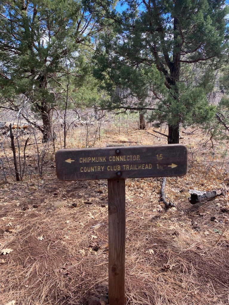
We followed the sign to the Country Club trailhead, making good time back to the car. The trail was pretty quiet on this Thanksgiving morning, though we did step aside for a pair of mountain bikers and a few hikers. This hike is rated moderate. I think this is a fair assessment, though perhaps on the easier side of moderate. The trail, while mostly flat, is rocky in many areas. It can also get muddy, depending on weather conditions. Like the Springs Trail, it is well-marked, except at the peak. It took us 1 hour 42 minutes to complete the 4.45 mile route, with a total elevation gain of 443 feet according to Strava.
Ice Cave via Blue Ridge Cave Trail
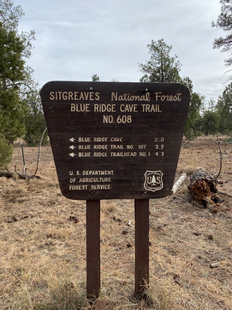
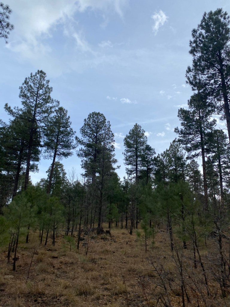
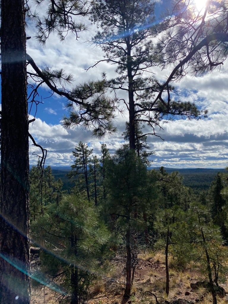
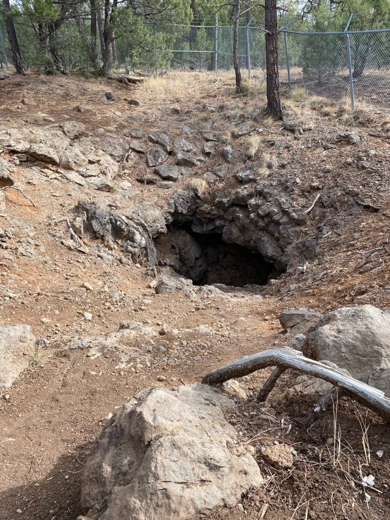
I think the most fun trail on this trip was the Blue Ridge Cave Trail. This trail took us through ponderosa pine and junipers to an ice cave. According to the U.S. Forest Service, the cave is actually a lava tube that formed from the volcanic activity in what was the Springerville Volcanic Field. It was possibly called an ‘ice cave’ because of the cool air that continuously flows from it.
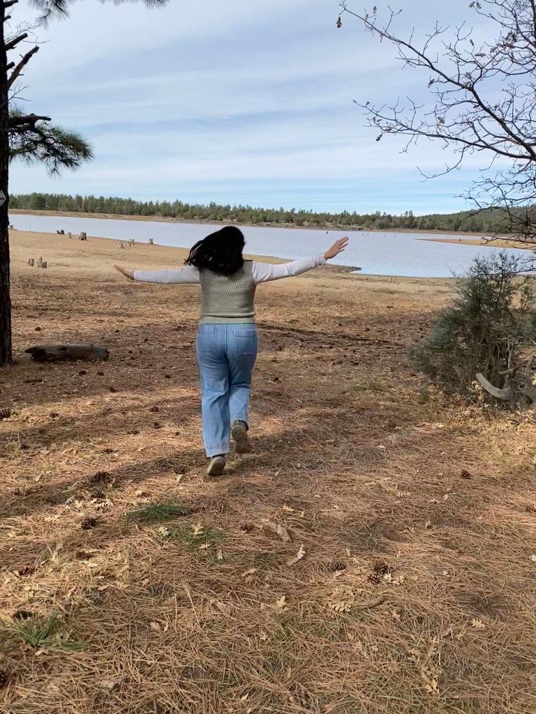
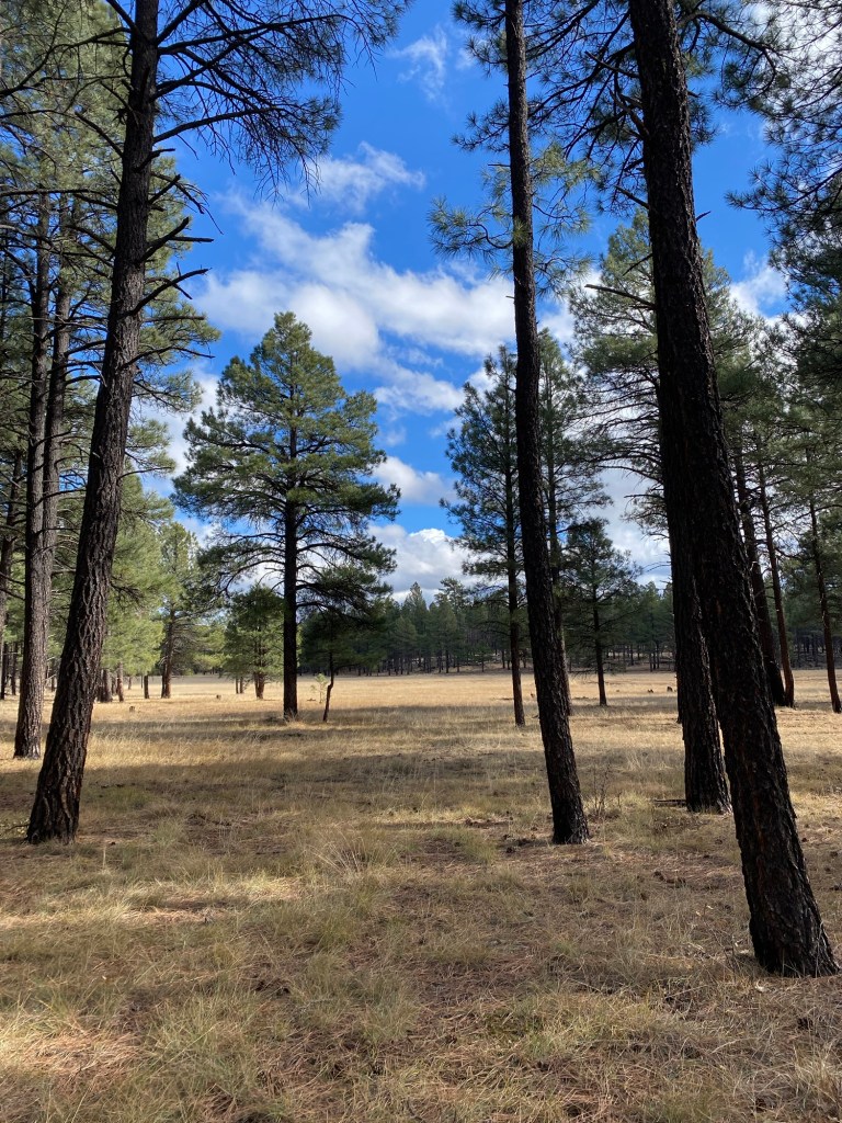
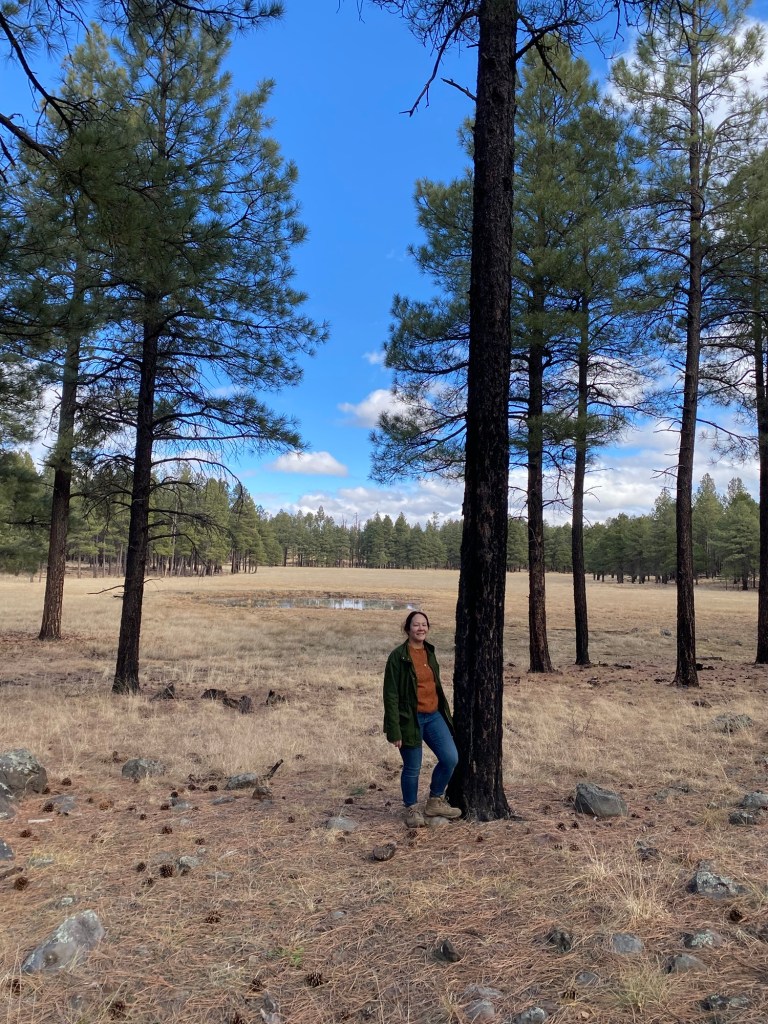
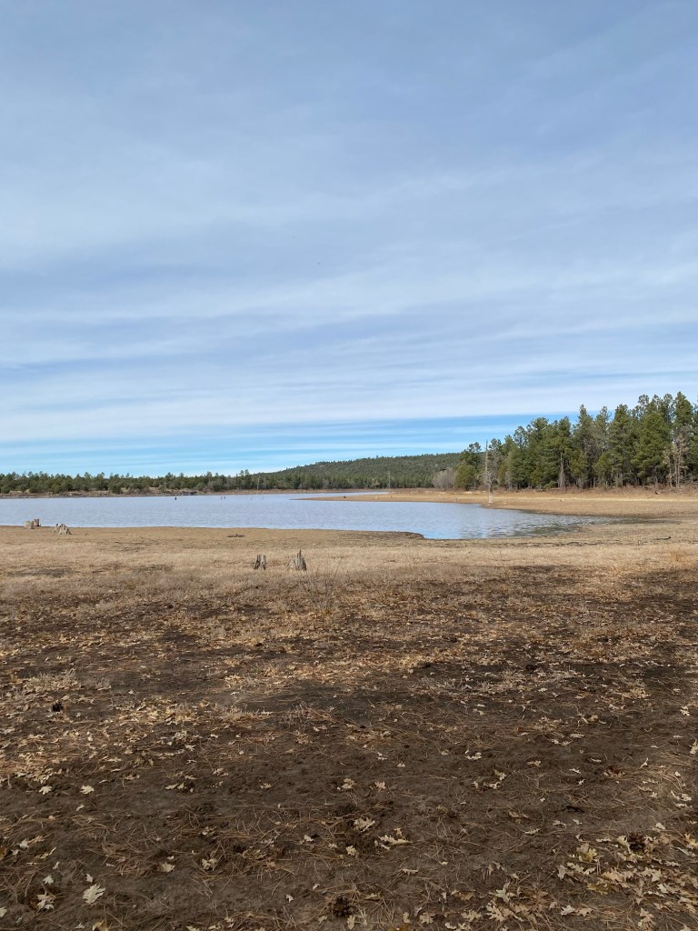
The trail starts near Porter Mountain Stables and heads down toward Porter Creek. After about a mile or so, we came to the south end of the Scott Reservoir. I was a bit surprised as to how pretty the scenery is, with the view of the mountains to the north and the pines against the blue skies.
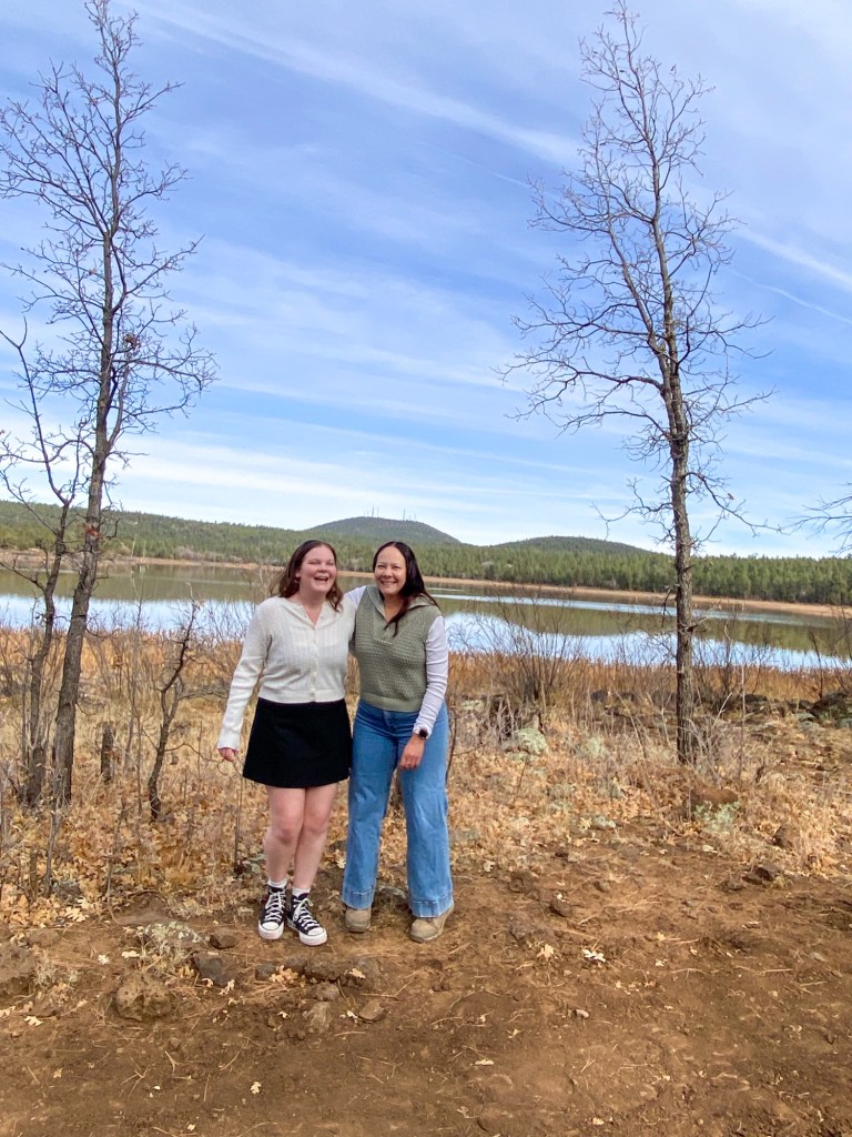
After taking more than a few photos and frolicking in the meadow near the lake, we continued on our hike. We past the Osprey Connector, continuing straight to stay on the Ice Cave Trail. Between markers IC9 and IC10, there was a shortcut trail that veered left. After passing it initially, we turned around and found where we wanted to go.
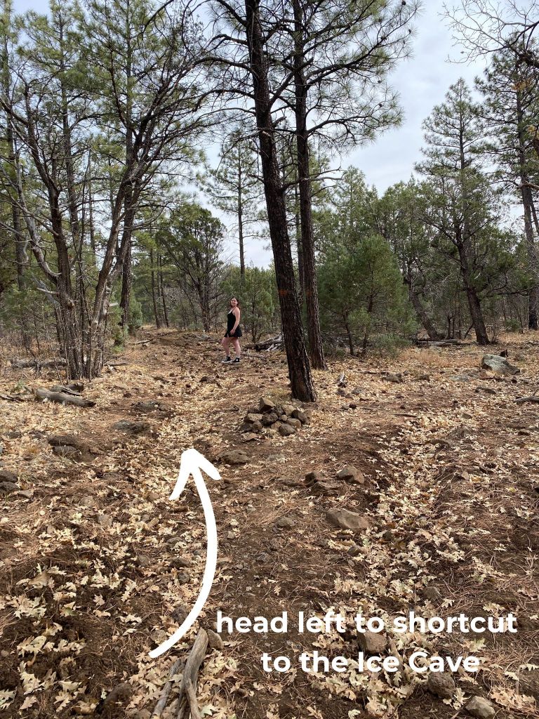
From that fork in the trail, it was about another tenth of a mile to the cave.
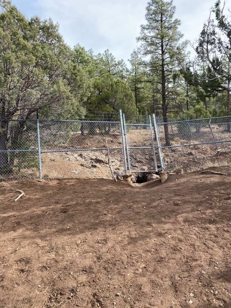
We found the fence that encloses the cave. The cave has been closed by the Forest Service for the preservation of the cave and the protection of hikers. We could peek into it from where we were, and it was still pretty cool. While I picture it being fun to explore, it is also likely unsafe.
We hung out near the cave for a few minuted before turning around. As we were heading out, a family of hikers was coming up the trail. This trail was definitely more trafficked by hikers and equestrians alike. While is was quiet compared to many of the trails in the Angeles, we did see a number of folks recreating on this Friday after Thanksgiving. I can understand why. This trail was pretty fun, and the weather was perfect for a trek outside.

This trail was surprisingly fun. Reviews on AllTrails noted the heavy presence of road apples along the trail, as well as the smell of horse droppings. While we did see this along the trail, it was not as bad as the reviews made it seem, at least not with the cooler weather. This hike is considered easy on AllTrails, which I would agree with. The trail is well-maintained and is pretty flat, with only 296 feet of elevation, according to Strava. The U.S. Forest Service has the trail rated as moderate, though I’m not sure why, other than the steps down toward Porter Creek from the trailhead and a few rocky portions. We hiked a total of 4 miles, out-and-back in about 1 hour 40 minutes. I thought is was an easy, family-friendly hike.
Some things to consider:
Pinetop is about 7000 feet in elevation, which can pose some issues for those who are sensitive to altitude. When recreating, be sure to pay attention to your body’s signals. It is okay to take time when hiking to acclimate to elevation.
Hydration is also important when hiking at higher elevations. Even with the cooler weather, we brought full water bottles, and made stops to stay hydrated, even on easy hikes.
I appreciated how well-marked the trails are here in the White Mountains. The silvery diamonds screwed into the trees mark the trail. Additionally, every quarter-mile, there is a letter and number to mark where on the trail you are, which is especially helpful in the case of emergencies.
Cell service was good along these trails. We were able to receive text messages, as well as make a post-Thanksgiving FaceTime call to the kids back home. While I cannot attest to the rest of the White Mountains Trail System, we did have good service on the hikes we took, along with the drives to get there.
There are many more adventures to be had in Arizona’s White Mountains. With 200 miles of trails, many lakes and streams, and gorgeous scenery, there is something to explore for everyone. Just pick a happy trail or three. Cheers!
References:
“State Route 87 – Beeline Highway – Aaroads – Arizona.” AARoads, 1 Apr. 2022, http://www.aaroads.com/guides/az-087/.
Gacheri, Purity. “7 of Arizona’s Most Dangerous Roads.” TheTravel, 13 Apr. 2024, http://www.thetravel.com/most-dangerous-roads-in-arizona/.
“Apache-Sitgreaves National Forests – Springs Trail #633.” Forest Service National Website, http://www.fs.usda.gov/recarea/asnf/recreation/recarea/?recid=45007&actid=50. Accessed 30 Nov. 2024.
“Apache-Sitgreaves National Forests – Blue Ridge Cave Trail #608.” Forest Service National Website, http://www.fs.usda.gov/recarea/asnf/recreation/recarea/?recid=44999&actid=50. Accessed 30 Nov. 2024.

1 thought on “Arizona Adventures: Pinetop-Lakeside Trails”