

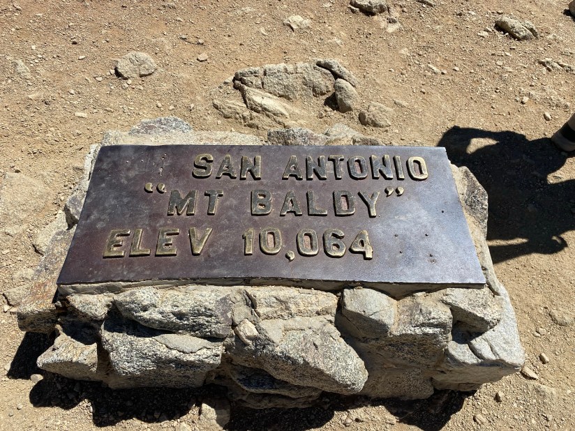
Also officially known as Mt. San Antonio
Mt. San Antonio, affectionately known as Mt. Baldy, is located in the Angeles National Forest and at 10064 feet above sea level is the highest peak in Los Angeles County. This famous feature is typically snow-capped from about December-April and is known for its skiing as well as other recreational activities. The hike to Baldy is popular among So Cal hikers training for other strenuous hikes such as Mt. Whitney, and is part of the Six Packs of Peaks social hiking challenge.
Our hike to the summit this past Saturday started at Top of the Notch and up Devil’s Backbone. We shaved off about two miles by taking the ski lifts up to Top of the Notch rather than starting from Manker Flats as is commonly done. As terrified as I was of the ski lifts, it was worth it to avoid the fire road. The trek from the flats to the notch looked pretty basic, and I don’t think we lost too much in terms of a hike. Devil’s Backbone was going to be well, devilish, enough.
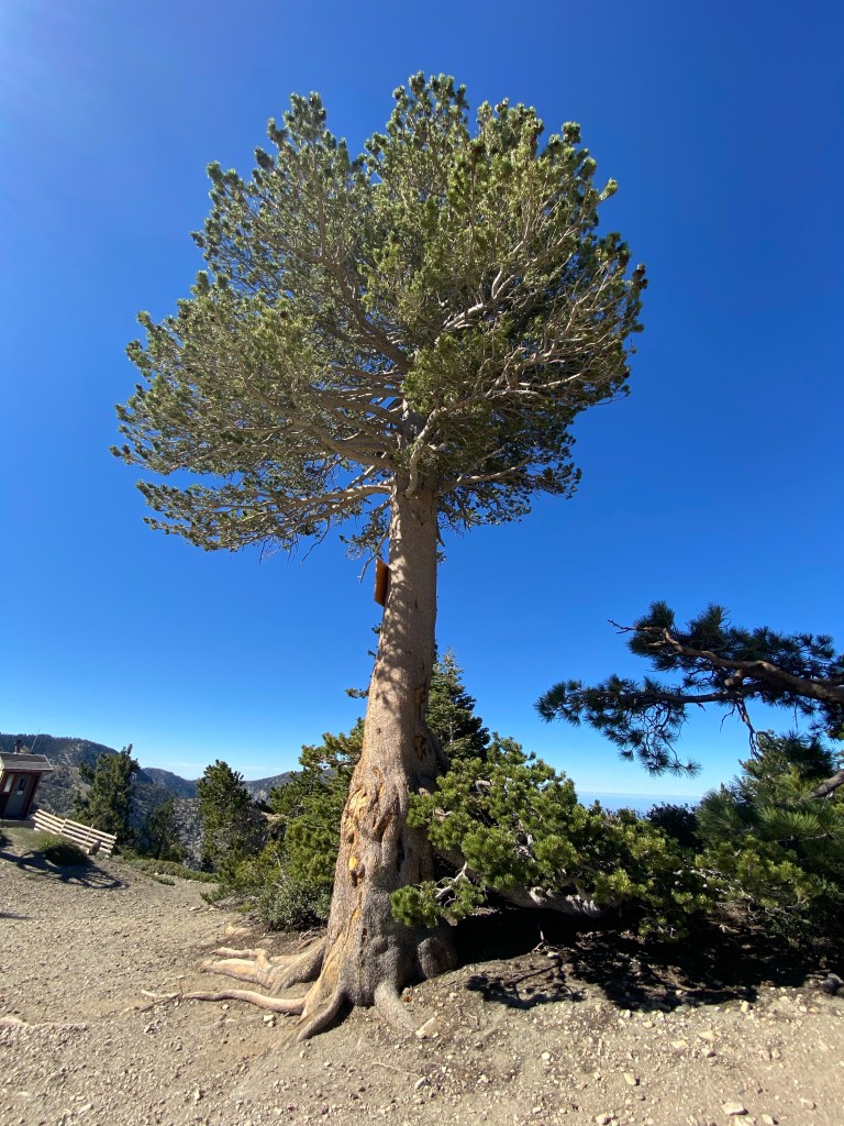
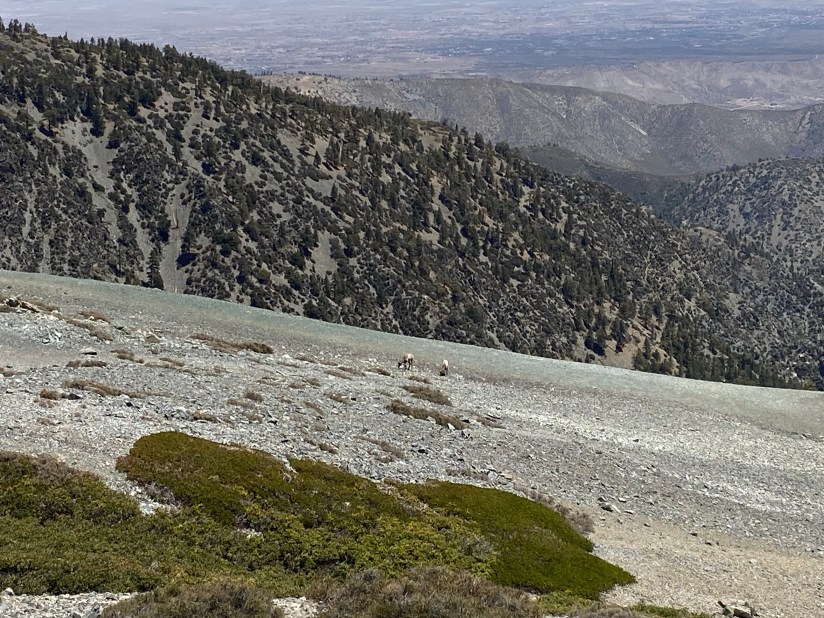
We arrived at Top of the Notch in about 20 minutes or so, and began our hike just after about 8 am. We knew that it was going to be a warm day, so the earlier we got up the mountain the better. The climb up the ski run to the start of Devil’s Backbone was steep and pretty tiring from the get go, but it ended up being a good warm up to the rest of the trail. The surrounding views were also very pleasant. Sugar pines and manzanita were common along this portion of the trail. Once we hit the end of the ski area, it was time to face the infamous Devil’s Backbone.
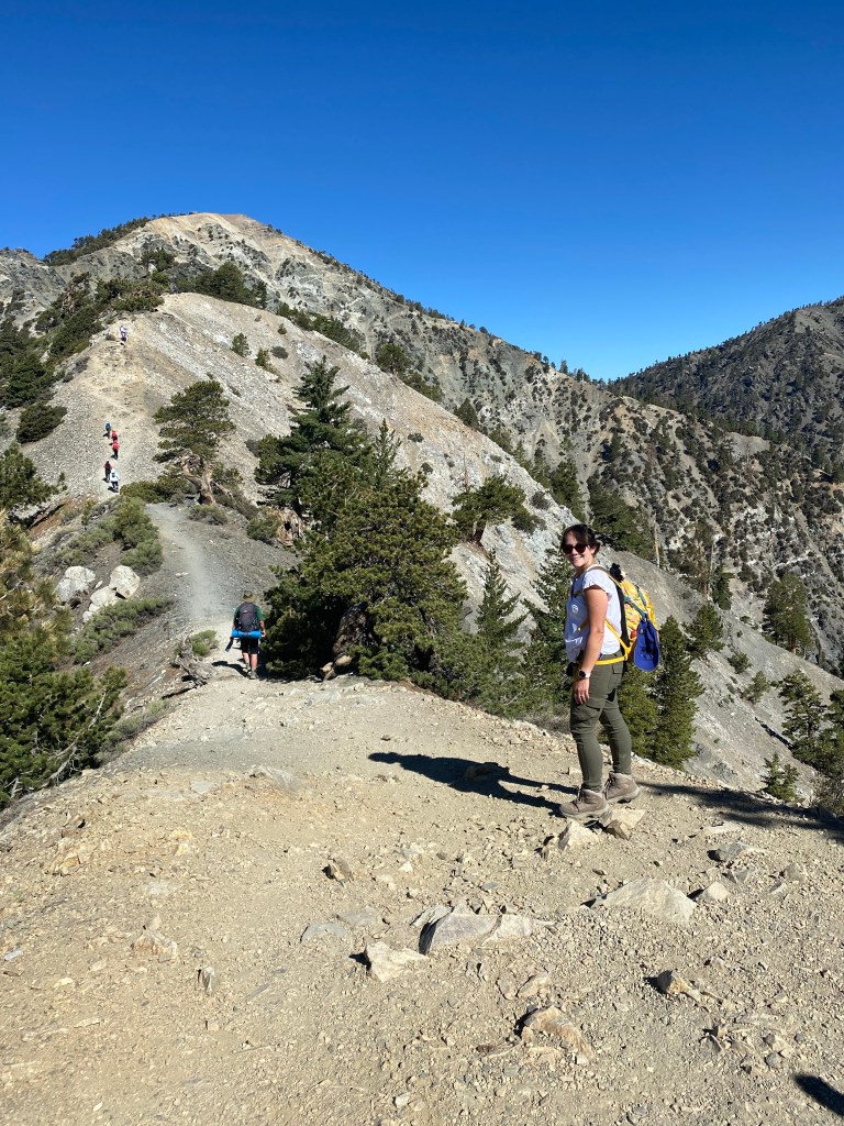
As scary as the name Devil’s Backbone makes this trail sound, it really is not quite that bad, at least not over the summer months. Don’t get me wrong, the backbone is narrow and has drop-offs on either side of the trail for a good portion of it. There are also areas with some loose rocks that can be slippery. It can give those who have a fear of heights some anxiety. That said, in the warmer months, when there is no snow or ice, hiking the trail does not require any equipment more technical than trekking poles. I do recommend caution and concentration at the narrow bits, but this trail not super horrible. That is until you get to the switchbacks.

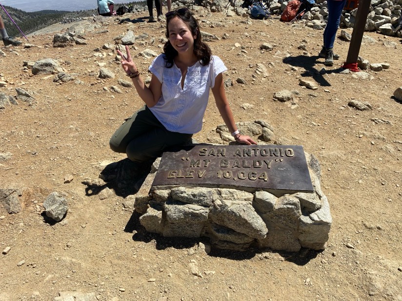
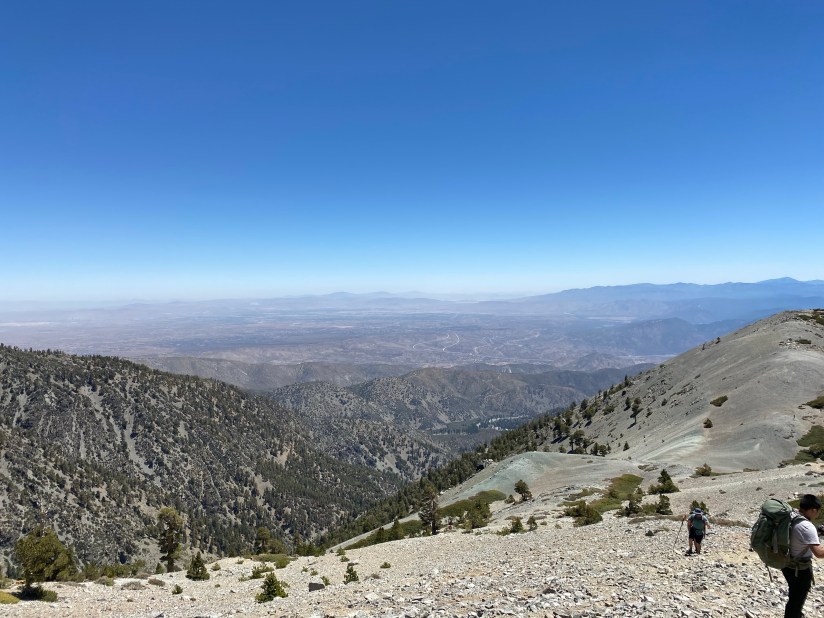
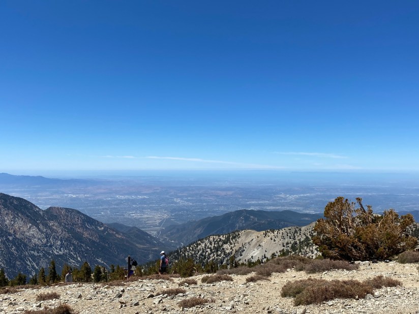
The final portion of the trail is a scramble up a series of switchbacks which take you to the peak. This climb is rather unforgiving; it’s steep and covered by loose rocks. This is the part of the trail that most kicked my booty. My advice: try to remember how far you’ve already come, pick a route, and go as slow as you need to. It’s not about how quickly you make it up the mountain, but that you get there in the end. And once you get to the peak, you’ll be rewarded with 360 views of the San Gabriel Valley, San Bernardino, and the peaks below. It is amazing.
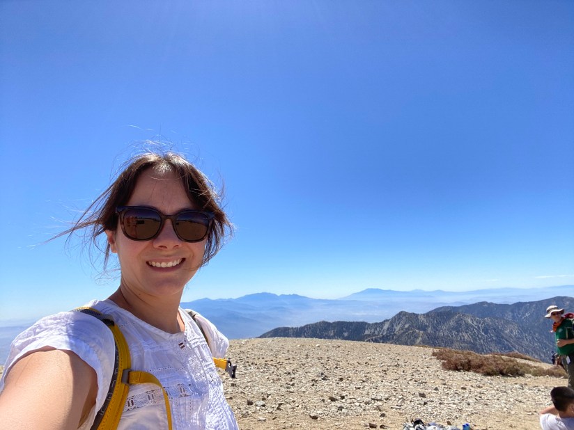
At the top of the mountain, we took photos (of course) and celebrated our first peak of the season with a trail lunch and some hangout time. There isn’t much in terms of vegetation at the summit, and there are some rock piles which made nice sitting areas for our group picnic. The temperature at the peak was cooler than below, as would be expected. It was actually very pleasant, but be sure to bring a light jacket in case the temperature drops or the weather changes suddenly.
After a good rest and fun conversation, especially as the boys digressed into singing Shakira hits, we started our descent. We took the Devil’s Backbone Trail back to the ski area, however you could do this hike in a loop. That will be an adventure for a different time. In some ways, the hike down was a bit trickier than the hike up. The loose rocks were hard on my sense of balance as well as my knees. I was glad to have a trekking pole for the journey down. It was a long three miles back to Top of the Notch, but we had a cold drink at the restaurant to look forward to once we got back down.
Some things to consider:
This hike is rated as difficult or strenuous by every hiking site I’ve read. There is good reason for that. From the ski lifts at the notch, it is ‘only’ about a three mile hike to the summit, however it is a steep 2308 feet of elevation gain according to Strava. There are very steep parts, as well as areas that can be a bit technical. I recommend some training hikes, such as Van Tassel, Henninger Flats, or Echo Mountain to help warm up to this trek.
While Devil’s Backbone is not quite as devious as its name, it is not a trail to be trifled with. There are narrow areas that require concentration. In the winter especially, this trail comes with some serious risks. There have been hiker deaths due to falls from this trail, usually due to ice and slippery conditions. This trail can definitely be dangerous, but with caution and weather awareness, we can minimize these risks and enjoy the fun this trail offers.
As the photos show, this trail is very exposed. There is very little shade, and the peak itself is fully exposed. Sunscreen, a hat, and plenty of water are a must. I recommend about 2-3 liters. I confess that I drank only about half of the water I should have and I felt it after I arrived home.
The parking for Mt. Baldy is within the Angeles National Forest. An adventure pass is required to park. For those who love national parks (raises hand) and other national lands, I recommend the America the Beautiful pass. At only $80 annually, this pass allows access to national parks, monuments, forests, recreational areas, and other federal lands. Our pass this past year covered parking on many hikes, as well as our entries to four national parks.
If you elect to take the ski lifts, it’s only about a 20 minute ride from the Sugar Pine Lift up to Top of the Notch. Tickets were $20 roundtrip, and can be purchased here.
This was a fantastic hike, either on its own or as a training hike. It is definitely a tough one, even for experienced hikers, but the views are worth the climb. Be safe, and enjoy a happy trail!

6 thoughts on “Hiking the Angeles: Mt. Baldy”