


The July 4th holiday weekend brought a new adventure in the form of a new hike. Continuing on the Six Pack of Peaks Challenge, I opted to attempt the hike up to Strawberry Peak beginning at the trailhead on Angeles Crest Highway and Red Box Road. The morning started off smoothly, then turned into an adventure indeed.
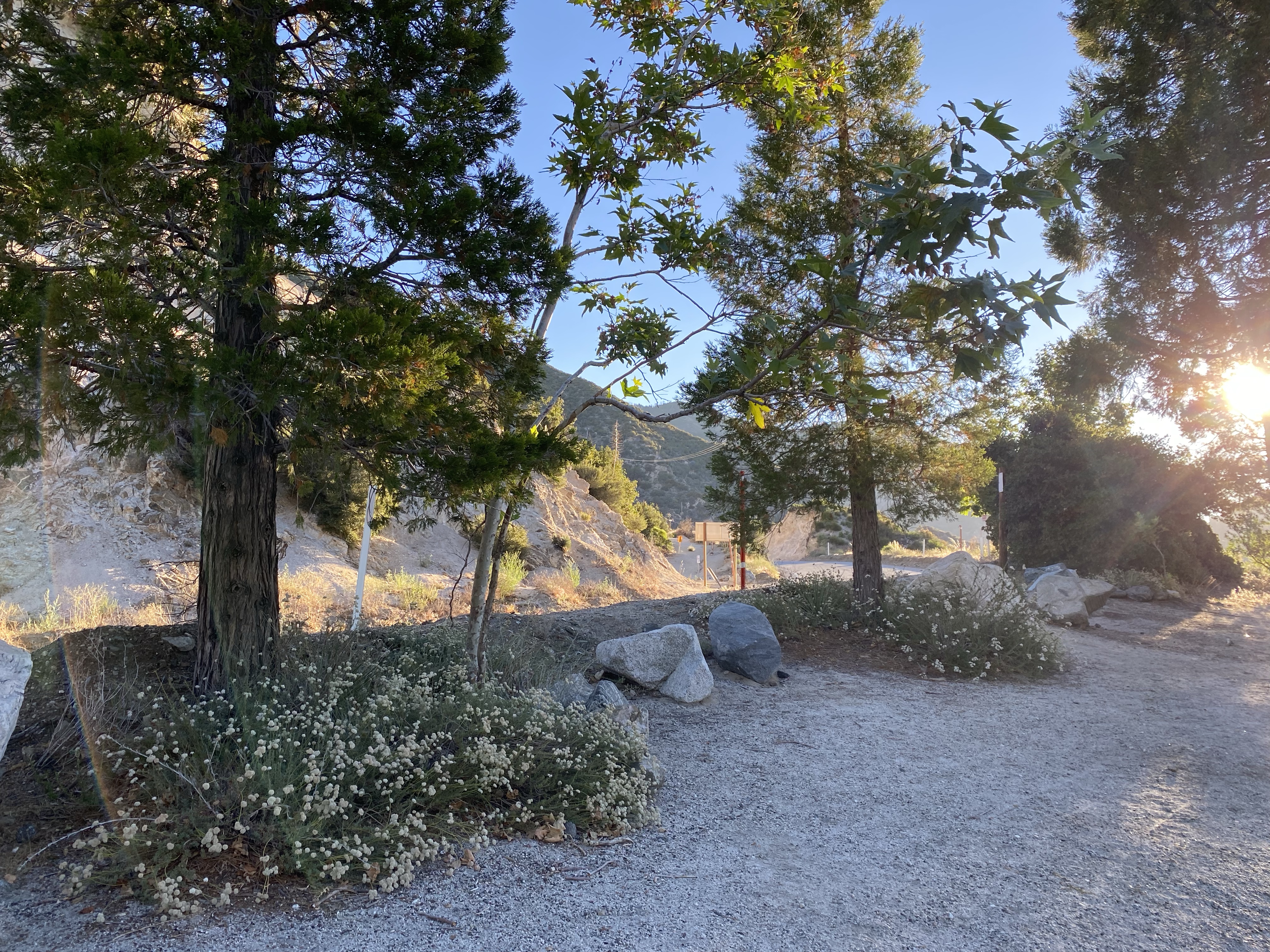
We headed up the Angeles Crest northeast of La Canada early on Saturday morning, and arrived at trailhead before 7 am. We figured that with the early start we were would reach the peak and be back down before it got too hot- and be early enough to still get breakfast. The trailhead was across the highway from the Red Box Picnic Area and the Haramokngna American Indian Cultural Center. So after gathering our gear and applying plenty of bug spray and sunscreen, we walked across and hit the trail.

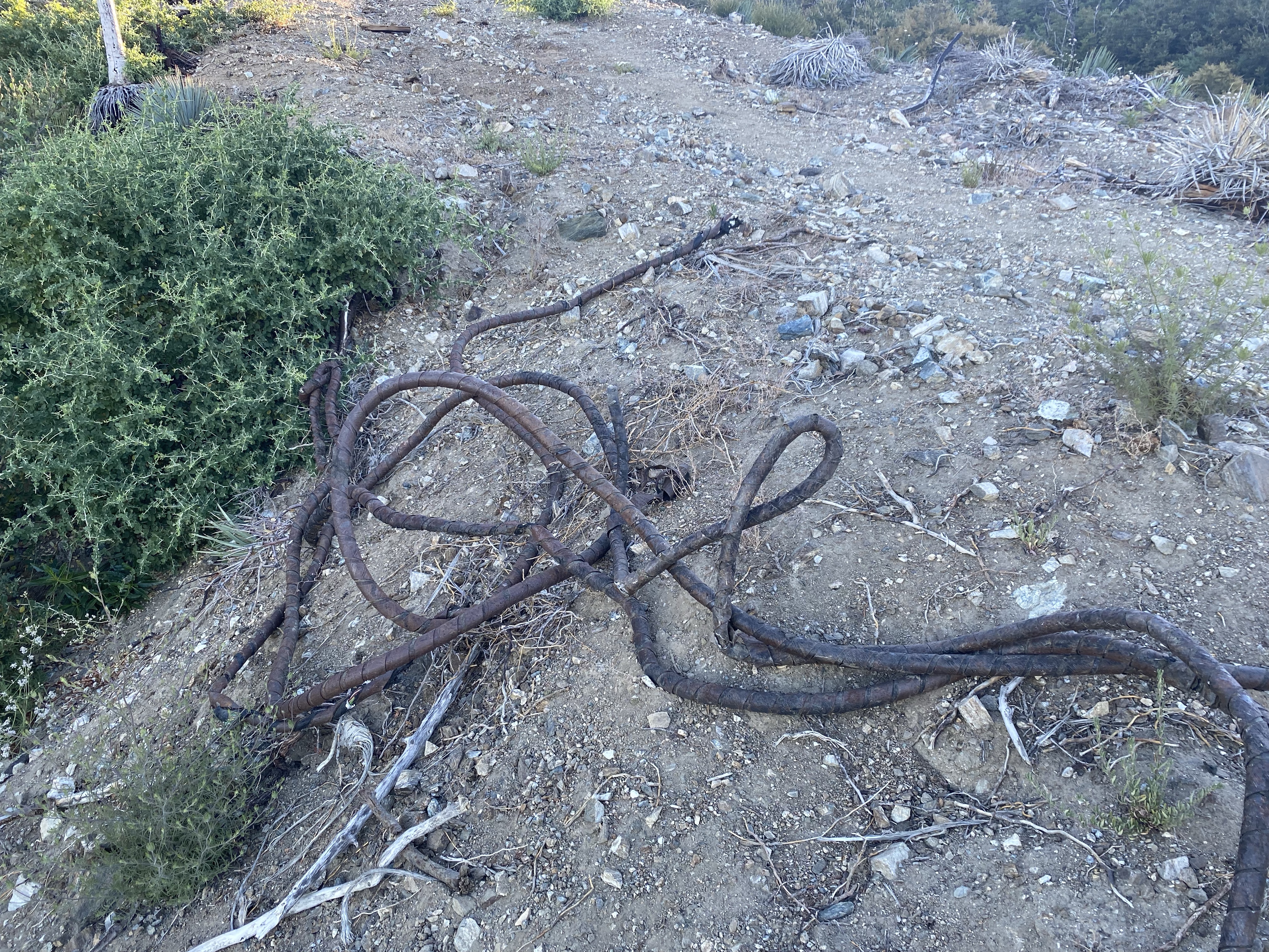
The thing about this particular trail is that anything that looked like it could be the trail really wasn’t. The first 2 miles or so were pretty easy, with a slow incline that felt relatively flat. We came to the first junction, which was an area that looked like a vista point to the left, the steep ascent to Mt. Lawlor to the right, and the flat but hidden trail also to the right but more center, and hidden behind some vegetation. There were some old cables that served as our trail marker, and following a moment’s pause to double check where we were, we trekked on, following the ridge
We arrived at the saddle and at this point the trail should have started upward, however, instead of going to the left, we started on the trail to the right. There had been a sign marking the trail to the peak, but this was not present on the day we hiked up. After about a mile and a half, the trail started to descend. We knew that this could not be the correct trail, however Nate was too far ahead. Fortunately the canyon echoed and he was able to hear me yelling for him to come back up. Once he met back up with us, he indicated that there was a wood sign with the direction to the peak. Unfortunately though there was some misunderstanding in what the sign actually said. We followed him down and found the sign. We had arrived at Strawberry Meadow. Strawberry Peak was in the direction we had come from- which meant a hike back up the arduous Colby Canyon trail.


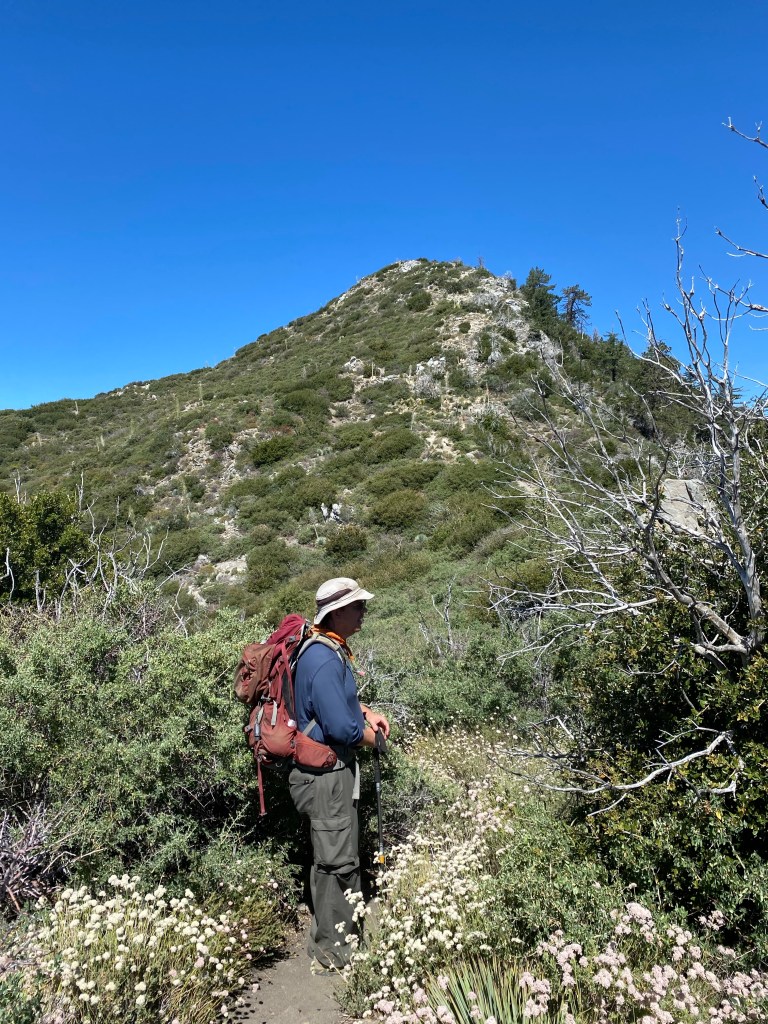
We arrived back at the saddle and this time continued on the Strawberry Peak Trail to our left. It was an immediate uphill climb that would only become more tiring as we went on, with a bit of bouldering and what some might describe as a scramble. I didn’t feel that the trail from the east was all that much of a scramble; Mt. Baldy to me has more of a scramble over loose rocks. There is some sand which makes the ascent more challenging, and there was definitely some rocks to walk over, but I think what made this part of the trail more difficult aside from the fact that we added just over three extra miles with our detour to the meadow, was the fact that there were a few false peaks before we got to the actual peak.
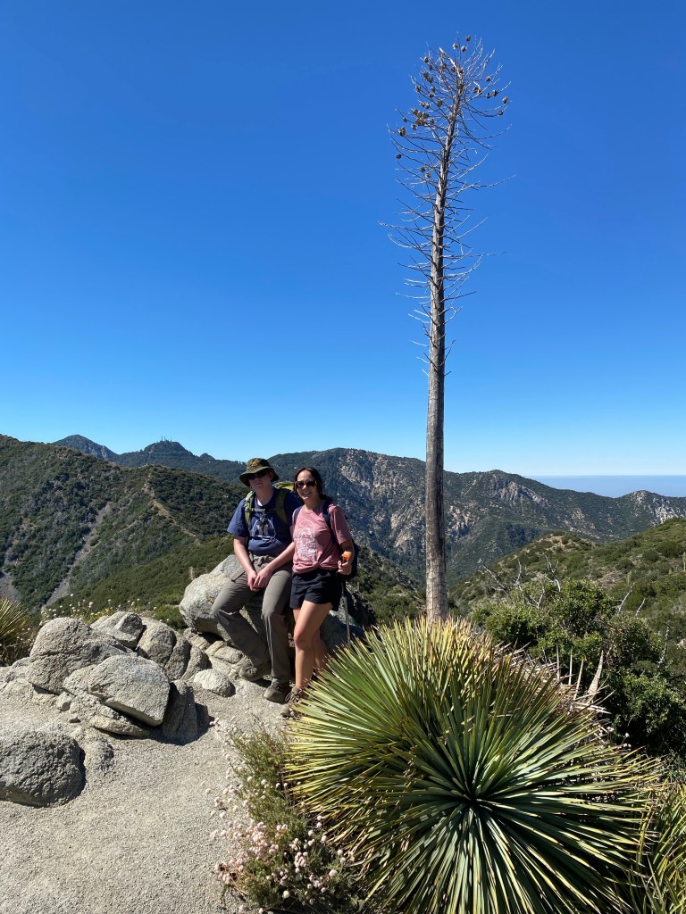
Thankfully, we did finally make it to the peak. We of course took photos with the signs at the peak and enjoyed our snacks, which did include strawberries. Though tired, we didn’t stay too long at the peak. It was getting later in the morning, and we would have to get back to the parking area if we wanted to get some brunch. As the hike had been expected to take about 4 hours to complete based on reviews and our estimate of how long it usually takes to hike a 7-mile out-and-back, we had not packed lunches. I had plenty of snacks, but those wouldn’t be the same as some fresh strawberry pancakes.
We hiked back down, taking care at the steeper parts. For me, it’s usually harder to get down than to go up, and the trekking pole really helped. Even so, the return to the trailhead took only about an hour and a half, which was not a bad time. We made good progress while on the ridge along Mt. Lawlor and on the flat portions of the trail. It was another half hour back to La Canada, where we did stop for some pancakes- with strawberries.
Some things to consider:
While the first two miles of the Strawberry Peak Trail were easy, please note there are a few spots on the trail that were narrow and did require some attention. The trail to the peak is definitely difficult and has many points that go straight up. The trail is generally considered challenging.
The trail was pleasant in the early morning, however the later morning revealed that the trail was quite exposed. There is a ton of vegetation and the wildflowers were in bloom on our summer hike, but there were not many shade trees. Sun protection and plenty of water are definitely essential.
Once on the trail from the start on Angeles Crest, the trail is not well marked. As mentioned, there apparently was a sign at the saddle marking the trail to the peak, however this was not there when we hiked. While hiking back to the saddle from the meadow, we ran into a couple other hikers who had made the same error we did. So if you have a Garmin or other fitness tracker, the trail is a very gradual, almost flat, incline for the first 2.5 miles. After that 2.5 miles or so, you should be heading steeply up the peak. If not, you may be on the wrong trail.
Adventure passes are required to park at the Red Box Picnic Area as it is in the Angeles National Forest. For those who are planning on other trips to national parks and other national lands, I recommend the America the Beautiful pass. At only $80 annually, this pass allows access to national parks, monuments, forests, recreational areas, and other federal lands. Our pass covers parking on peak hikes, as well as our entries to the six national parks we’ve visited so far this year.
Even with the added trek to Strawberry Meadow, this was a fantastic hike. While the last mile was definitely grueling, the sweet views at the peak were worth it. In this section of the Angeles, there are many happy trails that can be taken for some high adventure.


2 thoughts on “Hiking the Angeles: Strawberries on Strawberry Peak”