


After sitting for the school counseling praxis exam this past Saturday, I enjoyed a beautiful hike on a clear bright blue-sky day. I just happened to be in San Bernardino County, which had the closest testing center with availability on that date. So after completing the test, I continued about eight miles northeast and headed to the North Etiwanda Wilderness Preserve to check out Etiwanda Falls.
The Etiwanda Wilderness Preserve was established in 1998 by the San Bernardino County Board of Supervisors when they accepted mitigation land from San Bernardino Associated Governments for impacts related to the expansion of 210. An initial 762 acres was purchased and preserved for habitat conservation for the California coastal gnatcatcher, a sweet and tiny grey bird endemic to California’s coastal sage scrub. Its narrow habitat range has grown smaller due to development, and the gnatcatcher is now on the federally threatened list and is designated a Bird Species of Special Concern by the State of California. There are nine other species that are endangered or threatened that call the Preserve home; four are birds, and the other five include the Los Angeles pocket mouse, the San Bernardino kangaroo rat, the San Diego horned lizard, the San Diego ring-necked snake, and the mountain yellow-legged frog. Additionally, the preserve is right along the Pacific Flyway for migratory birds. Since then, more acreage has been acquired, and the preserve now protects 1176 acres of rare Riversidian Alluvial Fan Sage Scrub habitat, found only at the bases of the California Transverse ranges.
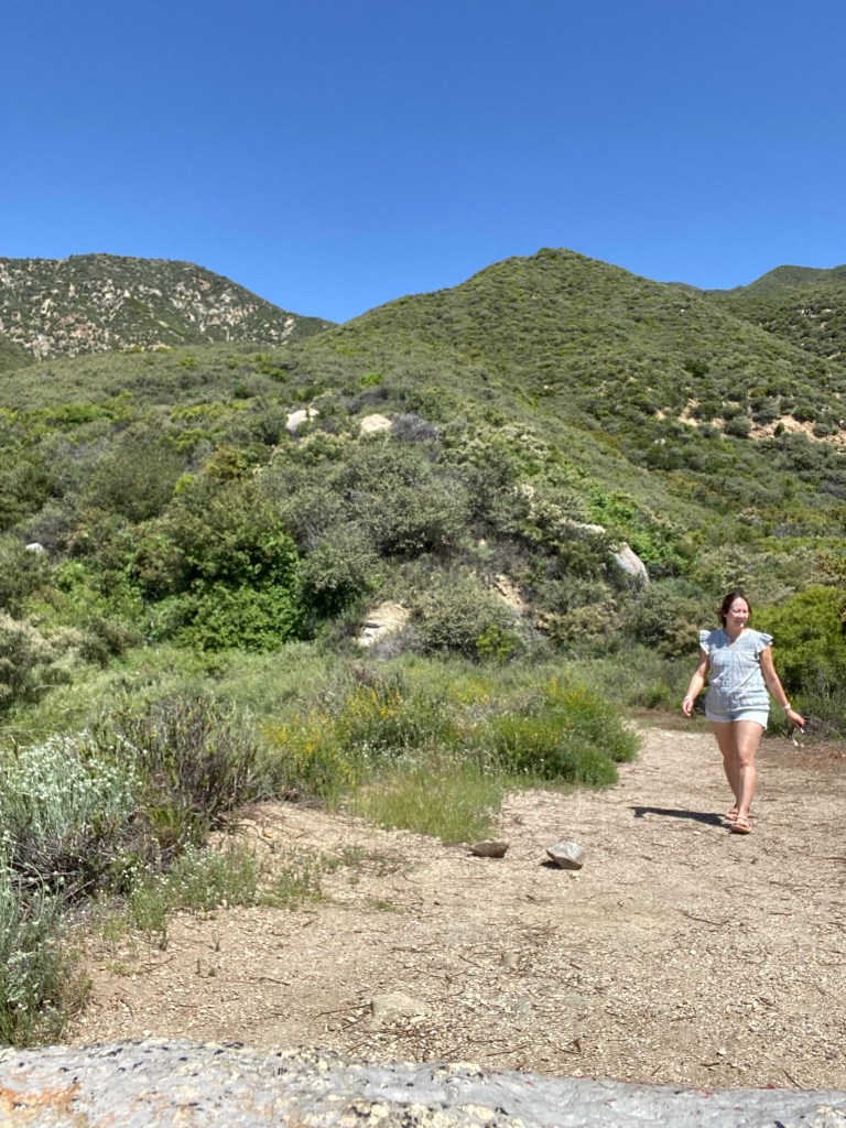

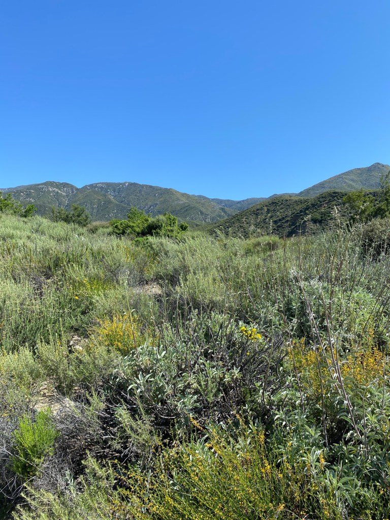
As such, the North Etiwanda Preserve is a pretty place to hike. While most of the trails in the preserve are not shaded, there is plenty of vegetation along the trail, with lovely wildflowers this time of year and the fragrant scents of sage and other aromatic plants. The mountains provide a lovely backdrop and were particularly scenic on the May morning as there were visible patches of snow on the peaks and the foothills were green and lush thanks to this year’s rainy winter. The trail to Etiwanda Falls is 3.4 miles out-and-back, and it is rated moderately challenging on many sites. There is about a 744-foot elevation gain according to Strava, but over 1.7 miles, this was not too challenging. The trail was wide and there were a few points where one could stop and rest before trekking on. The sound of East Etiwanda Creek and the light breeze was pleasant even as the mid-morning sun heated up the day.

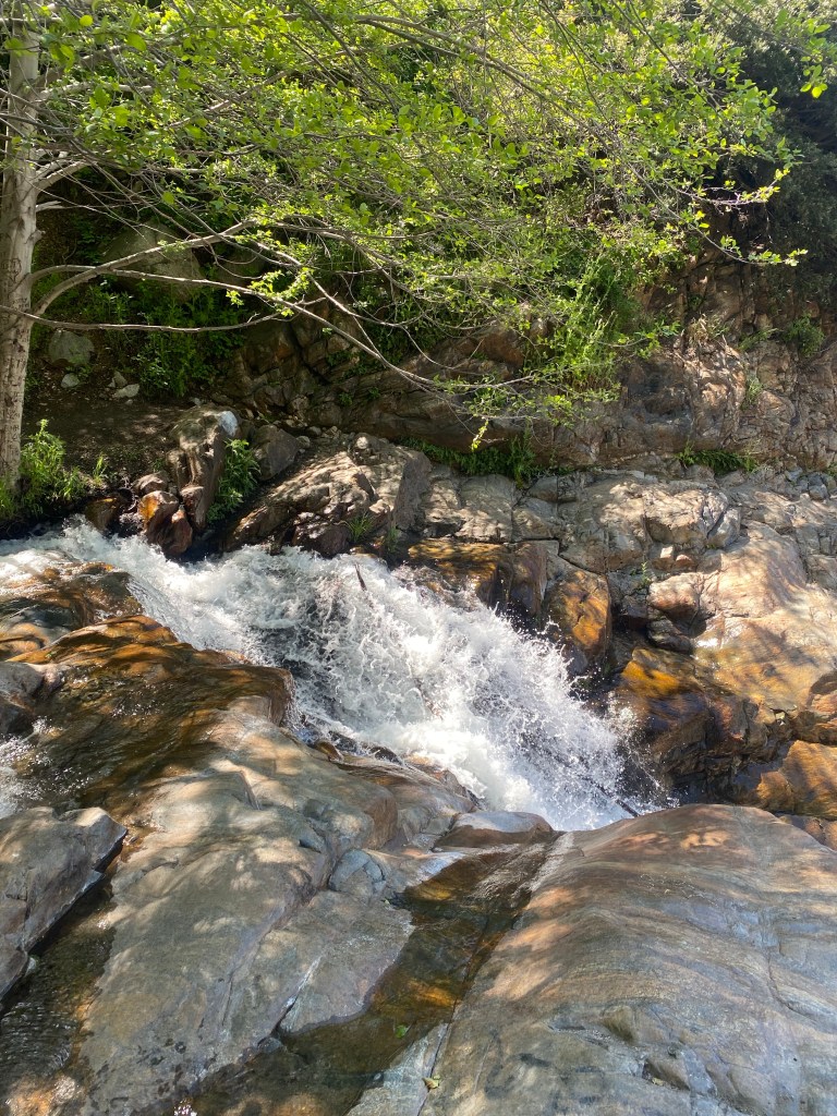
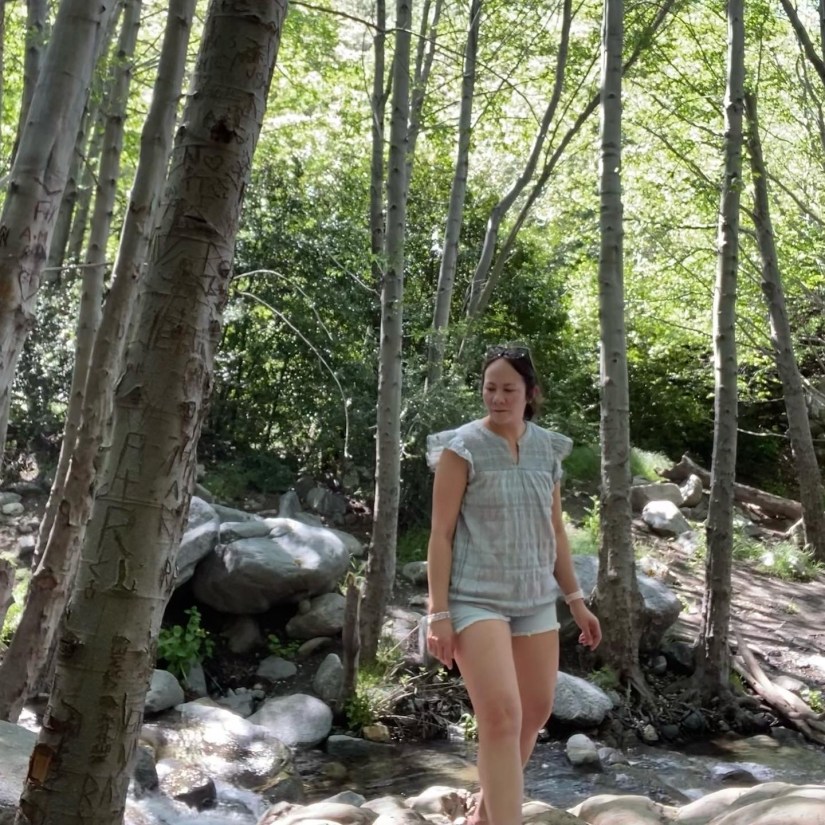
After about a mile-and-a-half, the trail turns into the canyon. The sound of water grew more prevalent, and after a tenth of a mile or so, I arrived at the short descent into the canyon and to the stream. The water was flowing well at the time of this hike; the rainy season had a clear impact on the flow of the creek as well as the falls. It was a perfect day to explore. I had a fun time climbing carefully along the rocks and wading in the refreshing cool of the creek. While the trail seemed popular, and there were quite a few folks enjoying the day as I was, it did not feel crowded. Also, people seemed respectful of the space which kept it enjoyable for visitors.
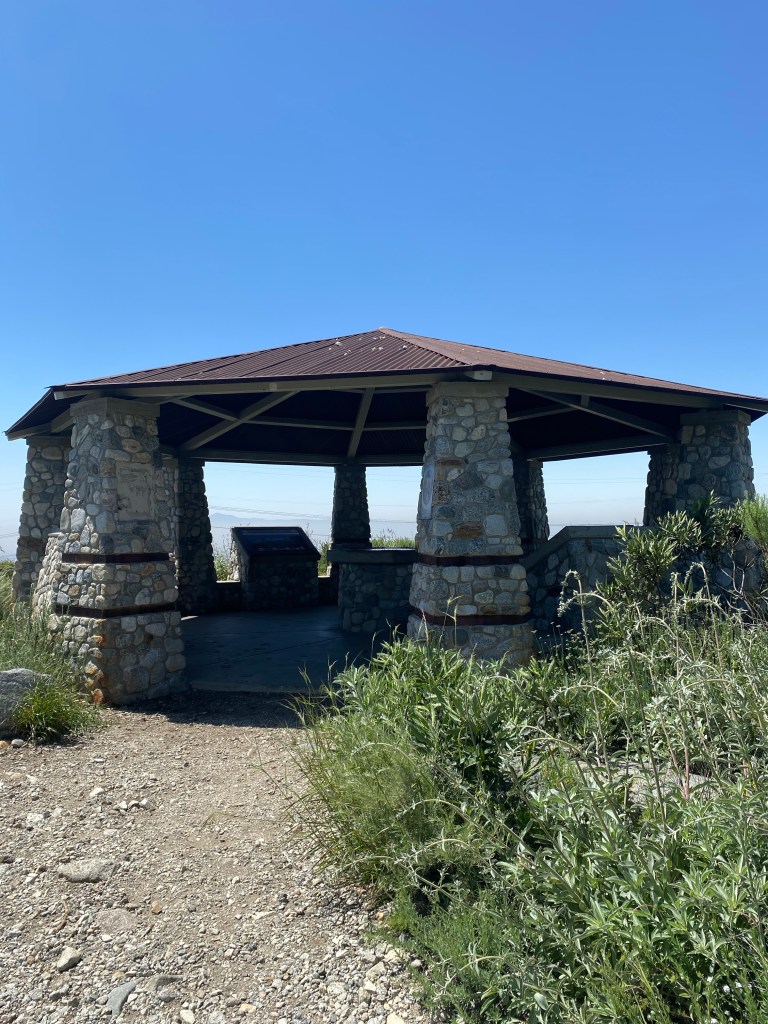
After exploring for a bit, and calls from the kids who wanted to run errands, I began the trek back. The day was definitely sunny, and while it was very fine and not too hot, I made sure to reapply sunscreen. Outside the canyon, there is no shade, so sun protection was a must. I did stop at the big rock to have a snack along the trail, and I also took a stop at the interpretive pavilion, which is where I got much of the information for the history and purpose of the preserve. It also provided a nice shaded water stop before the last couple tenths of a mile back to the car.
Some things to consider:
While the parking area is not small, the hike to the falls is popular, and the lots fill up quickly on weekends. I arrived at about 9:40 and the lot was full. Fortunately though, by then the earlier birds were heading out, and a few spots opened up after about a five minute wait. Parking is paid for by an app. Just scan the QR code posted on signs in the lot. It was $3.25 for four hours- plenty of time to complete this hike.
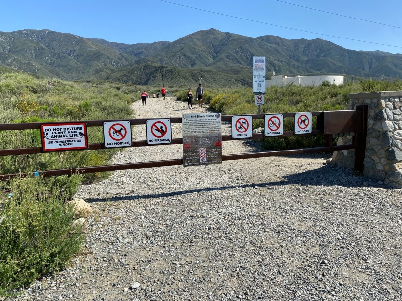
The area is a conservation zone and is important for the preservation of threatened and endangered plants and animals, many of which have a very limited habitat range. As such, dogs are not allowed on this hike. And as always, remember to follow Leave No Trace principles. Pack in and pack out. Take only photos, leave only footprints, and kill only time.
While not too challenging, the trail is rated moderately difficult, likely because of the elevation gain and the trail conditions. The trail is flat in many parts, but it is rocky. Light hiking gear or trainers with good support are a good bet in terms of footwear. I wore my Teva sandals since I planned to wade in the creek, and they were sufficient on this hike.
As mentioned, there is little shade on this trail. Sunscreen and other sun protection are a must on this hike. Bring plenty of water and salty snacks, especially on hot days.

While not as dangerous as most hikes, I did read about a few deaths while checking my information. There are inherent risks in hiking. The waterfalls can pose dangers if one isn’t careful, as can exhaustion or heatstroke when hiking on a warm day. Be prepared, stay on the trail, and trust your instincts.
There is cell reception in most areas along the hike. My kids were able to get ahold of me while I was at the falls. That said, it is still good to let a loved one or trusted friend know where you plan to hike.
In all, this hike is one that I would recommend for adventurers of any age when out in San Bernardino. It is relatively short and offers a very pretty payoff with Etiwanda Falls. I had a lovely time getting outside after the stress of the week and recharging my mental health. And I am happy to report, that I did pass my test. Happy trails, and cheers!
