


Winter in So Cal is typically rather mild. While January and February are typically our rainy seasons- indeed, this rainy season started a bit early- the sunshine stays plentiful and the temperatures are relatively mild and perfect for outdoor activities.
On the last Saturday in January, we did just that. Jacob, Sami, and I had planned on a hike and brunch in Montrose. The original plan was to head out early and hike up Strawberry Peak, but Sami was tired from activities the day prior. I confess that I too was fatigued after a long workweek, so it was good to take things a little slower. She slept in while I cleaned the garage, and I felt good about making some progress on something that had been on my ever-growing to-do list. That said, I thought that an easier hike would be in order with the later start and anticipated winter temperatures in the 80s for the San Gabriel Valley.
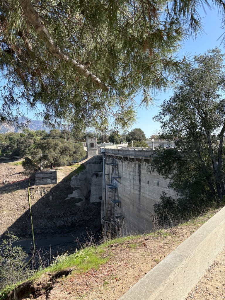
I was looking to try something new, and Devils Gate Dam had long held my interest. We pass by it on I-210 whenever we drive to Angeles Crest or beyond, so I was curious about the various routes in the area. The dam is part of the Hahamongna watershed, and according to the Los Angeles County Public Works website, is the oldest dam in Los Angeles County. After the devastating floods of 1914, Los Angeles County Flood Control District was created the following year. This paved the way for the modern day flood control we find throughout LA County today, including the concrete channeling of the Los Angeles River. The first major project was completed in 1920, the Devils Gate Dam, a concrete dam build to protect Pasadena and communities downstream of the Arroyo Seco.
While the structure has seen seismic updates and other improvement projects throughout the years, the structure stands along I-210 to the fascination of many who pass by it. Lore has it that the Devils Gate has connections to the occult and apparent connections to JPL and scientology. Whether or not it is actually haunted, I doubt, but there’s one way to find out: a sunny Saturday morning hike. We decided to hike to the dam starting from Cherry Canyon and hit the Flint Canyon Trail.
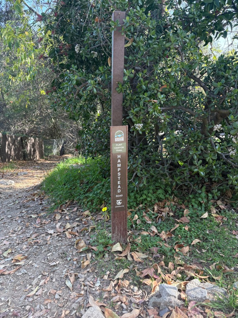
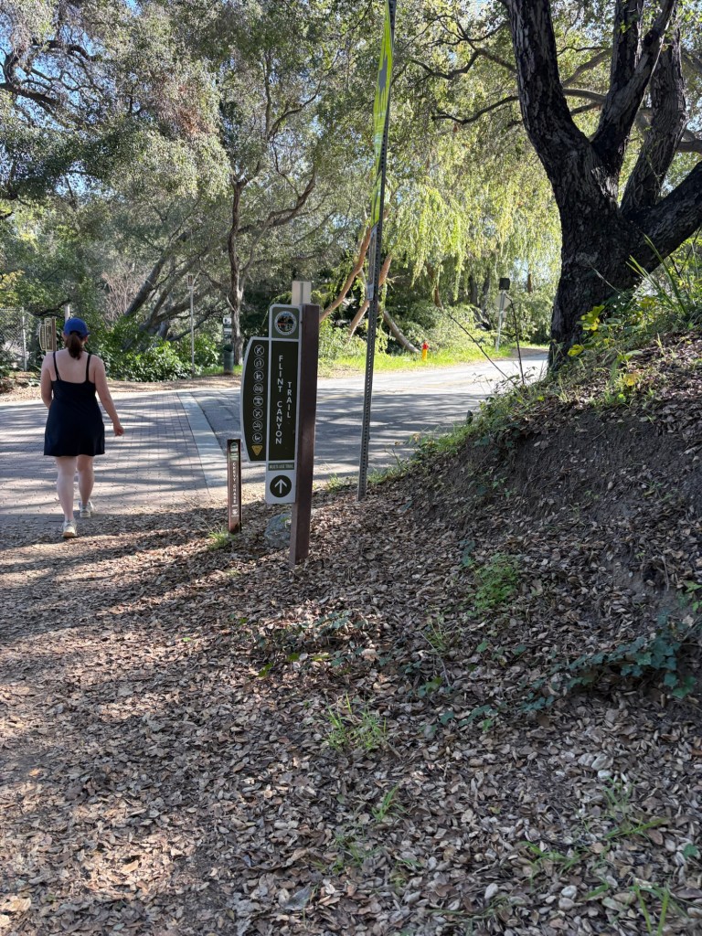
The trail was not exactly what I had expected. For starters, the trailhead is not actually in Cherry Canyon. It begins along Hampstead Road, and would be easy to miss if not for AllTrails. It also is an urban trail, traversing through neighborhoods for a good part of the way. After a false start hiking along the Cherry Canyon Motorway inside the park, we doubled back onto Hampstead, this time following AllTrails closely. We found the trail marker and got going.
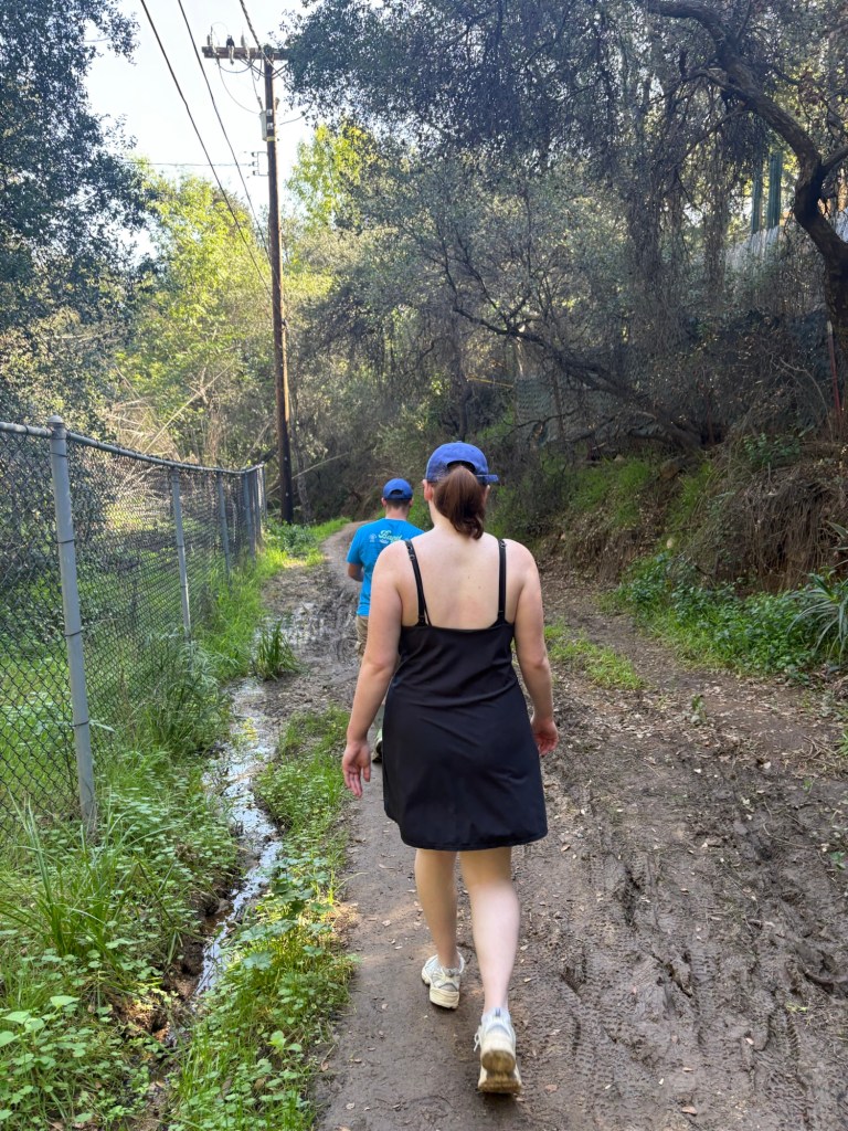
The trail took us along the back of La Canada homes, with several street crossings. This was a reminder that we were hiking along a Los Angeles County Trail in a wooded area, but a suburban one nonetheless. This continued for about the first mile or so, and then we crossed the flood control channel and followed Berkshire Road for a time.
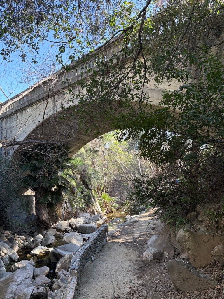
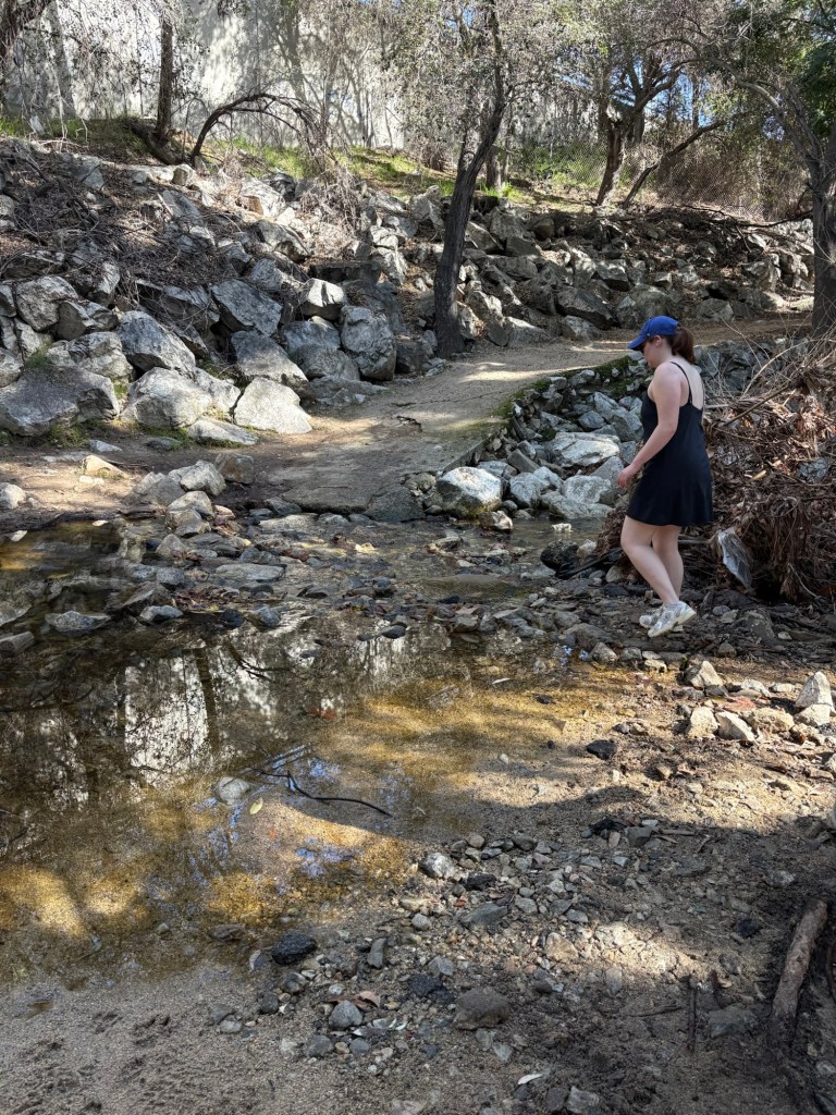
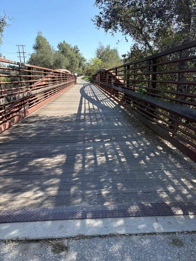
We then dropped into the canyon, and followed the stream. This part of the hike was very pleasant, and felt more like hiking. The babbling stream was relaxing to listen to, and we crossed under a scenic bridge which made for some nice photos.
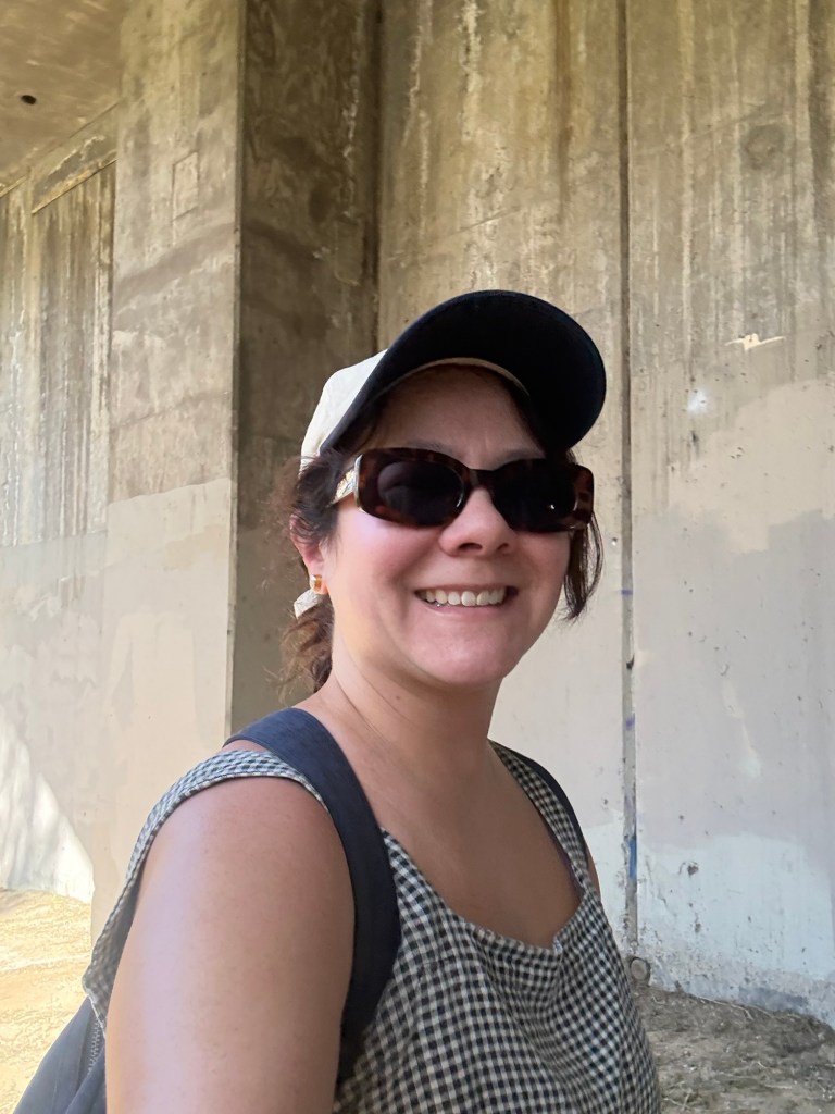
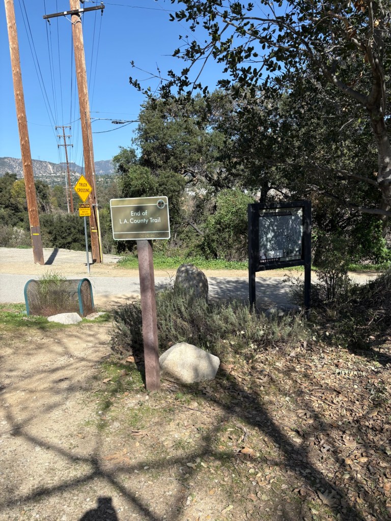
Continuing on, we approached I-210. We crossed under the freeway, which was not so romantic, but took us to where we needed to go. We came out from under it and the end of the 2 mile LA County-maintained trail. The loop trail circles the dam, and adds about a mile-and-a-half to the hike. We decided just to get to the dam and do an out-and-back hike. So we headed right and over the bridge. Another tenth of a mile, and we were at the dam.
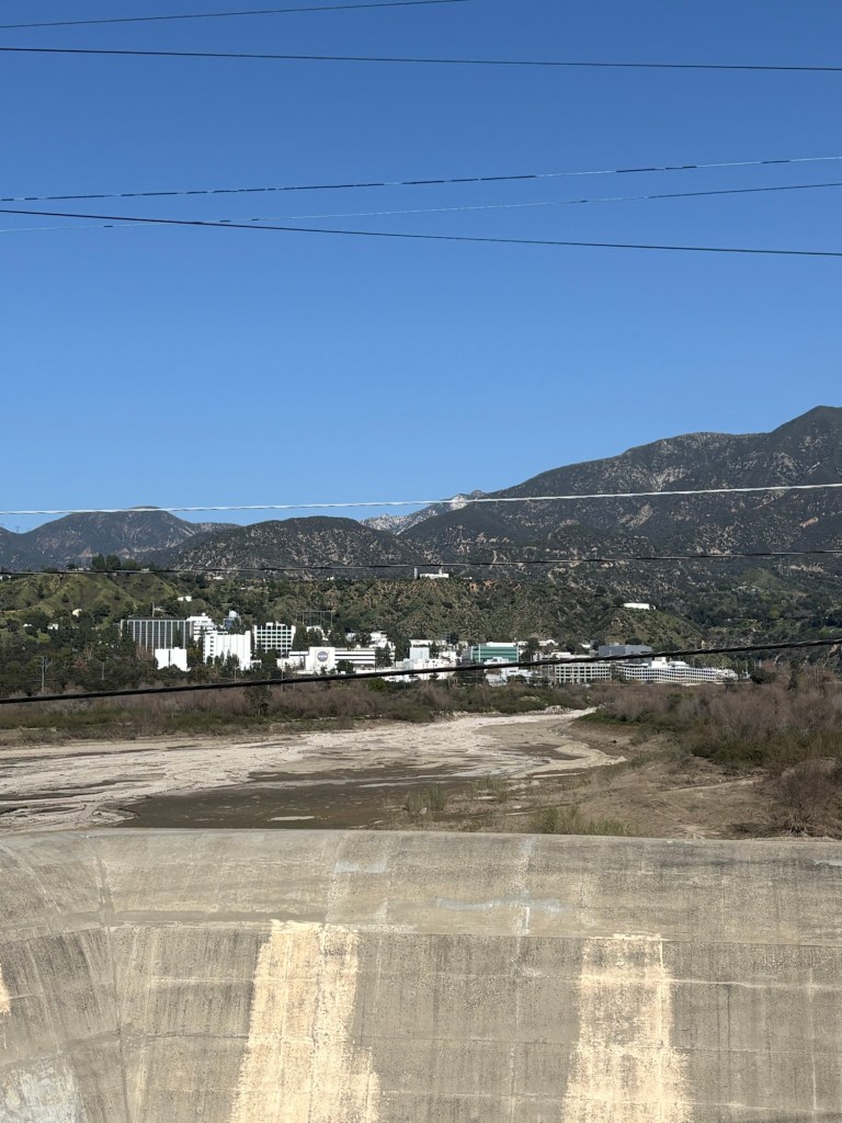
There was no water in the dam at the time of our hike. Water levels in the reservoir fluctuate according to amount of rainfall. There is also often quite a bit of sediment in the reservoir; there are ongoing efforts to clear sediment and maintain and restore the habitat of the Hahamongna Watershed. Still, the park is quite pleasant, and we got a good view of the famed Jet Propulsion Laboratory. Perhaps the only thing missing was the feeling of hauntedness. I may be a bit close-minded, but I did not sense any occult vibes and nor did I find the portal to hell.
After taking photos, we turned around, and retraced our path back to the car. This went fairly quickly as this time we knew where we were going, thankfully. By this point, we were getting hungry, and while I had some chilled fruit in my backpack, the kids were looking forward to the promised brunch at Black Cow Cafe in Montrose. And truth be told, after a five mile hike, so was I!
Some things to consider:
While the trail is an urban one, there are still some dangers along the trail. Coyotes and other wildlife can be found on the trail. As can poison oak. I learned this the hard way. I spotted some while hiking back toward the car, but apparently that was too late. I ended up exposed, and at time of publishing I am still experiencing the itchy effects of contact dermatitis. The rash developed about two days later and I at first I thought I had bug bites. But an over a week later with no improvement, I realized that I had probably brushed against the toxic plant without even realizing it. I reached out to my Telehealth provider for some advice and a prescription for a steroid cream.
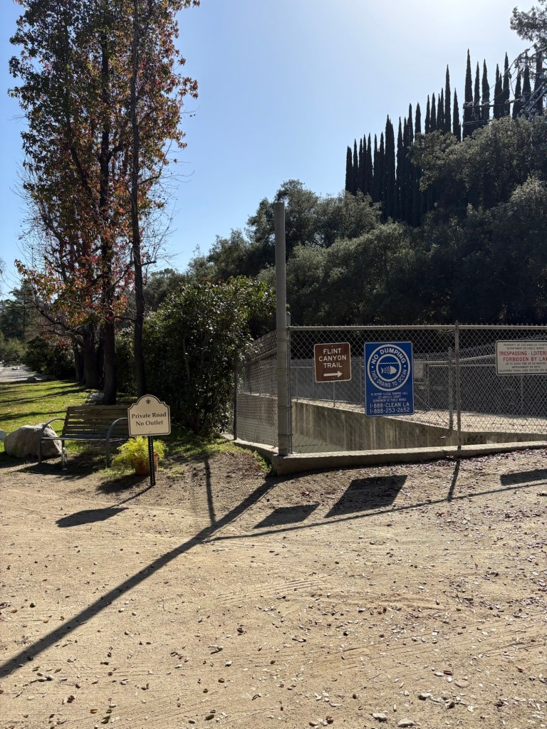
We parked in the tiny parking area for Cherry Canyon just off Hampstead. There is only room for about 3-4 cars, so street parking might be necessary. There are also points to hit the trail from other streets to shorten distance.
Much of the trail was shaded, however, there are points especially past the bridge and at Devils Gate Dam that are not. Water and sunscreen are important.
Please be aware that the trail follows the backs of residences. Many houses have surveillance or dogs to help protect their properties.
The hike to Devils Gate Dam via Flint Canyon is rated moderate. It is relatively flat; Strava measured 449 feet of elevation over 5.54 miles. There are some areas where the trail can get narrow or muddy, and there are some mild inclines, street crossings, and one stream crossing over rocks. Other than those, this trail is relatively easy.
Despite the literal brush with poison oak and the heat of a sunny winter’s day, this was a fun and relatively easy hike with the kids. For a longer hike, you can follow the perimeter trail to hike around the reservoir. This is especially nice when there is water there. There are also many fun trails to explore in the Lower Arroyo Seco as well as in Cherry Canyon Park. Just pick a happy trail-or two- and go. Cheers!

References:
“History of Devil’s Gate Dam & Reservoir.” History: Devil’s Gate Reservoir Restoration Project, 2025, pw.lacounty.gov/swe/devilsgate/history.
