


According to the U.S. Forest Service, the Angeles National Forest encompasses 700176 acres of land, with 80284 being designated wilderness. In those wide spaces, there are 53 trailheads that lead to 697 miles of trails. With so many miles of trails, including the Silver Moccasin National Recreation Trail as well as a 77-miles stretch of the famed Pacific Crest Trail, there are many adventures to be had in this swath of California wilderness.
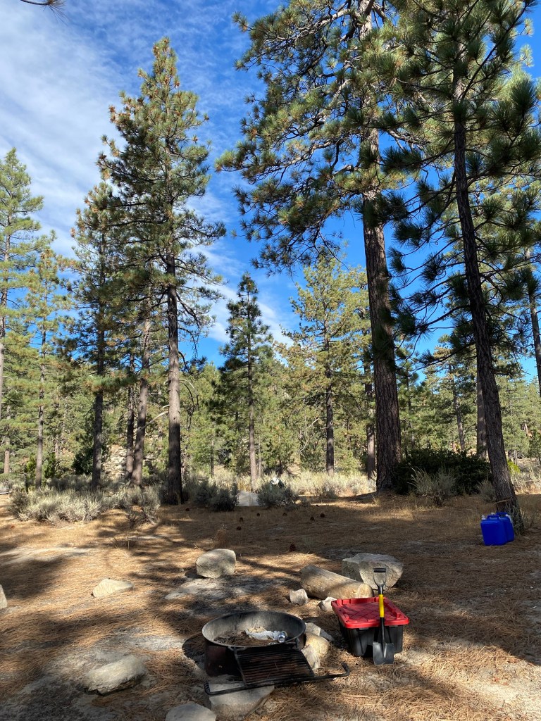
The clear skies and apple crisp October weather of this past Saturday lent itself to another adventure in the Angeles, not far from the Vetter Mountain Lookout we hiked to last weekend. I drove up Angeles Crest Highway, past Chilao to Horse Flat Campground, one of the 66 campgrounds in the Angeles National Forest.
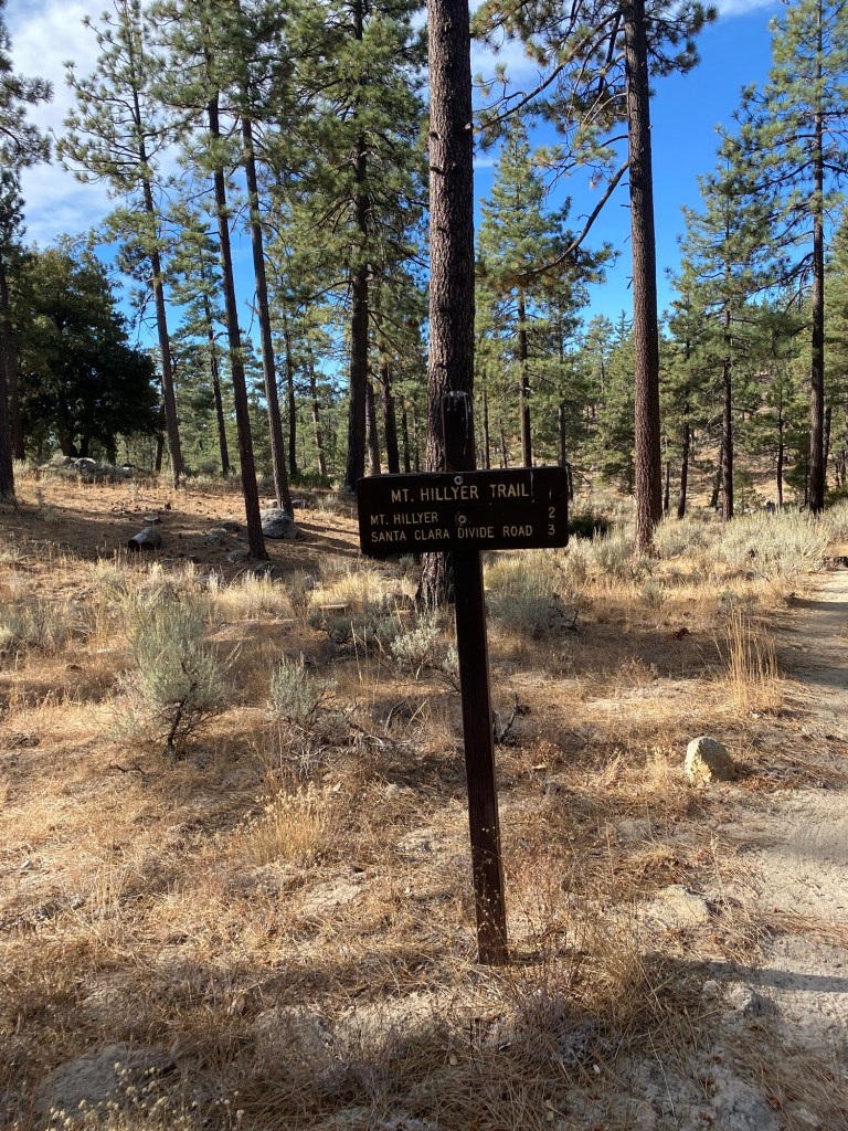
After parking at the campsite, I exited the vehicle to get ready for a hike up to Mt. Hillyer, a peak in the San Gabriels with an elevation of about 6200 feet. I stepped out into the unexpectedly cold wind, and scurried back into the car. I had been wearing a hiking dress with a flannel over it, but the autumn wind was a bit too biting for me. I was glad I brought a pair of Aerie leggings. I had meant to wear them in the case a trail was too overgrown, but they worked to give some buffer against the chill. I quickly made a quick outfit change in the back of the Subie, then set off for the trail near campsite 10.

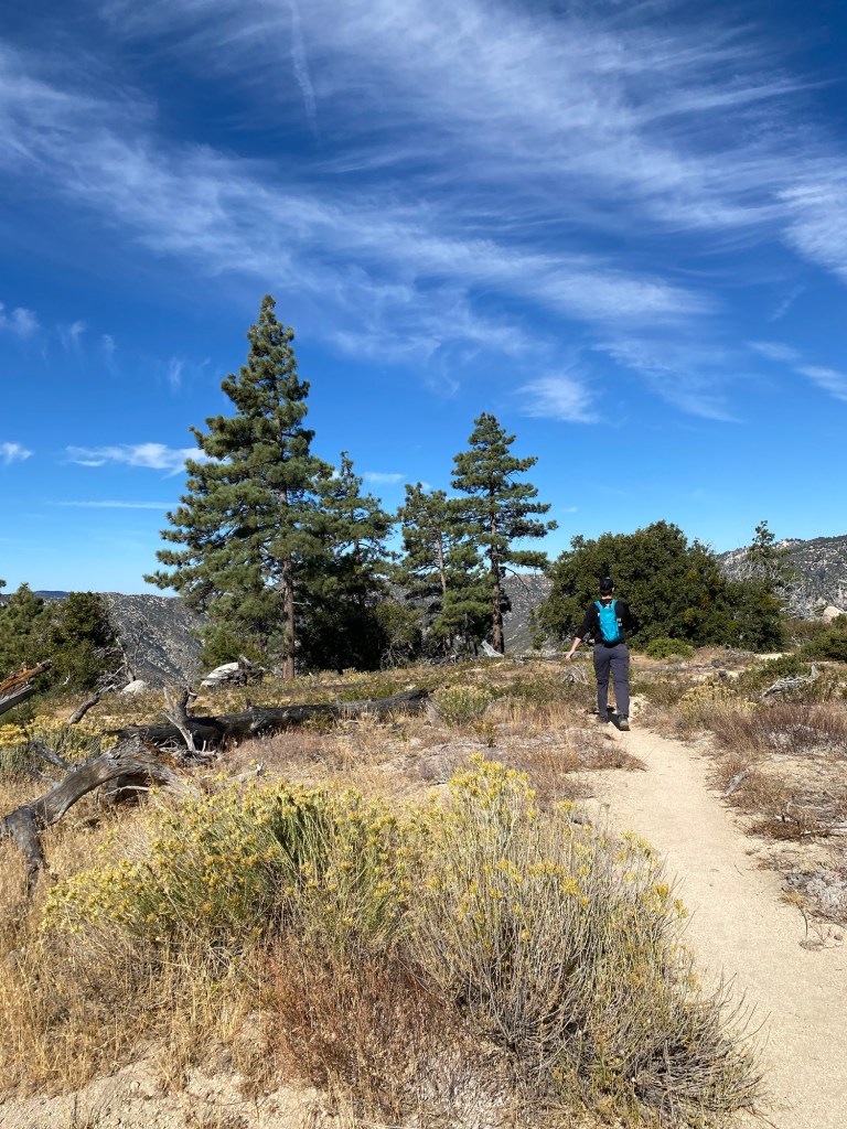
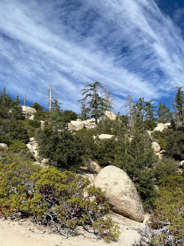
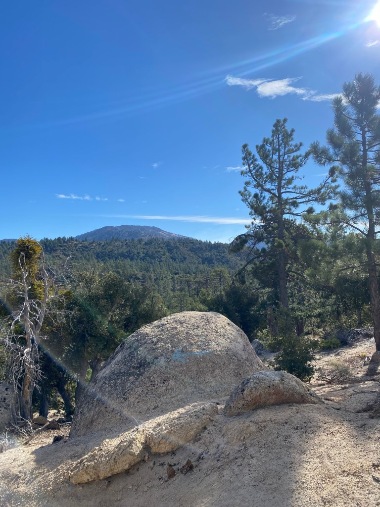
The trail to Mt. Hillyer is considered a moderate hike, taking hikers through picturesque boulder fields reminiscent of national parks. The trail through Horse Flat was just that- flat- but we quickly started a gentle ascent up the trail.
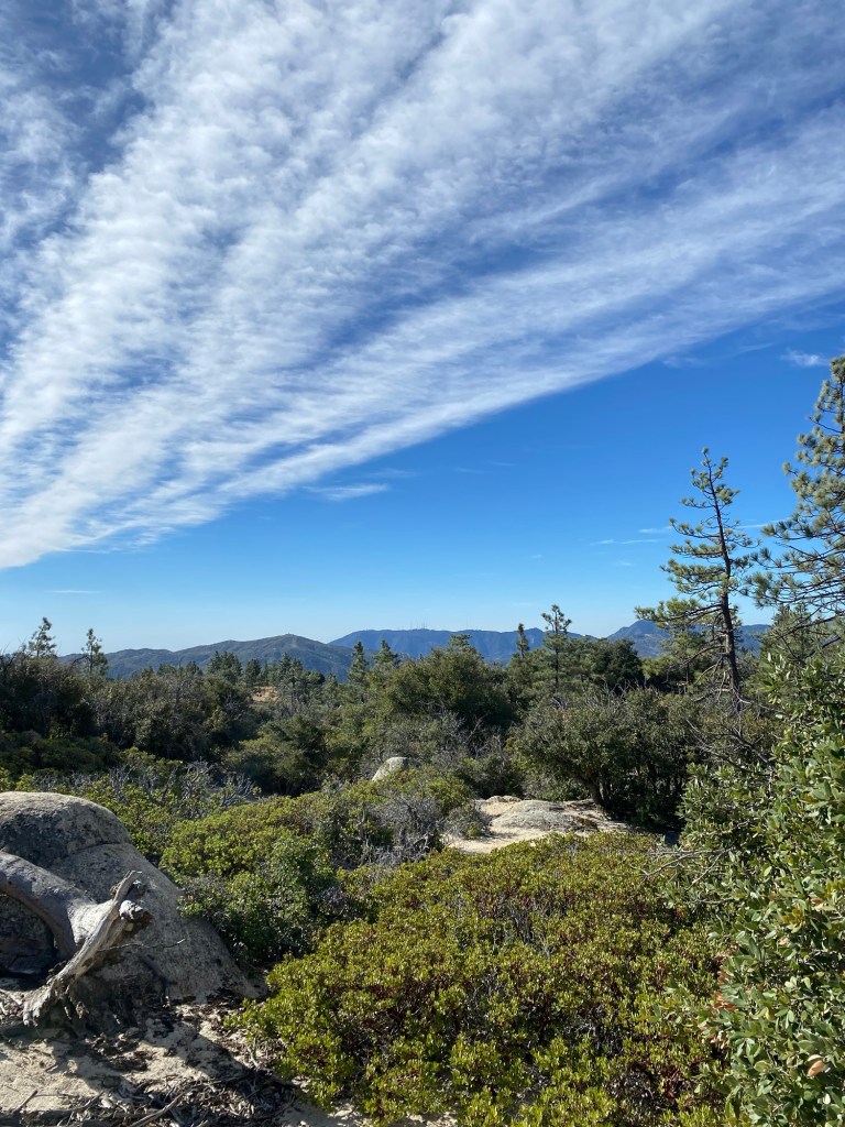
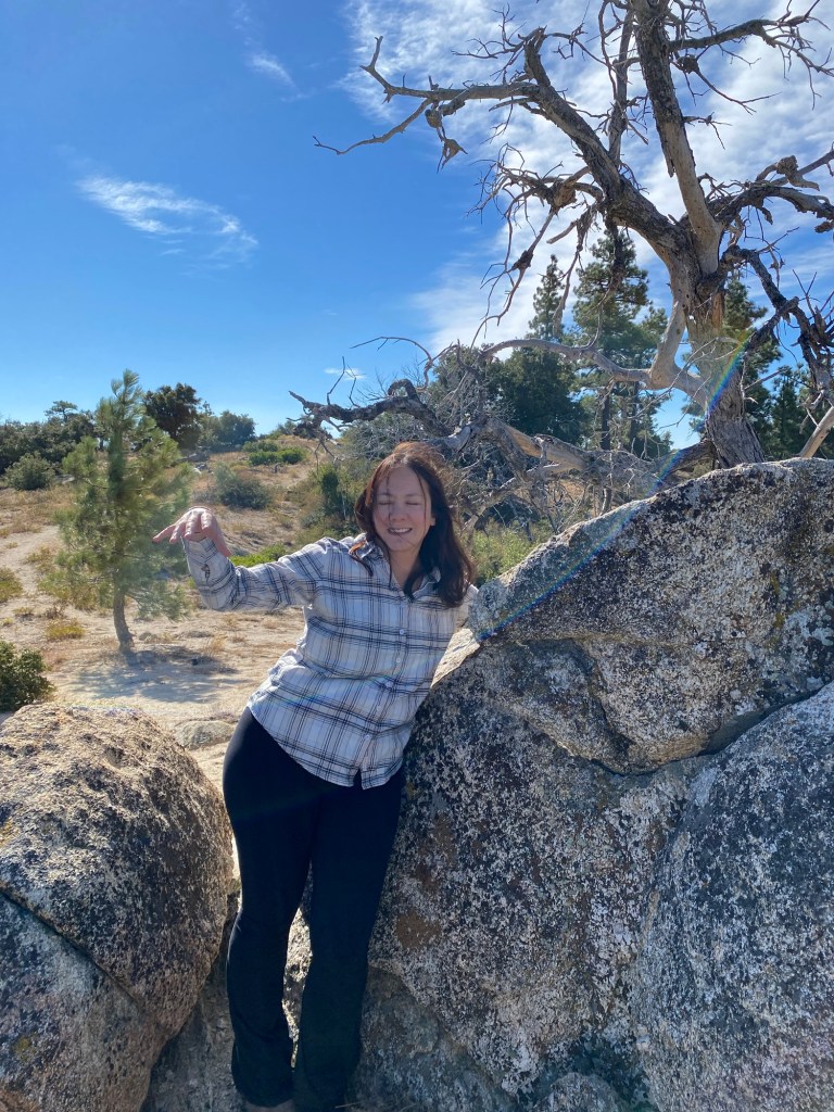
The climb was made more gentle by the fact that we kept stopping to take photos with the boulders. We also stopped to enjoy the views of the peaks of the Angeles. As we continued west on the trail, we were treated to views of Mt. Wilson, Mt. Disappointment and San Gabriel Peak, and Strawberry Peak.
We continued west on the trail, eventually looping slightly north. It was rather easy to get distracted by all the boulders, and there were some points where it could be easy to lose the trail.

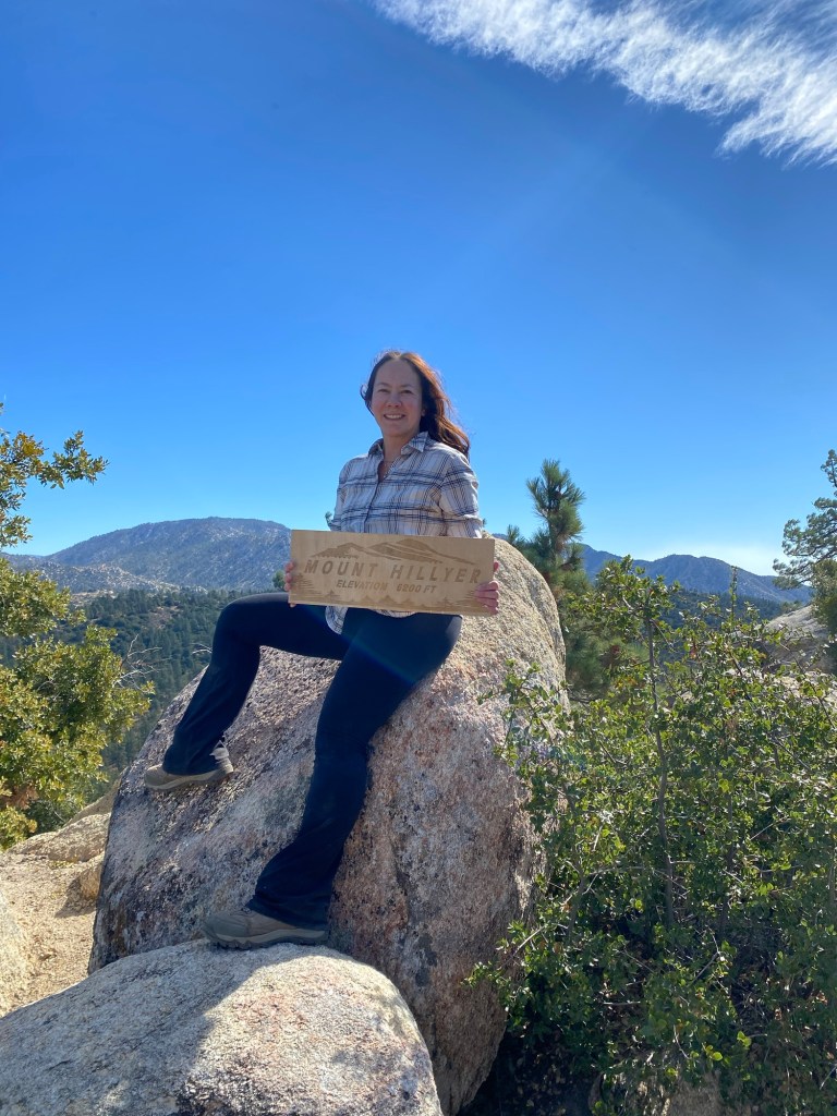
At about two miles as I was tracking by Strava, the trail started to head down. At that point, we wondered whether the pile of boulders and the sketchy trail to our right was the path the the summit. Nate, whom I was hiking with, thought that we had a little farther to go. We hiked a little ways, and I considered that we were beginning to loop back and had actually missed the spur to the peak. Fortunately at that point, a pair of hikers were headed up the trail, and we asked them where the summit for Mt. Hillyer was. They had their AllTrails going, and we could see that indeed the pile of boulders was what we had been looking for and we had walked past the trail. We joined them to hike to the peak, which was rather pleasant. The guys were friendly, and Nate had the opportunity to chat with them about his future plans as we hiked up the mountain. Together, we soon came to a pile of rocks that looked to be the summit.


Nate looked for the sign at the peak, however he did not find it. After taking some photos, we headed down a bit to find a comfortable boulder to have a trail snack before heading back to Horse Flat. The winds were picking up again, so we wanted to find a spot that would shield us from the gusts. We found a place to sit, and it was there that Nate found the wooden sign left by social hikers. We of course took a few more photos before Nate ran the sign to the hikers we met on the trail.
Before long, we headed back down the mountain, through the meadow, and back the way we came. We could have done the trail as a loop, but I opted for an out and back. While we have hiked the area before, it had been a couple years, and I had a time limit on how long we would stay for the hike. The girls were waiting for me at home, hoping to do some shopping in the afternoon. So Nate and I took the same trail back to Horse Flat and arrived quickly back at the trailhead. It had been a fun morning getting out in nature and catching up with my college-age son, but then it was time to drive back down the mountain and start the rest of our Saturday.
Some things to consider:
Many hiking sites route the trail to Mt. Hillyer as a lollipop starting at Chilao and hiking the Silver Moccasin Trail to where we started at Horse Flat. This adds about a mile each way to the hike. We had the luxury of parking at the campground and shaving off that hiking time as Nate’s Scout troop was staying at the campground.
Horse Flat Campground is a nice spot for a weekend adventure. The campground has 26 sites with fire rings and picnic tables. There are vault toilets that were basic but pretty clean. It is a quiet place, as it is a little ways into the forest. Sites are $12 per site, with an extra fee of $5 for additional vehicles.
Adventure passes are required to park anywhere within the Angeles National Forest, including at Chilao. These are $5 per day, or $30 for an annual pass. If you plan on visiting other national lands over the course of the year, I recommend purchasing an America the Beautiful National Parks pass. At just $80 per year, I feel we get our money’s worth out of it.
At time of writing, it is deer season. We saw several hunters as we were driving up, as well as while on our hike. They seemed careful and respectful of the space. That said, it is good to be aware of your surroundings. There are laws that govern hunting in California. For more information, check out the CA Department of Fish and Game.
While there are many pines and boulders along the trail, there are many areas that are rather exposed. We made sure to wear sunscreen, even on a chilly day. We also made sure to bring plenty of water.
Mt. Hillyer offers the chance to hike what can be considered a quieter part of the Angeles National Forest. With panoramic views and plenty of boulders that can be hopped, there is much to explore in this natural ‘playground.’ This was a perfect fall Saturday adventure meant to be shared.
References:
“Angeles National Forest – about the Area.” Forest Service National Website, http://www.fs.usda.gov/main/angeles/about-forest/about-area. Accessed 22 Oct. 2024.
*Some of the information in this post came from our visit Vetter Mountain Lookout. When open, the lookout can be a great source of information about the geography and history of the Angeles National Forest.
